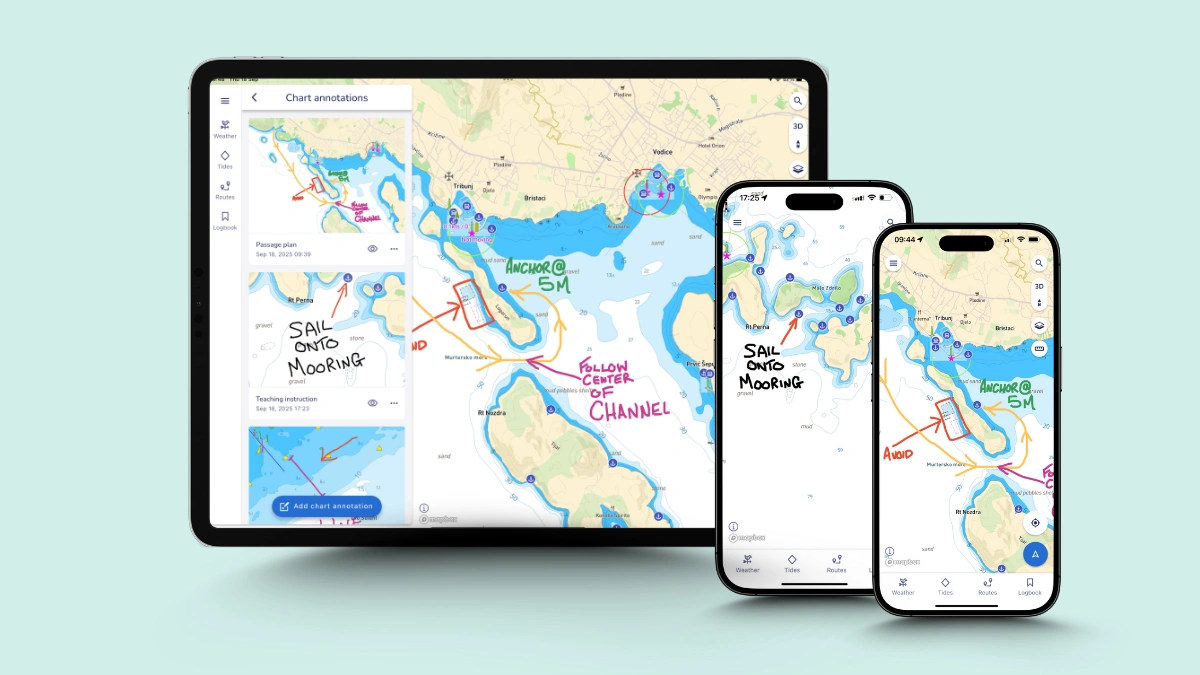
An image of Savvy Navvy's chart annotation tool on tablet and phone.
Updates

Savvy Navvy supports boating instructors with exclusive interactive learning feature

Savvy Navvy has launched an industry-first new chart annotation tool, enabling boating instructors to turn digital charts into interactive learning tools for the next generation of boaters.

Adding personal chart annotations enables boating instructors as well as recreational users of the marine navigation app to draw and mark up on charts, save and share with their network – a digital-first alternative to paper-based plotting. 

“We’ve been working with boating instructors worldwide for several years and developing features in the Savvy Navvy app to meet their needs. Chart annotations enable instructors to transform electronic charts into a dynamic teaching tool, making lessons clearer, safer and more memorable. They can map out scenarios, highlight hazards, and adapt lessons quickly. As more instructors embrace a digital-first approach to navigation, our goal is to provide the technology they need to make boating more accessible, safer, and intuitive than ever,” says David Cusworth, Head of Partnership and Innovation at Savvy Navvy.
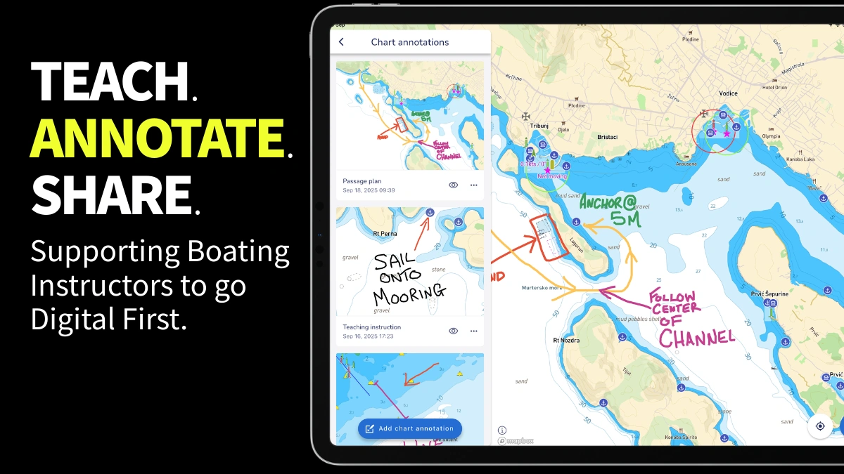
Draw direct on Savvy Navvy Charts - chart annotations

Chart annotations is the first in a series of instructor-specific features all built by Savvy Navvy specifically for the marine industry's ‘Digital First’ rollout. Around one in four RYA instructors are already using Savvy Navvy in their training courses. This year the marine technology company has delivered dedicated webinars to hundreds of instructors across the UK, USA, Australia, and New Zealand continuing to support the ‘Digital First’ campaign, first launched by RYA in 2023.

“I am surprised at how much we use Savvy Navvy’s chart annotations. When we can draw our own ‘no-go’ line around a shallow spot for our actual training boat, or drop a pin on a great little anchorage we’ve just visited with notes about what makes it great, the theory just clicks and Savvy Navvy becomes our shared playbook for the day. You see that lightbulb moment for students, and they leave with a chart full of their own notes and memories, which is just brilliant,” says David Killpack, Principal at Sunshine Sailing Australia.

Savvy Navvy, often referred to as ‘Google maps for boats’, has had over two million downloads globally. The revolutionary Savvy Navvy app solves vital navigation issues for boaters, kayakers, paddleboarders and jet-skiers. Unlike any other navigation solution, Savvy Navvy provides smart routing — giving users the optimal route and dynamic ETAs based on real-time data: departure time, chart information, weather conditions, tide, boat specifications and local regulations. 

Chart annotations will go live to Savvy Navvy users worldwide next week.

Inspired to get out on the water? Try Savvy Navvy free today.

Latest News

Updates

Savvy Navvy backs RNLI’s 25th anniversary campaign by adding lifeguarded beach data

Marine navigation app Savvy Navvy has added Royal National Lifeboat Institution (RNLI) lifeguarded beaches to its app ahead of the charity’s International Lifeguard Appreciation Day held on Friday 31 July.

Read Article
Updates

American Sailing and Savvy Navvy partnership brings digital navigation into sailing and powerboat education

The partnership enhances training and safety for boaters across the US - placing digital navigation in the hands of American Sailing (ASA) and American Boating (AB) instructors and students and its 400+ affiliated schools.

Read Article
Updates

Fairview partners with Savvy Navvy to offer innovative navigation tools and benefits for charter customers.

Fairview Sailing, one of the UK’s longest-running yacht charter operators, is entering this year’s Round the Island Race with Savvy Navvy across its fleet.

Read Article
Features

See your friends on the water and be seen with live location sharing. 

Live location sharing lets you see your friends’ positions on the water, right on the same digital navigation chart you already use. You share your location, they share theirs, and everyone appears as a live marker that updates every 2 seconds.

Read Article
Updates

Savvy Navvy wins Boat Navigation Product of the Year 

Savvy Navvy has been named ‘Boat Navigation Product of the Year’ at the Outdoor Innovation Awards, a global programme celebrating outstanding products that inspire outdoor and sports enthusiasts worldwide.

Read Article
Updates

Savvy Navvy scales global chart coverage through advanced geospatial data processing

Savvy Navvy has developed an in-house approach to processing and reconciling fragmented hydrographic data - combining official hydrographic data with expert geospatial data analysis to scale chart coverage faster and with greater accuracy.

Read Article
Updates

Savvy Navvy software donations to RNLI volunteers proving popular

Marine navigation app Savvy Navvy has donated accounts to more than 1,400 Royal National Lifeboat Institution (RNLI) operational volunteers, with take-up far exceeding expectations, since their collaboration launched last year.

Read Article
Features

Savvy Navvy launches waves feature empowering boaters to plan safer and more comfortable journeys

Savvy Navvy has launched a new waves feature, turning complex wave data into a simple visual view that helps boaters understand how conditions will actually feel on the water.

Read Article
Updates

Seaward Automation selects Savvy Navvy for chart integration on CommandTM platform

Marine technology company Savvy Navvy has partnered with Seaward Automation to integrate its full navigation solution to their Command™ vessel management system, completing a fully integrated helm experience for boaters worldwide.

Read Article
Updates

Savvy Navvy discusses AI and digital technologies at Boot Düsseldorf

Savvy Navvy CEO Jelte Liebrand spoke at Boot Düsseldorf about how AI and digital technologies are transforming boating. The panel explored making boating more accessible and sustainable, with Jelte highlighting our success in gaining mass adoption.

Read Article
Updates

BoatUS and Savvy Navvy collaborate to improve boat safety across the USA

With grounding incidents among the leading causes of on-water assistance calls in the United States, BoatUS and navigation technology company Savvy Navvy are thrilled to announce a partnership for recreational boaters to navigate more safely and conf

Read Article
Updates

‘Google Maps for Boats’ secures £692,000 in latest crowdfunding round

Marine technology company Savvy Navvy has just closed its crowdfunding round to the public, having raised more than £692,633 from over 450 investors.

Read Article
Updates

Savvy Navvy launches NMEA Connect for integrated onboard navigation

Marine navigation company Savvy Navvy introduces a new NMEA Connect feature, which seamlessly integrates NMEA-enabled boat instruments with the app, providing real-time data and enhanced AIS visibility.

Read Article
Updates

Savvy Navvy charts integrated into CPAC Systems’ new product line Marivue

Marine technology company Savvy Navvy has been onboarded as a system content-provider to CPAC Systems, providing its intuitive chart solution for integration into the newly launched Marivue product line.

Read Article
Updates

Savvy Navvy supports boating instructors with exclusive interactive learning feature

Savvy Navvy has introduced a groundbreaking chart annotation feature that allows boating instructors to transform digital charts into dynamic, interactive learning resources for the next generation of boaters.

Read Article