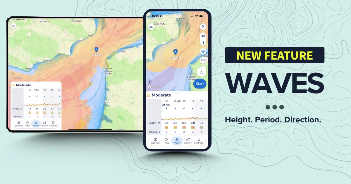
Savvy Navvy has launched a new waves feature, turning complex wave data into a simple visual view that helps boaters understand how conditions will actually feel on the water.
Savvy Navvy is continuing to bring boaters all they need in one place - wind, weather, tides and now waves, allowing boaters worldwide to easily assess sea conditions before heading out on the water.
The waves feature includes a clear, colour-coded overlay showing comfort factors based on official data from Copernicus Marine Service, designed for simpler and safer planning.
“Our waves layer combines wave height, period and direction to provide a more complete view of sea state. Shorter wave lengths create steeper, less comfortable conditions, while longer wave lengths result in a more gradual, manageable motion.
.webp)
“Savvy Navvy brings this together into a simple wave comfort graph, so boaters can quickly see whether they’re in for a smooth cruise or a more challenging ride. It’s all about continuing to bring all boaters' needs into one place – and help them make better and safer decisions before leaving the dock,” says Misha Vysokovskiy, Chief Product Officer at Savvy Navvy.
The RYA’s guidance on weather, wind and waves makes clear that wave height alone isn’t the key safety concern - its steepness and the behaviour of breaking waves that matter most. The new Savvy Navvy waves feature is built around exactly that understanding, giving sailors wave period and steepness data to make safer, more informed decisions quickly.
“The impact of swell direction, height and period on the planning process is equal to that of a wind forecast. A large swell may seem intimidating but accompanied by a longer period it has less impact on boat speed and comfort than a short sharp chop with a smaller period. If managed correctly, most vessels will cope with significant wind speeds, but the subsequent sea state is the element that poses the bigger threat. The Savvy Navvy waves feature is a genuinely useful addition for any boater planning a trip on the water,” says Emily Caruso, RYA Cruising Instructor and Yachtmaster.
Savvy Navvy, often referred to as ‘Google maps for boats’, has had over three million downloads globally. Unlike any other boating navigation solution, Savvy Navvy provides smart routing - giving users optimal routes and dynamic ETAs based on real-time data: departure time, chart information, weather conditions, tide, boat specifications and local regulations.
The new waves feature has gone live to Savvy Navvy users worldwide today.

