We all know this familiar scenario. You’ve planned a boating trip for the weekend, and everyone’s planning to meet up. All the boats are leaving from different marinas; a rough ETA is agreed via text message, and a plan to “meet somewhere around the headland” is formed.
An hour in, and one boat’s running late, another decided to head north to avoid some chop, and nobody knows where anyone is; the group chat is full of texts that arrived out of order, and general chaos ensues. Sound familiar?
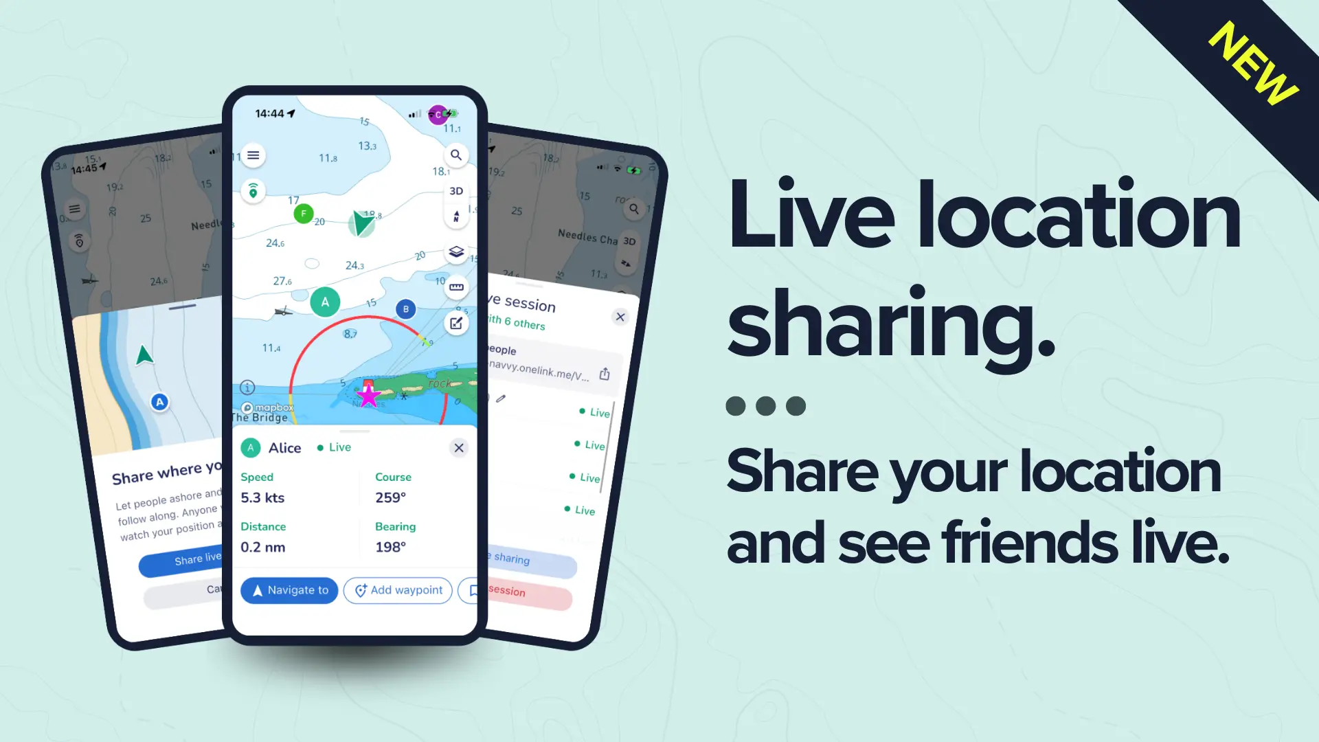
That’s the problem live location sharing solves, and it’s now built directly into the Savvy Navvy app.
What is live location sharing?
Live location sharing lets you see your friends’ positions on the water in real time, right on the same digital navigation chart you already use. You share your location, they share theirs, and everyone appears as a live marker that updates every two seconds.
To start, you create a sharing session and send a link to the people you want to include; they then tap the link, open Savvy Navvy, and they’re in, which means there’s no need to hunt through menus or set up group accounts.
People you share with don’t need a paid subscription to view your location; they just need the app installed, but if they want to share their position back, they’ll need to be signed in.
The social side of sailing together
Boaters have always found ways to stay connected on the water, whether via group chats, radio check-ins, AIS, or the occasional shouted update across an anchorage. But none of it was built for the way most of us actually sail; in groups, making plans on the fly, trying to coordinate with friends who are somewhere over the horizon.
Live location sharing changes that.
Planning a meet-up on the water
Coordinating with friends across open water is notoriously tricky. “Meet us near the island” becomes a 30-minute guessing game when you’re all underway. With live location sharing active, you can see exactly where your friends are, track who’s close to the agreed spot and time your arrival together, without anyone picking up a phone to text coordinates.
Flotilla sailing and group passages
Keeping a flotilla together across a long passage means constantly checking who’s ahead, who’s fallen behind, and whether anyone’s had to alter course for weather. Live location sharing gives flotilla organisers and lead boats a real-time picture of the whole group on the chart, so you can adjust pace, make decisions together, and ensure nobody gets left behind.
Boat clubs organising member outings and charter companies monitoring client vessels will find this particularly useful, with a shared view of where everyone is, all in one place, without switching between multiple apps.
Racing, regattas, and event days
Race committees tracking a fleet, coaching boats watching their sailors, friends following a regatta from the club, whatever you’re doing live location sharing creates a shared, real-time picture of what’s happening on the water that everyone can tune into from their own device.
Spreading out without losing track of each other
Anglers who spread across a wide area to cover more ground, kayakers and paddleboarders exploring the coastline in a group, jet ski riders covering large distances: live location sharing lets everyone fan out without losing awareness of where the rest of the group is.
Why having it built into your navigation chart matters
The concept of location sharing is, of course, nothing new; you can share your location via normal messaging apps, Google Maps has a feature for it, and AIS lets you see commercial and some recreational vessels. So why does a navigation-native version make a difference?
Because context is everything on the water.
When you see your friend’s position in a text, it’s a dot on a road map; when you see it in Savvy Navvy, it’s a position on a nautical chart with water depths, hazards, anchorages, tidal streams, and weather overlays all visible at the same time. You can immediately understand what conditions they’re dealing with, which route they’re on, and how far they are from your waypoint.
On top of that, there’s no app-switching, so you don’t lose your route to go check where someone is. Your friends are just there, on the same chart you’re already navigating with.
How to get started
Getting a sharing session up and running takes about 30 seconds:
1. Open Savvy Navvy and start a sharing session.
2. Share the link with your friends.
3. They open the link and can see your position on the chart; they can then share their position in return.
You’re in control of your sharing at all times, which means you decide who gets the link, and you can stop sharing whenever you choose.
If you lose signal, your position freezes on the chart and is marked with a “last seen” timestamp so your crew knows the signal dropped, not that you’ve stopped moving. When you’re back in range, your position updates automatically.
Available on all plans, including free
Live location sharing is available to all Savvy Navvy users, including those on the free plan.
Ready to try it?
Next time you’re heading out with friends or organising a group boating trip, start a sharing session before you leave the marina. See where everyone is from the moment they cast off, all on the same chart you’re navigating with.
Download Savvy Navvy or update your existing app to get started.

