Pilotage Plan: Chesapeake, Virginia to Smithfield, Virginia
Overview
This voyage from Chesapeake to Smithfield promises a delightful journey through Virginia's eastern waterways, where navigators will encounter scenic landscapes, rich history, and suitable shelter points should the weather take a turn. The route is primarily for recreational boaters and is suitable for small to medium-sized vessels, given the prevailing conditions in the Chesapeake Bay region.
Departure: Chesapeake, Virginia
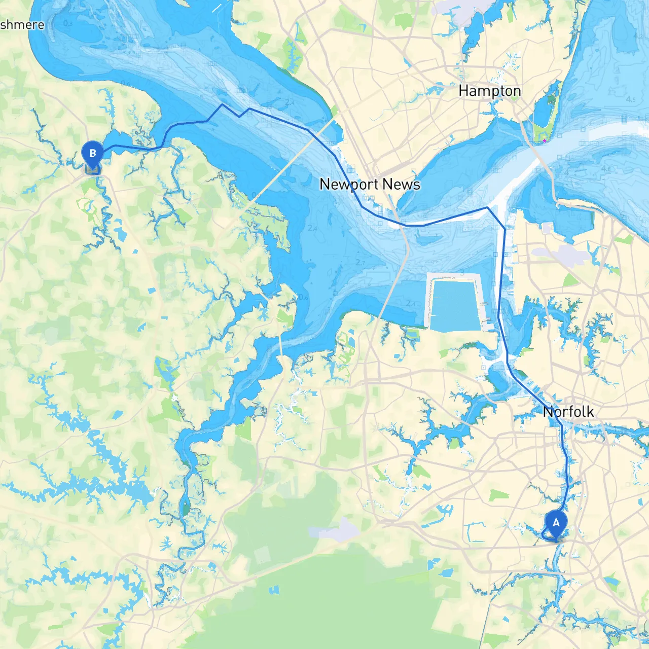
Starting from the coordinates (Long: -76.2985, Lat: 36.7757), the journey begins in the well-known waters of the Chesapeake Bay. Before setting off, check your vessel's readiness, including navigation equipment, safety gear, and weather forecasts.
Notable landmarks in Chesapeake:
- Chesapeake Bay Bridge-Tunnel: A remarkable engineering feat that connects the Norfolk/Virginia Beach area with the Eastern Shore.
- Elizabeth River: An extensive tributary that’s perfect for a quick start towards the open bay.
Route Overview
The path necessitates a careful navigation through the Great Bridge Locks, any windy stretches, and embracing the serenity of the small harbors and creeks along the way.
Section 1: Entering the Elizabeth River
- Waypoint: Starting at the mouth of the Elizabeth River.
- Navigational Aids: Pay close attention to buoys marking the shipping channels; especially the green and red day markers to keep you in a safe navigable channel.
- Points of Interest: Great Dismal Swamp National Wildlife Refuge if you desire a short detour for wildlife viewing.
Section 2: Navigating through the Great Bridge
- As you cruise north, you will approach the Great Bridge Locks. Be mindful of the lock schedules—timing can greatly impact your progress.
- Hazards: Strong currents can flow through locks depending on the tide, so exercise caution.
Should conditions shift unexpectedly, the Chesapeake and Albemarle Canal offers several sheltered spots to anchor or tie up while waiting out bad weather.
Section 3: Entering the Intracoastal Waterway
- Continuing towards the south of the Chesapeake Bay, you’ll navigate through scenic sections, including navigable waters chock-full of history, protected wetlands, and natural beauty.
- Navigational Aids: Markers will assist in guiding through turns, shallow spots, and entrances to inlets.
Section 4: Approaching the Nansemond River
Before reaching Smithfield, you'll turn onto the
, a quieter waterway that offers respite from any local boat traffic. As you navigate, watch for small recreational boaters and commercial vessels increasingly common in this area.
- Shelter Points: Hog Island provides excellent shelter and picnic opportunities if you feel the need to enjoy some laid-back beach time.
Arrival: Smithfield, Virginia
Upon reaching Smithfield at the coordinates
(Long: -76.62475, Lat: 36.98335)
, you are greeted by one of Virginia's charming waterfront towns, known for its historical significance and culinary delights.
Additional Considerations
- Local Regulations: Familiarize yourself with local regulations regarding speed limits, fishing zones, and anchoring practices in the Smithfield area. This ensures compliance and respects local waterways.
- Weather Check: Regularly review local forecasts, as conditions can change rapidly. Ensure you have a reliable app, like Savvy Navvy, for real-time weather updates and navigational assistance.
Safety Tips
1. Always wear life jackets while boating.2. Keep a first-aid kit and emergency supplies onboard.3. Plan for potential changes in weather—carry navigational lights and flares if embarking during the evening.4. Make use of marine radios to stay informed and communicate with harbor authorities.
This plan not only accommodates a safe journey but also infuses a spirit of adventure throughout the route, ensuring your trip from Chesapeake to Smithfield is memorable and practicable! Enjoy the waters and happy boating!