
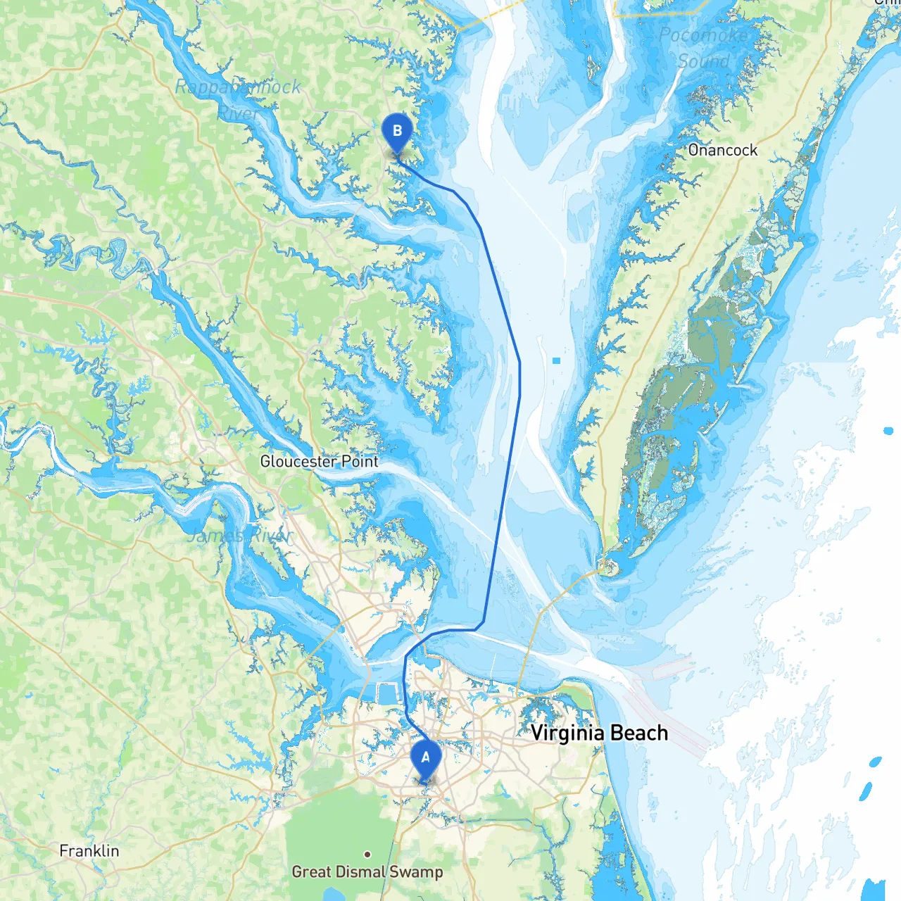
Overview:This captivating journey from Chesapeake to Kilmarnock offers a delightful exploration of Virginia's waterways. The route meanders through scenic views, quaint towns, and offers ample opportunities for shelter and enjoyment. It’s ideal for experienced boaters as well as those looking for a leisurely cruise with a focus on safety.
Starting Point:Chesapeake, Virginia Coordinates: Longitude -76.2984793, Latitude 36.7756933
Departure Considerations:As you set out from Chesapeake, be mindful of the bustling shipping lanes on the Elizabeth River. Always keep an eye out for commercial traffic and be prepared to yield when necessary. It’s crucial to be aware of weather conditions, especially strong winds and storms, which can arise swiftly in this region.
Route Overview:1. Elizabeth River - Head north along the Elizabeth River and keep clear of large vessels navigating to and from the port as you follow the marked channels. - Hazards: Low bridges and strong currents can be found closer to the port.
2. Chesapeake Bay - Upon exiting the Elizabeth River, you will enter the expansive Chesapeake Bay. Stay within the navigational markers to avoid shallow areas. - Notable Landmark: The Chesapeake Bay Bridge-Tunnel is an engineering marvel worth admiring from a distance.
3. Hampton Roads - As you pass through this major waterway, pay attention to the numerous vessels and navigational aids. Keep your radar on, especially during foggy conditions. - Shelter Bay: Willoughby Bay offers a safe harbor should inclement weather begin to set in. It’s well-protected and has facilities for temporary docking.
4. Mobjack Bay - Continuing up the bay, Mobjack Bay provides ample opportunities for exploration. It’s a great spot for those looking to enjoy fishing or just soaking up the peaceful surroundings. - Shelter Bay: If the weather becomes rough, the sheltered waters of Mobjack Bay are excellent for waiting out a storm.
5. Navigational Aids: - Be sure to keep a check on navigational markers such as buoys and signs—particularly those marking shoal waters as you navigate further into Rappahannock River approaching Kilmarnock. - Consider an up-to-date marine chart on hand as well as using apps like Savvy Navvy to keep track of your route.
Destination:Kilmarnock, Virginia Coordinates: Longitude -76.3516667, Latitude 37.6993333
Arrival Considerations:Entering Kilmarnock, you will encounter a blend of commercial and recreational vessels, so maintain a vigilant watch. The area is known for its charming atmosphere, with local shops and dining options readily available once you dock.
This route from Chesapeake to Kilmarnock offers not just a means to reach a delightful destination, but an opportunity to engage with Virginia's stunning natural beauty along the way. Perfect for cruisers looking for a mix of tranquility and adventure, this journey emphasizes safety while allowing for enjoyable experiences as you navigate from one enchanting spot to another. Remember, while the sights are spectacular, your safety and preparedness are paramount for a successful boating experience!