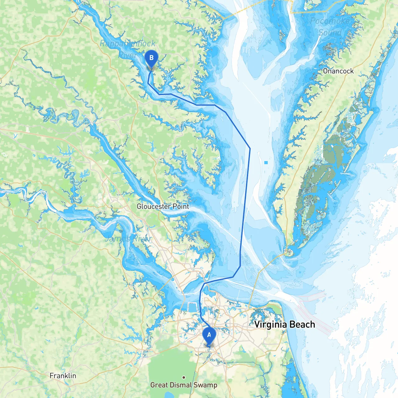
Pilotage Plan: Chesapeake, Virginia to Lancaster, Virginia
As you set out from Chesapeake, Virginia, this delightful waterway journey will take you northward toward Lancaster while showcasing the beauty of the Chesapeake Bay region. This route is especially suited for experienced cruisers and those looking for a blend of natural splendor and navigational challenge. Allow the following plan to guide you safely through this stunning area.
Route Overview
Starting Point: Chesapeake, Virginia
- Coordinates: -76.298479, 36.775693
Begin your journey in the bustling waters of the Chesapeake Bay, known for its rich history and vibrant ecosystems.
Ending Point: Lancaster, Virginia
- Coordinates: -76.544962, 37.715138
Conclude your adventure in the serene environs of Lancaster, where the Rappahannock River meets the Bay.
Route Sections and Hazards
Section 1: Chesapeake to Rappahannock River Inlet
- Distance: Approximately 20 nautical miles
- Key Navigational Aids: Caution is advised as you navigate the busy waters. Be mindful of the navigation buoys marking the shipping channels. Look out for the Cape Henry Light and the Point no Point Light, which provide essential visual references as you traverse this section.
- Hazards: Watch for commercial shipping traffic, especially in the main channels. Be aware of shallow areas, particularly near the mouth of the Rappahannock River. Local weather patterns can shift rapidly, so check forecasts regularly.
Section 2: Rappahannock River to Lancaster Creek
- Distance: Approximately 12 nautical miles
- Shelter Options: If the weather turns against you, the Rappahannock River offers several coves and such as Windmill Point, which provide excellent refuge. You can also anchor in well-marked areas or seek temporary slips at local marinas.
- Points of Interest: Consider making a stop at the historic town of Tappahannock. Here, you can enjoy local dining and explore waterfront attractions steeped in colonial history.
Section 3: Lancaster Creek to Lancaster
- Distance: Approximately 5 nautical miles
- Navigational Considerations: As you navigate the east side of the Rappahannock River, pay careful attention to the channel markings and any potential shoaling in the creek. The changes in tide and currents can impact your approach to Lancaster.
- Final Destination: Upon arriving in Lancaster, take time to soak in the tranquil river views. The area is perfect for leisurely walks, or enjoying local seafood at the waterfront eateries.
Additional Navigation Aids and Regulations
- Charts and Apps: Utilize detailed marine charts tailored to the Chesapeake region. Recommended resources include NOAA charts and the savvy navvy app for real-time navigation support and hazard alerts.
- Local Regulations: Be sure to comply with local marine speed restrictions, particularly in environmentally sensitive areas. Pay attention to any dredging activities or channel maintenance that may temporarily alter navigation.
Final Thoughts
This journey from Chesapeake to Lancaster promises not only safe navigation through well-marked channels and beautiful landscapes but also the chance to immerse yourself in the heritage and charm of Virginia's waterways. Equip your vessel with all necessary safety gear, keep an eye on the skies for changing weather, and prepare for an adventure through one of the gem regions of the East Coast. The tranquility of Lancaster's shores awaits as you complete a rewarding journey across these historic waters. Enjoy your trip!

