
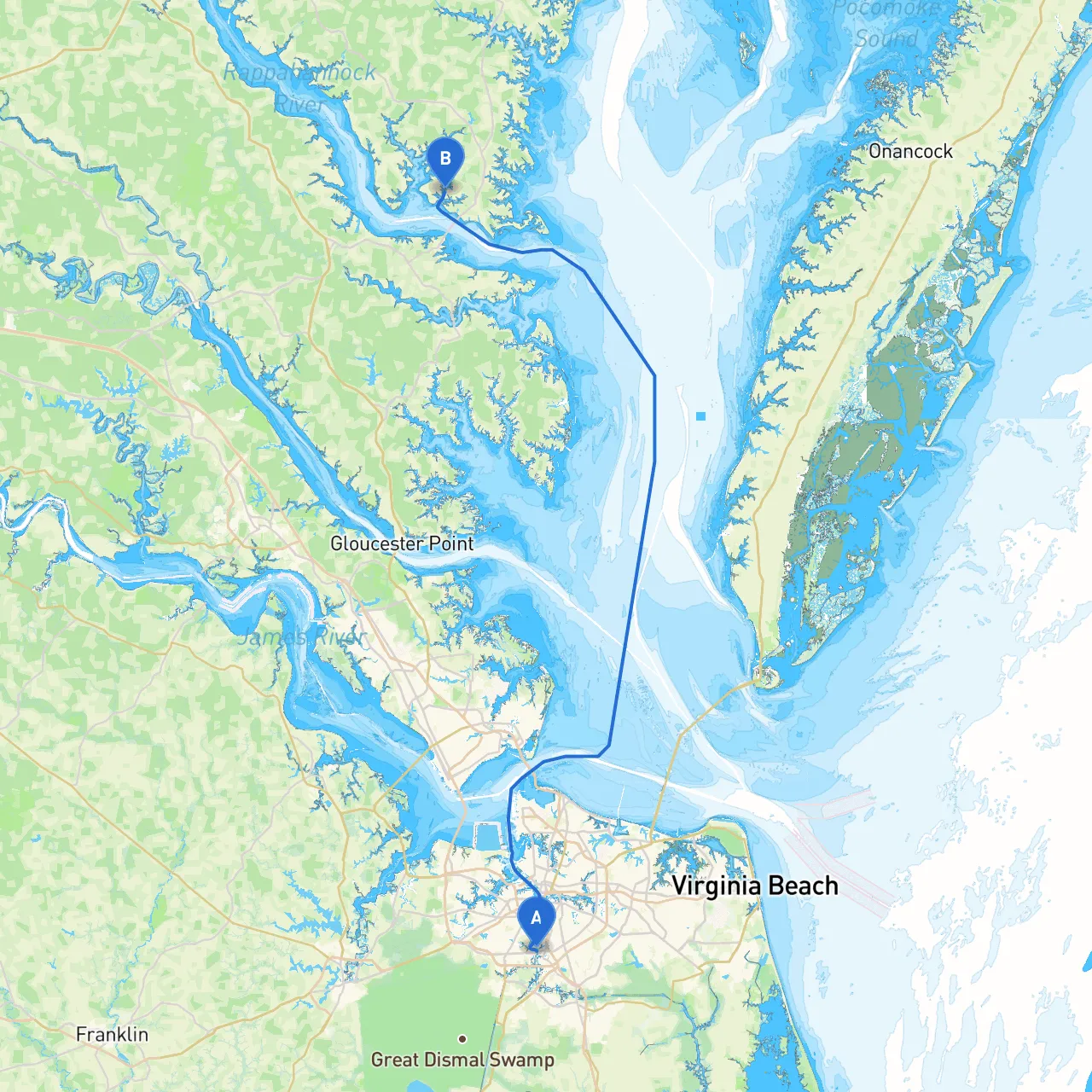
This journey from Chesapeake, Virginia, to Irvington, Virginia, is a delightful cruise that takes you through the serene waters of the Chesapeake Bay and Rappahannock River. The trip is perfect for experienced boaters looking for a scenic journey filled with opportunities for exploration and relaxation. The cruising distance is approximately 45 nautical miles, making it an ideal day trip or an easy overnight excursion.
1. Departure from Chesapeake: - Begin your voyage at the coordinates 36.7757° N, 76.2985° W. As you set out, it's crucial to navigate out of the Portsmouth area through the Elizabeth River, watching for commercial traffic associated with the local shipyards. Adhere to your nautical charts to ensure you stay clear of marked hazards, particularly near the Norfolk Naval Base.
2. Navigating the Elizabeth River: - Maintain a lookout for red and green navigation buoys that guide you past the busy shipping channels. As you exit the river, the waters will open up into Chesapeake Bay. This transition is critical; ensure your navigation aids and GPS systems are fully operational.
3. Chesapeake Bay: - Once in the Bay, you’ll experience expansive views. Watch out for water traffic regulations, especially in designated shipping lanes. The Bay is generally well-marked, but always be attentive to changes in weather conditions as this body of water can experience sudden shifts.
4. Dividing Point and Point of Interest: - After cruising north for about 10 to 12 miles, you will want to consider stopping at Hollis View Marina or Laurel Kay Marina on the eastern shore before heading toward the Rappahannock River. Both offer excellent facilities, including fuel, dining, and shelter should the weather turn unfavorable.
5. Approaching the Rappahannock River: - Upon reaching the river’s mouth, be vigilant for local fishing vessels and sailboat traffic. You’ll navigate past the Rappahannock River Lighthouse and should always keep an eye on depth changes, particularly in narrow or shallow sections.
6. Navigating the Rappahannock: - As you continue upstream, landmarks like Belle Isle State Park provide good stops for picnicking and nature walks. Make sure to check the local tide tables, as the river can be affected significantly by tidal changes, especially in its upper reaches.
7. Arrival at Irvington, Virginia: - As you near your destination, the waters widen. Keep a sharp lookout for local pleasure craft and recreational fishing boats. Your destination coordinates are 37.6642° N, 76.4333° W. Upon arrival, you’ll find a charming small-town atmosphere with plenty to offer, ranging from quaint shops to local seafood eateries.
This route is specially crafted for experienced boaters seeking safety, comfort, and enjoyment. The charm of the Chesapeake Bay combined with the relative ease of navigating through the Rappahannock River makes this a prime cruising destination. With its carefully planned stops and understanding of local conditions, you’re set for a safe and memorable adventure. Enjoy the beauty of nature while being responsible and aware of your surroundings, ensuring a wonderful time on the water!