
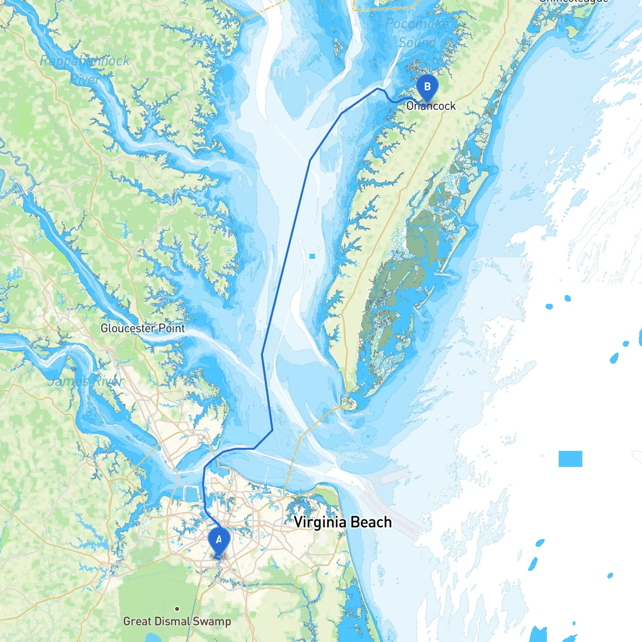
Starting Point: Chesapeake, Virginia (Coordinates: -76.2985, 36.7757) Destination: Onancock, Virginia (Coordinates: -75.7582, 37.7104)
As you embark on this coastal journey, you'll find the route from Chesapeake to Onancock encapsulates the beauty of Virginia's waterways while providing opportunities for exploration and shelter should inclement weather arise. This plan is tailored for experienced boaters who appreciate scenic coastal navigation with attention to safety and notable attractions along the way.
Your voyage will primarily navigate the Chesapeake Bay and its tributaries, employing a mix of well-marked channels and picturesque landscapes. The distance spans approximately 60 nautical miles, making it a perfect one to two-day trip, depending on your cruising speed.
Distance: ~15 Nautical Miles Navigational Aids: The Chesapeake Bay is clearly marked with numerous buoys and markers. Look for “Chesapeake Bay Bridge-Tunnel” markers as you pass through the mouth of the bay. GPS coordinates will be crucial at this section due to the traffic and busy shipping lanes.
Points of Interest:
Harbor Considerations: Should the weather begin to turn, Hampton is equipped with various marinas and safe anchorage points.
Distance: ~12 Nautical Miles Navigational Aids: Stay alert for the Mobjack Bay markers that indicate shallow areas as you begin to skirt along the coastline. Look out for buoys leading into the bay.
Points of Interest:
Shelter: If the weather shifts, Mobjack Bay provides plenty of shallow bays to tuck into, ensuring that you can ride out any unfavorable conditions without risk.
Distance: ~18 Nautical Miles Navigational Aids: The navigation becomes narrower and shallower. Stick closely to the channel markers to avoid running aground.
Points of Interest:
Shelter: The East River offers numerous inlets for seeking shelter. Should heavy weather approach, consider anchoring off one of the smaller waterways.
Distance: ~15 Nautical Miles Navigational Aids: As you return to the main waterway, look out for markers indicating the entrance to Onancock Creek.
Points of Interest:
Final Approach: As you navigate into Onancock, heed the local charts closely. The creek entrance can be tricky due to shoaling; maintaining a vigilant eye will ensure a safe passage into the harbor.
This journey is wonderfully suited for cruisers seeking a mix of adventure, relaxation, and nature. Whether you want to fish, explore historical sites, or simply soak in the sights, the route from Chesapeake to Onancock promises a fulfilling boating experience. Prioritizing safety and readiness ensures not only a pleasant trip but also the opportunity to create lasting memories along Virginia's stunning coastline. Safe travels and happy cruising!