
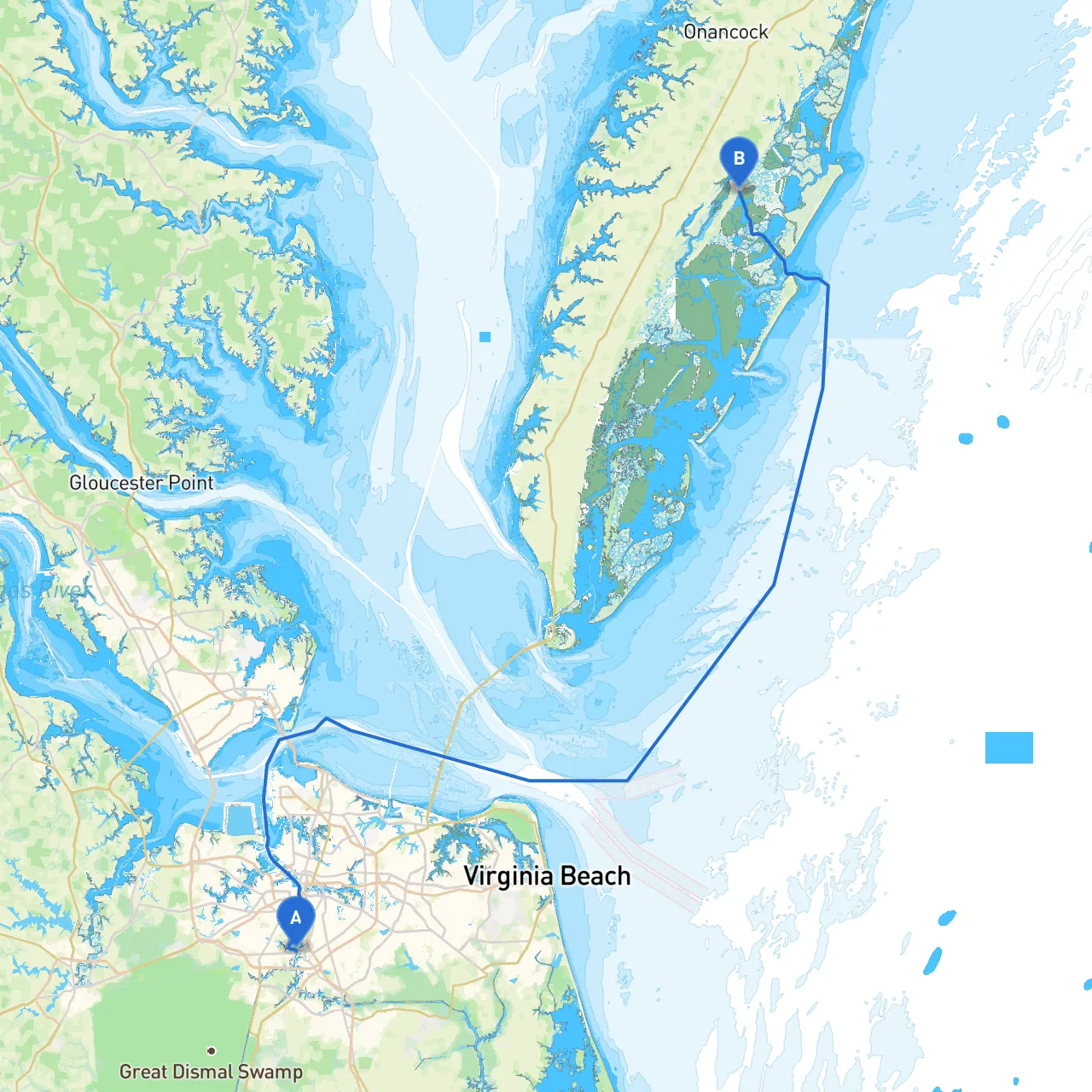
This voyage from Chesapeake, Virginia, to Quinby, Virginia, is a delightful journey that traverses the beautiful waters of the Chesapeake Bay and into the serene Eastern Shore of Virginia. The trip is 60 nautical miles and offers a blend of natural beauty, navigational challenges, and potential for fun activities along the way. Ideal for experienced boaters who are comfortable navigating through coastal waters and are keen to enjoy the rich avifauna, great fishing spots, and charming local culture.
Coordinates: -76.298479, 36.775693 Before you set sail, consider checking the local weather conditions and advisories. The waters around Chesapeake can experience tidal changes and currents, so it’s best to navigate during safe conditions. As you depart, you can take a moment to visit the nearby Chesapeake City Park to soak in some scenic views of the surrounding waterways.
1. Hampton Roads - A significant point marking the intersection of several waterways where naval military presence is notable. Keep an eye out for naval vessels and respect local navigation rules.
2. The Elizabeth River - Known for its busy port activity and commercial fishing. Here you can find marinas and restaurants if you desire a stop along the way.
3. Langley Air Force Base - As you pass by, you may spot air traffic as planes take off and land. Keep clear of restricted airspace as marked on your charts.
4. York River - An excellent area for shelter; should conditions worsen, consider anchoring here. The picturesque town of Yorktown stands nearby, offering historical attractions and an opportunity to stretch your legs.
5. Matthews County - Offers an excellent chance for fishing, especially for crabs. If time allows, stop in at a local seafood shack to sample fresh catch of the day.
6. Mobjack Bay - A sheltered area just before entering the more open waters toward Quinby. Should you find yourself needing refuge from inclement weather, this is a great place to secure for the night.
As you travel through these waters, be sure to keep a close lookout for the following navigational aids:
Coordinates: -75.73195, 37.54945 Upon arriving in Quinby, take advantage of the quiet, unspoiled beauty of this coastal village. You can enjoy the shoreline, rich marine life, and potentially engage with local fishing communities. This is a great spot for birdwatching and just enjoying the tranquil environment after a day spent navigating.
This route from Chesapeake to Quinby is not only practical, considering the available shelter points and navigational aids, but it also showcases the best of Virginia’s coastal beauty. The journey is tailored for boaters with a penchant for both adventure and safety, ensuring a memorable trip filled with stunning views and opportunities for exploration. Make sure to stay vigilant and respect the surrounding environment; the rewarding experience will surely make it all worthwhile!