Pilotage Plan: Tampa, Florida to Nokomis, Florida
Introduction:Embarking on a boat trip from Tampa to Nokomis is a terrific opportunity to explore Florida's beautiful coastline and inland waterways. This route offers a mix of scenic beauty, interesting landmarks, and a variety of sheltered bays for safe anchorage should the weather turn sour. The trip is particularly suitable for experienced recreational boaters looking for an enjoyable yet safe journey.
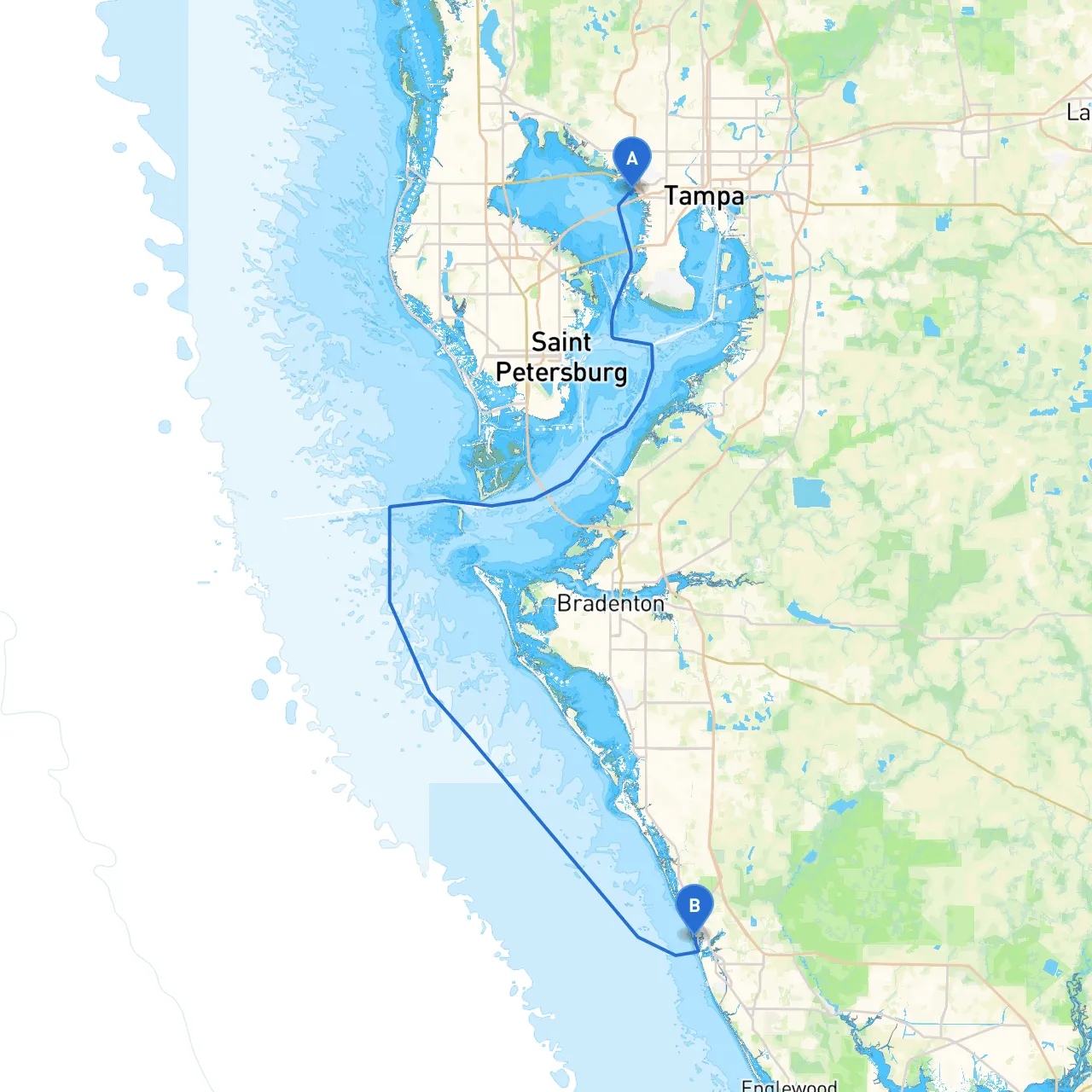
Route Overview:The journey spans approximately 60 nautical miles and primarily follows the Gulf Intracoastal Waterway (ICW) to Nokomis. The route is distinguished by its diverse marine environments, wildlife observations, and opportunities for fun shore stops.
Section 1: Departure from Tampa
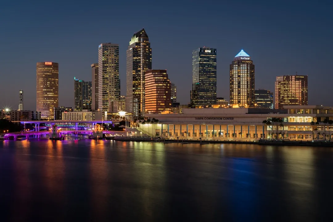
- Starting Point: Tampa, FL (Coordinates: -82.547921081, 27.951735708)
- Navigational Aids: Be sure to leave the Tampa Bay area while paying attention to markers and buoys in the busy shipping channels.
- Hazards: Watch for large vessels and potential shifting currents. The Port of Tampa has significant commercial traffic; avoid navigation during busy shipping hours if possible. Emerging from the bay, stay close to marked channels to keep clear of shallow areas.
Points of Interest:
- Tampa Bay: As you depart, enjoy scenic views of the Tampa skyline and the historic Tampa Bay Hotel. This is a great area for spotting dolphins and seabirds.
Section 2: The Intracoastal Waterway
- Route to Nokomis: Once clear of Tampa Bay, align yourself with the ICW heading southwest. The ICW offers well-marked channels, making navigation straightforward but remain vigilant for local weather changes.
- Sheltered Bays along the Route:
-
A great stop for shelter during rough weather. This bay is an excellent place to anchor, especially in strong easterly winds. -
Just north of Nokomis, this bay provides another sheltered anchorage option and also serves as a hub for fishing and wildlife observation.
Navigational Considerations:
- Keep an eye on waypoints along the ICW and listen to local weather broadcasts. The ICW typically has lighted bouys and markers to help with navigation.
- Be mindful of local speed limits, especially in posted zones near residential areas.
Section 3: Notable Landmarks and Activities
- Point of Interest: Casey Key: Renowned for its pristine beaches and wildlife, it's a great anchor point to explore, relax on the sand, and snorkel in clear waters.
- Venice Inlet: As you approach it, enjoy the sights of Venice's charming downtown and the famous fossil beaches. It can be a good place to stop for lunch or a swim if time allows.
Section 4: Arrival in Nokomis
- Destination Point: Nokomis, FL (Coordinates: -82.47065, 27.1274333333)
- Local Facilities: Upon arrival, various marinas and boat yards make docking convenient. Check with local marinas regarding services and amenities provided, including fuel, food supplies, and repairs if needed.
Final Navigational Considerations:
- Watch for shallow areas as you approach the Nokomis coastline. Ensure that you use navigational aids such as GPS or apps for precise location referencing.
- Make note of local boating regulations, including any no-wake zones.
Safety Recommendations and Apps:To ensure your trip remains enjoyable and safe, consider using the following apps:
- Savvy Navvy: Essential for route planning and navigation, offering real-time weather updates and navigation alerts.
- Navionics: Helpful for detailed charts and community-driven information on points of interest along your route.
- Weather Radar: For real-time weather conditions on the water to help you stay informed.
By keeping safety as your number one priority and enjoying the stunning scenery along your journey to Nokomis, you create the perfect recipe for an unforgettable boating experience in Florida's captivating waters. Enjoy your trip!