
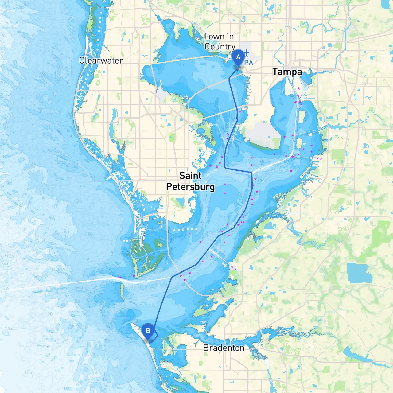
Route Overview: This journey from Tampa to Holmes Beach is a delightful expedition through some of Florida's most picturesque coastal scenery, making it perfect for leisure-seeking boaters and those who appreciate the beauty of the Gulf Coast. Covering approximately 35 nautical miles, this voyage offers varied experiences, combining open-water navigation with delightful stops along the way.
Section 1: Departure from Tampa
Starting from Tampa, FL, you will begin your trip in the bustling Tampa Bay, utilizing the rich network of navigational markers. Before casting off, ensure you check the tide charts and weather forecasts; Tampa's waters can be influenced significantly by tidal changes, which affect navigability especially around the Hillsborough River's mouth.
Hazards to Watch For:
As you leave the harbor, keep an eye out for picturesque landmarks such as the Tampa Skyline and the University of Tampa's historic minarets.
Section 2: Navigating Through Tampa Bay
Once you've cleared the city, you'll head into the sprawling Tampa Bay. This expansive waterway is traversed by many recreational boats, but it remains critical to respect local traffic and navigational aids. Be sure to maintain a lookout for:
If the weather takes a turn for the worse, Simmons Park or Upper Tampa Bay Park along the northern shore provides sheltered mooring options.
Points of Interest:
Section 3: Entering the Gulf of Mexico
After navigating through the bay, you’ll make your way towards the Gulf of Mexico. This stretch is marked by stunning vistas and, at times, lively waters. The navigational hazards here include:
Observe buoys indicating the offshore channels, and always be vigilant of other vessels, especially larger ships entering or leaving the bay.
Section 4: Gulf Coast Navigation Towards Holmes Beach
As you head west, you'll be treated to an expanse of open water leading directly to Holmes Beach. This leg of your journey is generally straightforward but does come with some navigational considerations:
Bays for Shelter:Should conditions become unfavorable, consider taking refuge at Anna Maria Sound. This inlet offers excellent shelter from wind and is surrounded by scenic rich landscapes.
Section 5: Arrival at Holmes Beach
As you approach Holmes Beach, the scenery becomes particularly charming with sandy beaches and quaint beach homes. Navigate carefully through the busy coastal areas; keep an eye out for swimmers and small craft.
Points of Interest in Holmes Beach:
Final Notes on Safety:When navigating, always maintain compliance with NOAA navigation rules, and ensure your life jackets, flares, and safety equipment are up-to-date and inspected.
Utilize helpful apps like Savvy Navvy for real-time GPS tracking and tidal information, alongside other marine apps to enhance your cruising experience.
This route not only offers tranquility and natural beauty but also provides all the essential navigational considerations to ensure a safe and enjoyable journey. Perfect for the leisure boater, it balances scenic wonders with the thrill of adventure in Florida’s coastal wonders.