
Pilotage Plan from Tampa, Florida to Anna Maria, Florida
Starting Point: Tampa, Florida As you begin your journey in Tampa, take a moment to enjoy the bustling waterfront. The sunsets here can be spectacular, and if you have time, consider stopping by the Tampa Bay History Center or enjoying the local dining scene before you set sail.
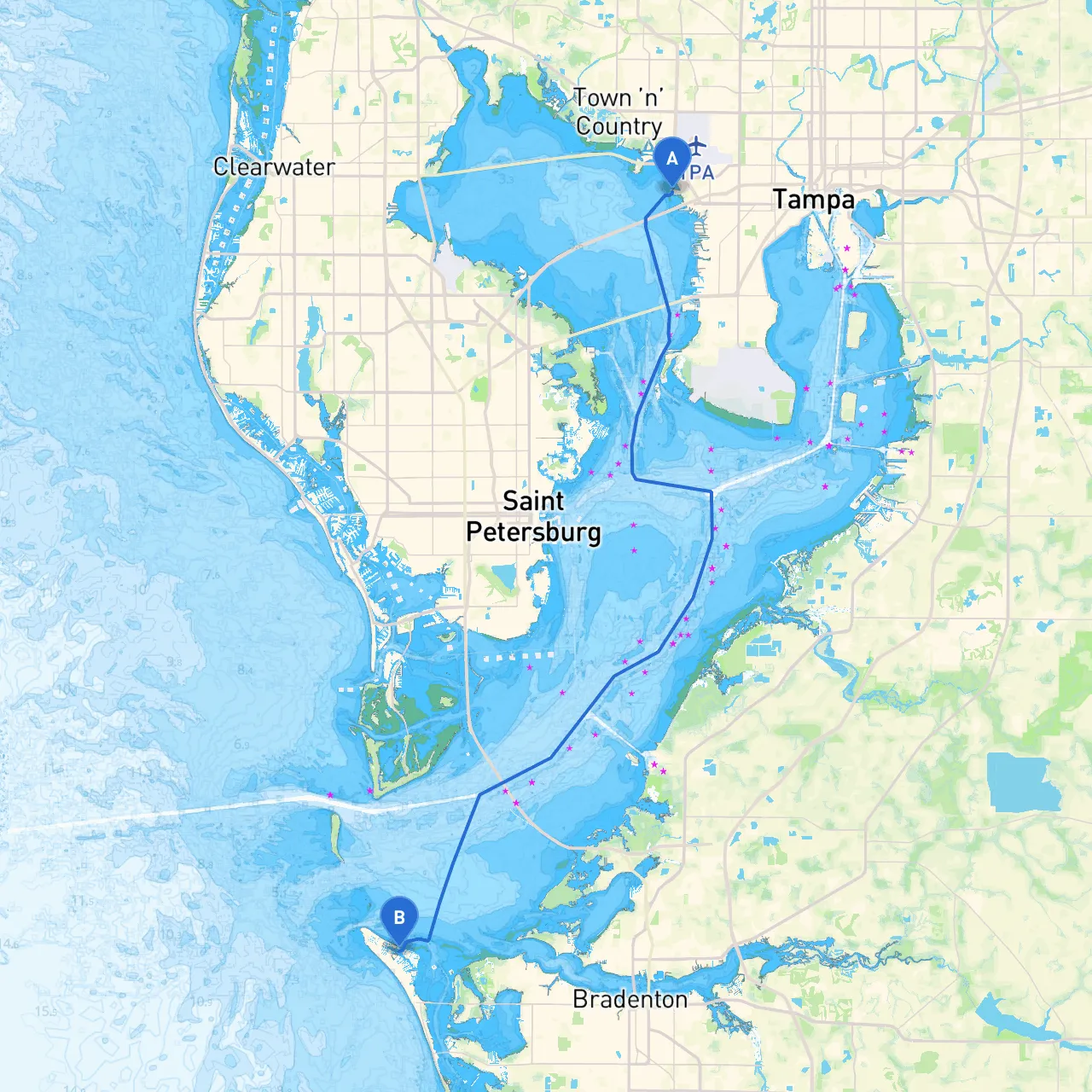
Route Overview Your trip to Anna Maria Island is approximately 37 nautical miles, predominantly through Tampa Bay and along the coastal waters of the Gulf of Mexico. This is a fantastic route for cruisers who appreciate a mix of urban and natural settings, however, navigating these waters requires sharp attention to weather patterns and maritime regulations.
Key Sections of the Route:
1. Tampa Bay - Navigational Aids: As you leave Tampa, follow the marked channels, paying close attention to structures like the Sunshine Skyway Bridge to the south. This bridge is a notable landmark and can effectively guide you as you navigate southward. - Hazards: Watch for shallow areas as you exit towards the Gulf. The marker buoys (red right returning) will help keep your path clear of potential grounding zones. - Shelter Options: If the weather suddenly turns, consider dropping anchor in the sheltered areas of the "Hillsborough River" for a safe haven.
2. Pass-a-Grille Channel and Boca Ciega Bay - Notable Points of Interest: Upon exiting Tampa Bay, you'll navigate through the Pass-a-Grille Channel where you'll see the quaint village. Also known for its golden beaches, it makes for an excellent stop for those wanting to stretch their legs or grab some food. - Local Regulations: This area is known for heavy boating traffic during weekends, so maintain a sharp lookout for recreational boaters and personal watercraft.
3. Gulf Waters - After clearing Boca Ciega Bay, head west toward the open waters of the Gulf of Mexico. Here, the navigational aids become crucial as you will be dealing with deeper waters and potentially stronger currents. - Hazards: Keep an eye out for shoaling in various areas; the water can change depth rapidly especially in areas impacted by tidal flows.
4. Anna Maria Sound - Approaching Anna Maria: As you near Anna Maria Island, you’ll navigate into the Anna Maria Sound where the waters become much calmer. Be vigilant for any commercial traffic, particularly during peak times. - Docking Options: Anna Maria offers several marinas and boat docks. The popular spots like the Anna Maria City Pier present opportunities for stopping and enjoying the scenic views. - Final Approach: Look for the green and red markers enclosing your final approach to the island’s various docking options.
Recommended Boating Apps: Before you embark on your journey, consider downloading savvy navvy along with other navigation tools such as Navionics or OpenCPN. These tools can help you track your route, check for any navigational hazards, and stay updated on weather changes.
Safety Tips:
This route embodies a growing experience for boaters—from the vibrant city of Tampa to the restful beaches of Anna Maria Island. With due vigilance and preparation, you're set for a safe and enjoyable adventure, blending both safety and excitement on the water! Enjoy your journey!