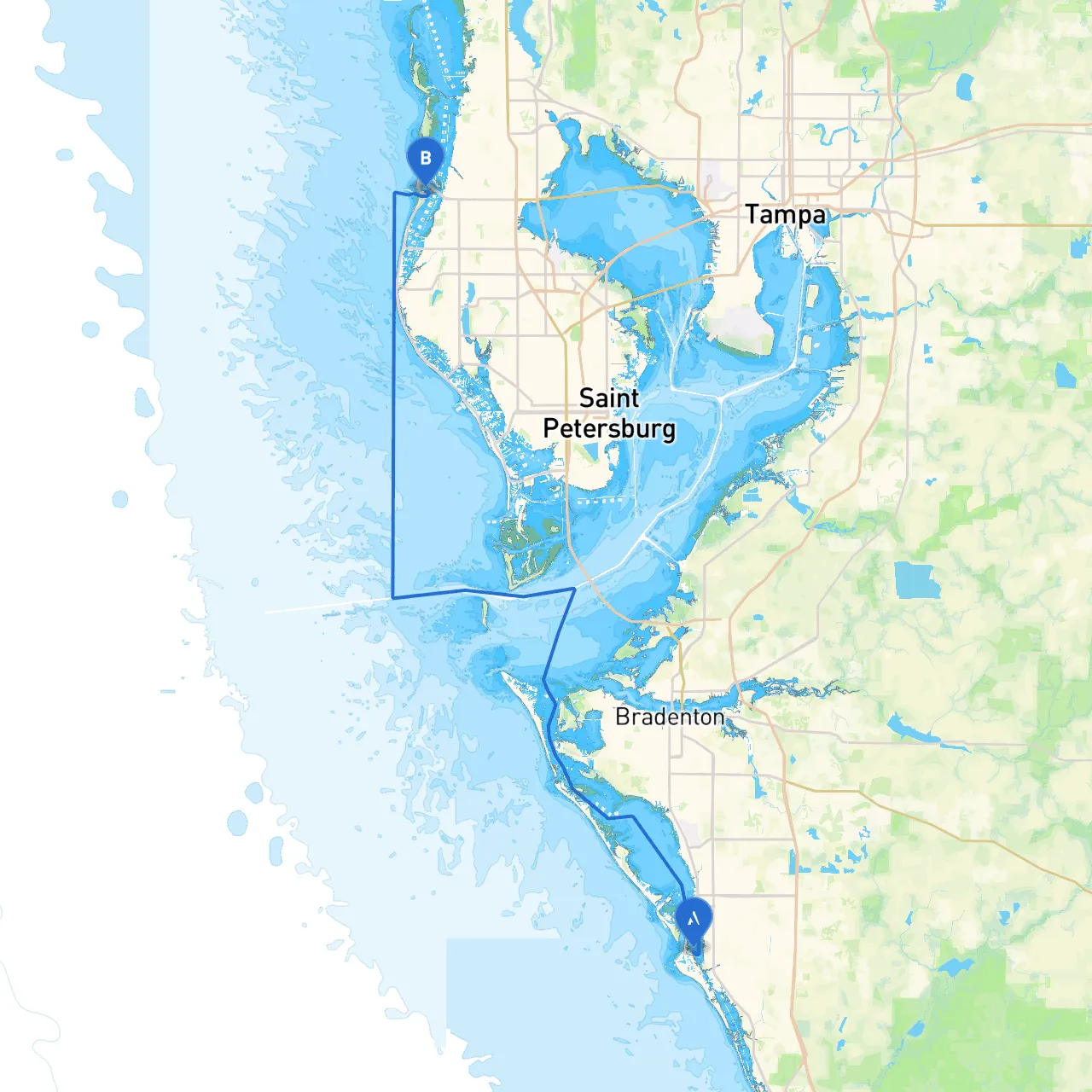
Pilotage Plan from Siesta Key, Florida to Clearwater Beach, Florida
Starting Point: Siesta Key, Florida (Coordinates: -82.5509, 27.2877) Ending Point: Clearwater Beach, Florida (Coordinates: -82.8214, 27.9678)
Overview
This journey takes you from the serene beaches of Siesta Key to the bustling shores of Clearwater Beach, traversing through some of Florida's beautiful coastal waters. This route is ideal for recreational boaters with moderate experience, as it combines scenic views, navigational aids, and safe harbors for refuge. While the enjoyment of coastal cruising is paramount, safety considerations will ensure a smooth and worry-free adventure.
Route Highlights
1. Departing Siesta Key:
Setting off from Siesta Key, you'll want to head north, keeping a watchful eye on the local navigation markers. The waters near the island are generally calm, but be cautious of shifting shoals, especially around the southern parts of the bay.
- Point of Interest: Visit the famous Siesta Key Beach before departure for its powdery white sands and turquoise waters.
2. Sarasota Bay:
As you venture into Sarasota Bay, navigate towards the northern exit that leads you to the Gulf of Mexico. The Bay is well-marked with buoys and lighthouses, including the prominent Sarasota Bay Light, which is essential for your course.
- Hazards: Watch for fluctuating tides and boat traffic around the marina areas.
- Shelter Option: Consider taking refuge in Bradenton Area’s marinas if the weather shifts unexpectedly.
3. Gulf of Mexico:
Once you’re in the Gulf, you’ll experience the vastness of the open water. The journey here is about 10 nautical miles, so equip your boat with good navigation tools - GPS and depth sounders.
- Navigation Aids: Pay attention to offshore markers and the Anna Maria Island Bridge, which might have height restrictions based on the tide.
- Warnings: Be aware of any weather advisories, as squalls can build quickly in the Gulf.
4. Pass-A-Grille:
On your way, a slight detour to the quaint and historic community of Pass-A-Grille can be delightful. It provides a charming atmosphere with cozy restaurants and shops.
- Activities: Enjoy some local seafood at a harborside restaurant, and don’t miss the scenic views from the nearby beach park.
5. Approaching Clearwater:
As you get closer to Clearwater, keep an eye on the boating traffic and any restrictions around the Clearwater Memorial Causeway. The channel becomes narrower and more crowded, so stay vigilant.
- Navigational Aids: Look for the Clearwater Beach Marina markers and stay within marked channels to avoid sandbars and shallow areas.
Safety Considerations
- Weather Monitoring: Always check the weather before departure. Apps like Savvy Navvy, along with local marine forecasts, will offer crucial updates.
- Life Jackets: Ensure all passengers wear life jackets. Florida law dictates they must be readily available for all on board, and children under six must wear them.
- VHF Radio: Have a VHF radio onboard for marine communications. Monitoring Channel 16 can provide emergency updates and traffic information.
- Environmental Awareness: Adhere to the no-wake zones in sensitive areas and marinas to protect marine life and avoid penalties.
Conclusion
This cruising route from Siesta Key to Clearwater Beach blends safety and enjoyment beautifully, making it perfect for the conscientious boater after a mix of adventure and leisure. With opportunities for shelter and points of interest along the way, this trip can provide memorable experiences while ensuring utmost safety. Remember, preparation is key; with the right plan and attention to detail, you’re set for an unforgettable day on the water!