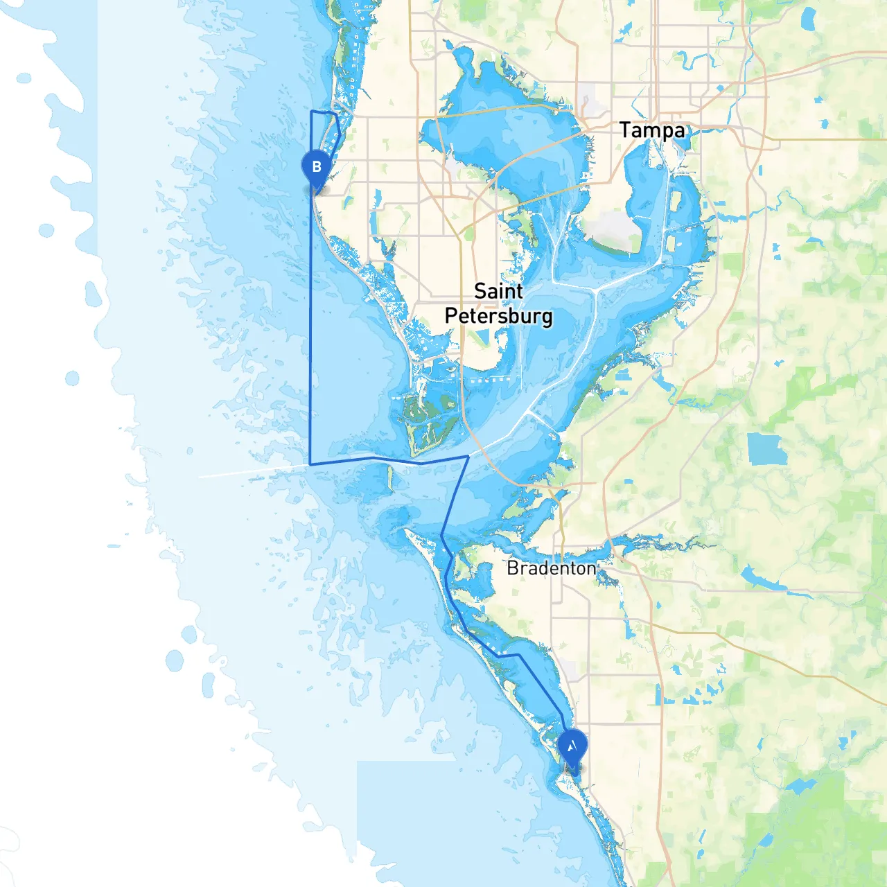
This pilotage plan outlines a safe and enjoyable cruising route from Siesta Key, Florida, to Indian Rocks Beach. This trip is particularly suited for recreational boaters with moderate experience, as it combines beautiful scenery, opportunities for leisure activities, and access to safe harbors in case of changing weather conditions. The overall distance spans approximately 30 nautical miles, taking you along the stunning coastline of Florida’s Gulf Coast.
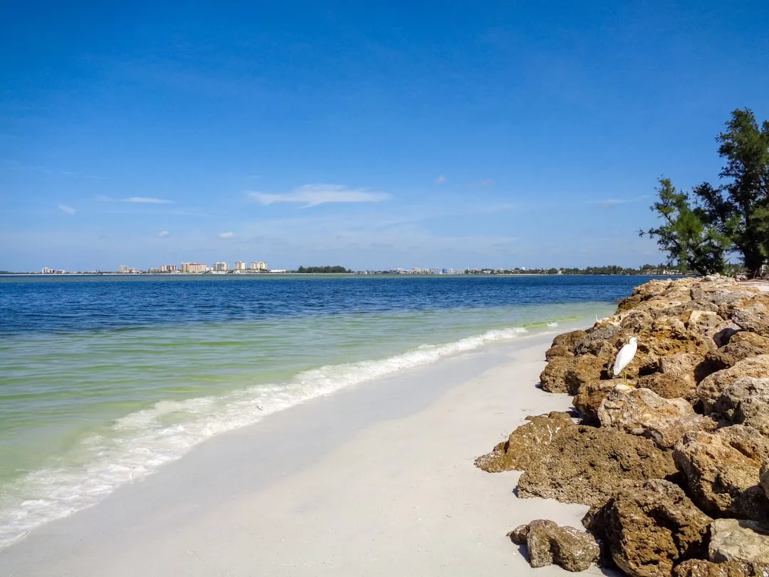
Before setting off, ensure your vessel is well-equipped. Check your navigational systems, safety equipment, and stock provisions. As you depart from Siesta Key, be sure to admire the vibrant beaches and the local atmosphere.
1. Departing Siesta Key: As you leave Siesta Key, you’ll navigate through the Gulf of Mexico. Ensure that you are familiar with local navigation charts and have your vessel's GPS set to guide you along the route.
2. Important Navigational Aids: Look out for the Siesta Key Lighted Buoy (Fl.G.4s) as you head northwest from the island. This aids in keeping you safely away from shallow waters.
3. Venice Inlet: About 8 nautical miles from your departure, you’ll encounter the Venice Inlet. This is a great point of interest for a potential stopover, offering beautiful beaches and opportunities for fishing or exploring. If you need to take shelter here, you can tuck into the inlet should the weather become unfavorable.
4. Manasota Key and Stump Pass: After passing Venice Inlet, continue towards Manasota Key. If time allows, this area is excellent for snorkeling or beachcombing. Navigate through Stump Pass, being mindful of the tidal currents. This area reveals beautiful views of pristine waters and nature.
5. Englewood Beach: Approximately 14 nautical miles into your journey, you’ll reach Englewood Beach. Consider stopping for a break, enjoying the sun, and perhaps engaging in some water sports if conditions permit. The beach often serves as a perfect spot for lunch.
6. Gasparilla Pass: Continuing north, the next point of interest is Gasparilla Pass. Watch for local fishing boats and the occasional pleasure craft making their way in and out of the channel. This is another good location to take shelter if conditions worsen.
7. Boca Grande and Surrounding Waters: Just north of Gasparilla Pass lies Boca Grande, known for its charming village vibe and historical lighthouse. If you have the chance to explore, it’s worth taking your time here.
8. Pass-a-Grille: As you approach the shore of St. Petersburg, you’ll come to Pass-a-Grille. This area offers picturesque views and various dining options. It is also a suitable harbor if weather conditions take a turn.
9. Approaching Indian Rocks Beach: From Pass-a-Grille, you’ll proceed to the final stretch towards your destination: Indian Rocks Beach. The waters here can be busy; hence, maintain vigilance for other vessels, swimmers, and buoys marking swimming zones.
Upon arrival, you’ll find Indian Rocks Beach teeming with local charm, offering unique shops, cafes, and access to public beaches. The area provides fantastic opportunities for fishing, lounging on the beach, and participating in local activities.
With its combination of beautiful sights and practical navigational routes, this journey from Siesta Key to Indian Rocks Beach offers a wonderful boating experience while prioritizing safety and enjoyment. Prepare your vessel, stay alert, and enjoy the moment as you cruise through these beautiful waters.