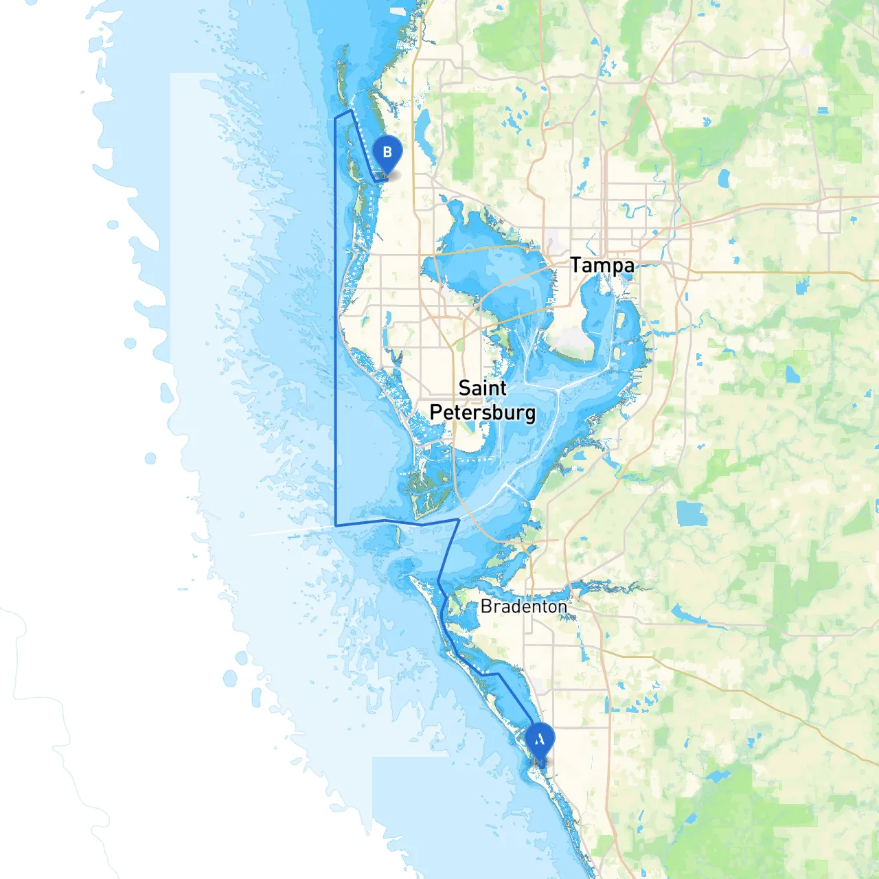
Starting Point: Siesta Key, Florida Ending Point: Palm Harbor, Florida
Welcome aboard! This pilotage plan will guide you on an exciting yet safe journey from Siesta Key to Palm Harbor. You will encounter stunning views, coastal wildlife, and charming stops along the way. This route is particularly well-suited for moderately experienced cruisers, ensuring the thrill of open water while remaining manageable and safe.
The trip will take you through the gorgeous waters of the Gulf Coast, covering approximately 22 nautical miles directly. The journey is predominantly along the Intracoastal Waterway (ICW), providing protection from open sea conditions and reducing exposure to swells and waves.
The Sarasota Bay Area: As you depart from Siesta Key, Sarasota Bay should be your first stop. With ample amenities, you can explore local parks or dine at waterfront restaurants. This bay also offers several sheltered spots should the weather turn unfavorable.
Longboat Pass: After leaving Sarasota Bay, you'll pass through Longboat Pass. It’s a narrow but scenic channel. Keep an eye out for local fishers and leisure craft, but the currents can be tricky here. Consider fishing or enjoying a picnic at the surrounding parks.
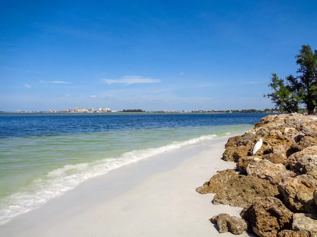
Turtle Beach: While this can be just a quick navigational marker, it’s a lovely place to pause for a swim or a lunch break. The beach is scenic and tranquil, making it a perfect spot to enjoy the views before continuing your journey.
Robinson Preserve: This expansive natural preserve offers a glimpse into Florida's rich ecosystem. While navigating around the entrance, take note of the mangroves and tidal waters. It’s an ideal location for kayakers and bird watchers.
Bayshore Gardens: After Robinson Preserve, check out this area for potential anchorage and a chance to explore nearby. While it’s not a full bay, the nearby marinas provide excellent services and hospitality, should you need to dock.
Safety is paramount on every journey. Ensure you have appropriate safety gear onboard, including life jackets, flares, a first aid kit, and a working VHF radio for communication. Before departing, inform someone on land of your itinerary. This way, they can assist if unexpected complications arise.
In summary, this route from Siesta Key to Palm Harbor not only offers stunning landscapes and enjoyable stops but also ensures that you journey in a safe manner. There’s plenty of wildlife to observe and charming communities along the route. So set your sail, keep your senses alert, and enjoy the breathtaking views that the Florida Gulf Coast has to offer! Happy cruising!