
Pilotage Plan for a Boat Trip from Stamford, Connecticut to New Rochelle, New York
Route Overview
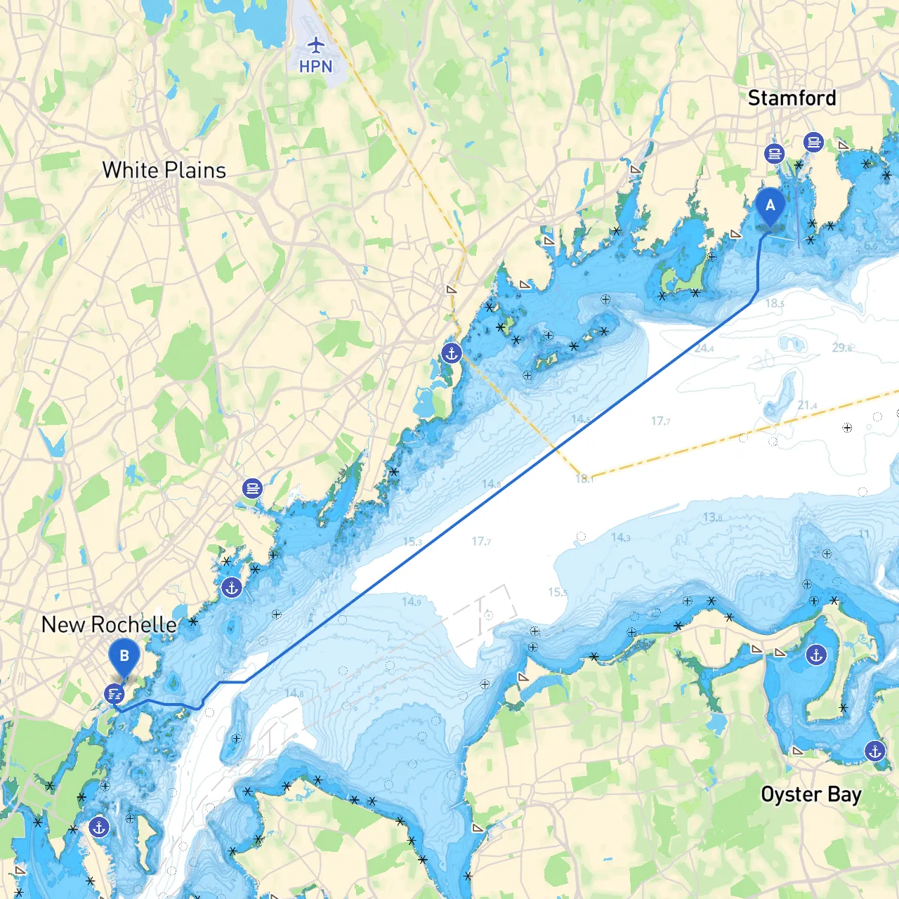
Setting sail from Stamford, Connecticut, to New Rochelle, New York, presents a delightful coastal voyage rich with picturesque scenery, vibrant marine life, and a variety of options for shelter and attractions along the way. The journey covers approximately 24 nautical miles and is particularly suitable for experienced recreational boaters, families, and those looking to explore the beautiful Long Island Sound.
Leg 1: Departing Stamford (Coordinates: 41.0172, -73.5465)
Begin your trip at Stamford Harbor, which offers robust navigational support and easy access to the sound. As you depart, make sure to heed the channel markers that guide you out of the harbor and remain aware of any local moored vessels, which can pose navigation challenges.
Points of Interest:
Navigational Aids:Watch for Stamford Harbor Light (Fl (2+1) R 6s) marking the channel. Maintain a safe distance from shoals as you head out into the open waters.
Leg 2: En Route to New Rochelle
Once you've exited Stamford Harbor, you will follow the coastline towards New Rochelle. This leg of the trip is relatively straightforward, but you should stay alert for the following:
Shelter Options:
Navigational Considerations:Passing Mamaroneck, you'll navigate past several navigational aids, including buoys marking the local channels. Keep an eye on the Larchmont Breakwater Light (Fl R 4s) as you approach. Be aware of local boating regulations regarding no-wake zones, especially in populated areas close to shore.
Leg 3: Approaching New Rochelle (Coordinates: 40.8957, -73.777)
As you near New Rochelle, your approach will be marked by the wider waters of Long Island Sound. The shoreline here offers beautiful views and character; take your time to enjoy the scenic vistas.
Points of Interest:
Navigational Aids:Pay attention to the New Rochelle Light (Fl W 4s). As you dock at New Rochelle, be mindful of the crowded marina and follow local docking protocols to ensure safe mooring.
Local Regulations:Always check the local regulations for speed limits and no-wake zones as you enter more developed dock areas. The waters around New Rochelle can be busy, particularly in the summer months, so vigilance is paramount.
Navigational Apps:For added convenience and safety on your journey, consider apps such as savvy navvy, which excels in providing navigational charts and route planning appropriate for your skills. Other helpful apps can include Navionics and Aqua Map for real-time weather updates and navigational assistance.
In summary, this route from Stamford to New Rochelle not only showcases the beauty of the Connecticut and New York coastlines but also ensures a thoughtful consideration for safety and well-being on water. Embrace the journey, keep an eye on the weather, and enjoy the rich marine experience that awaits you. Happy boating!