
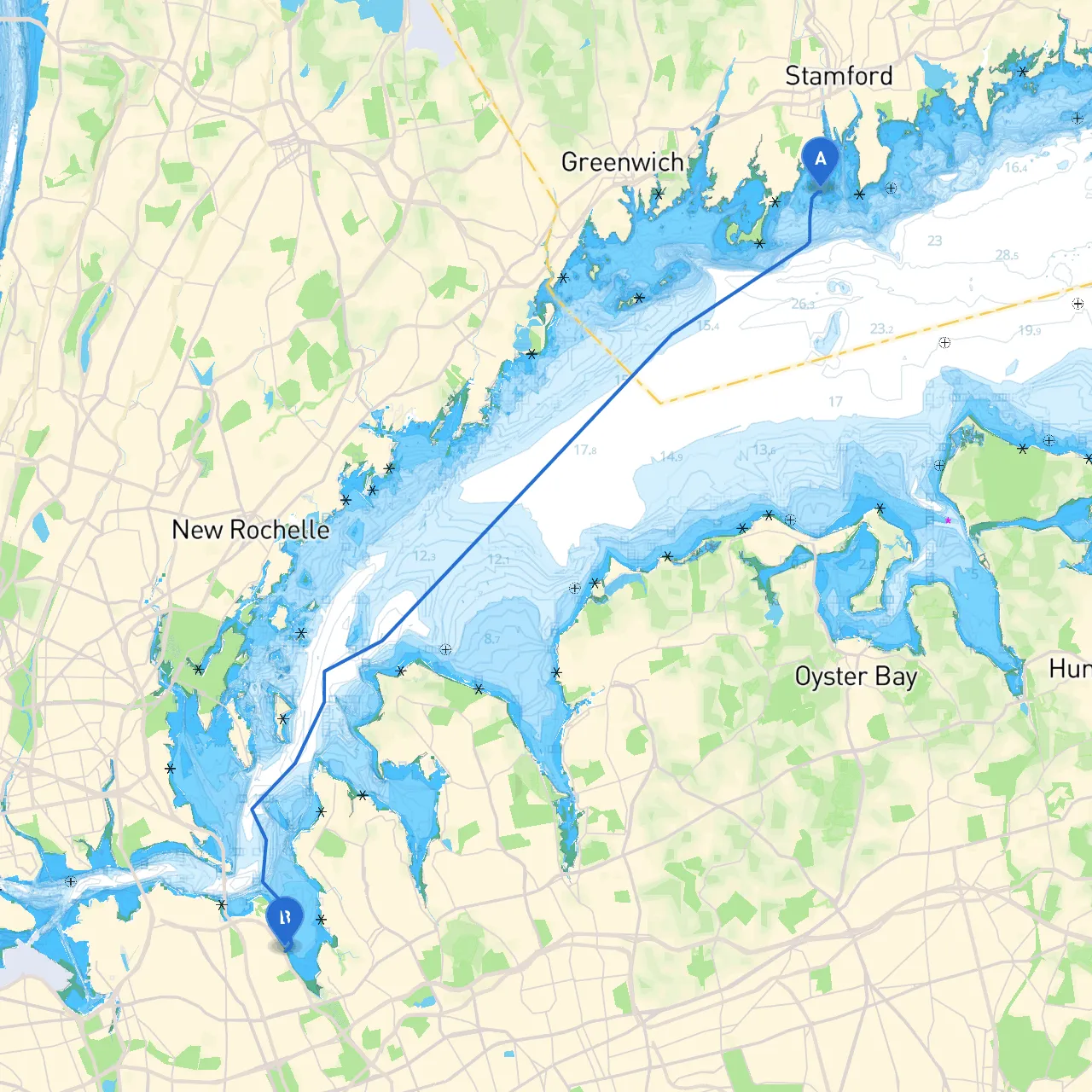
This piloting journey from Stamford, Connecticut to Bayside, New York offers an engaging blend of scenic coastal views and urban attractions, providing the perfect escape for recreational boaters. While the allure of the open waters and charming harbors is inviting, safety remains paramount. This route is particularly well-suited for experienced boaters who enjoy a mix of sheltered bays and navigational challenges—perfect for sailors and motorboat enthusiasts alike.
Before you leave Stamford, ensure that you have all required equipment onboard, including life jackets, navigation tools, and flares. The departure from Stamford Harbor, a protected anchorage, offers safe access to Long Island Sound and the Atlantic Ocean.
1. Stamford Harbor to Long Island Sound (approx. 5 NM) As you set off from Stamford, head southeast to exit Stamford Harbor. Be vigilant of local vessel traffic, especially in the busy summer months. The first navigating aid is the Stamford Harbor Light (Fl R 4s), which will guide you as you make your way into Long Island Sound.
2. Long Island Sound (approx. 15 NM) Once in Long Island Sound, you have plenty of coastal sights—keep an eye out for the picturesque coastline of Connecticut on your left. Stay within the marked channels to avoid shoal areas. You’ll want to check in on the navigation buoys, particularly the Harding Rock Light and the Greens Ledge Light, ensuring to follow the deep-water routes.
3. Shelter Options - Norwalk Harbor: Approximately 10 NM from Stamford, Norwalk is a great option if conditions change. The harbor is bustling with marinas and local eateries. If you’re feeling adventurous, consider stopping at the Norwalk Islands for a quick hike or picnic. - New Rochelle: Another stop worth considering, just off to the northwest of your course line, offering good amenities and refuge.
4. Passing Execution Rocks Light As you navigate eastward, pay close attention to Execution Rocks Light (Fl W 10s). This landmark serves as both a navigational aid and a rich historical reference. The rocky outcrop and its lighthouse make for an excellent photo opportunity.
5. Entering Throgs Neck When approaching the Throgs Neck Bridge, watch for both commercial and recreational traffic. Utilizing a marine traffic monitoring app such as Savvy Navvy can be particularly useful here, as it provides real-time updates on waterway conditions and nearby vessels.
6. Final Stretch to Bayside (approx. 4 NM) After passing under the Throgs Neck Bridge, continue navigating carefully. Pay attention to navigational aids as you traverse the busy waters leading into the Bayside area. You’ll be greeted by a vibrant community with plenty of docking facilities.
Upon reaching Bayside, take time to enjoy the local waterfront park, which provides walking trails and picnic spots. For those who would like to explore, there are plenty of boating services available, ensuring you can relax or continue your adventure effortlessly.
This route not only offers safe shelter options along the journey but also presents the gift of beautiful landscapes and a taste of coastal culture. Perfect for pleasure cruising, it’s a trip that satisfies both the desire for adventure and the need for a secure and enjoyable boating experience.