
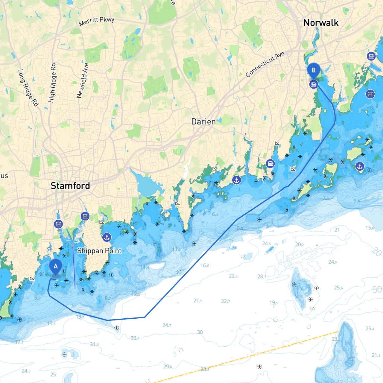
This journey from Stamford to South Norwalk takes you through the beautiful waters of Long Island Sound, showcasing the picturesque New England coastline. The route spans approximately 10 nautical miles and offers a mix of sheltered bays, navigable channels, and vibrant landscapes, making it ideal for both leisure and experienced boaters. Safety is paramount on this route, but the scenic views and highlights along the way will certainly enhance your boating experience.
1. Departure from Stamford, CT - Starting Point: Stamford Harbor (Coordinates: -73.5465, 41.0172) - Harbor Considerations: Stamford Harbor has well-marked channels and several marina options if you want to check in before heading out. Ensure you follow the designated navigation channels to avoid shoals, particularly on the western side. - Hazards: Various private moorings and boats docked in the harbor can create challenges during departure, so remain vigilant, especially in busy periods.
2. Navigating Long Island Sound - Heading East to South Norwalk: Once you exit Stamford Harbor, set a course toward South Norwalk, navigating along Long Island Sound. Maintain a lookout for large vessels, as this area can be busy with both commercial and recreational traffic. - Navigation Aids: Pay close attention to the following navigational aids: - Stamford Harbor Light (Fl R 4s): This light will guide you out of the harbor. - Green and red buoys: Mark the channel and indicate shallows on either side. Proper adherence to these marks is crucial. - Local Regulations: Be aware of speed limits in certain areas, especially near marina approaches and densely populated sections.
3. Points of Interest En Route - Cove Island Park: As you cruise eastward, take a moment to view the natural beauty of Cove Island. It’s a great stop for picnicking, with trails and beaches on the island. - Cheese Spring: A notable navigational mark which can serve as a delightful visual landmark. Entry into some bay areas is advised, depending on the wind and weather conditions. - Norwalk Islands: Further on, you may consider a detour to the Norwalk Islands if time permits. They are a series of small islands that offer picnic opportunities and stunning views.
4. Shelter Options - Bays for Shelter: If conditions turn unfriendly, several nearby locations can provide good anchorage: - Cove Marina Bay: A quick retreat if the winds pick up. The solid protection from various directions offers a secure place to wait out a storm. - Norwalk Sound: Provides ample space for anchorage with a good depth of water, though be mindful of local mooring regulations.
5. Arrival at South Norwalk, CT - Destination: SoNo (South Norwalk) Harbor (Coordinates: -73.4117, 41.0943) - Harbor Description: Upon entering South Norwalk Harbor, you'll find the charming waterfront area featuring restaurants and shops. This marina is welcoming to transient boaters and offers the amenities needed to restock and explore the local culture. - Final Navigational Aid: Follow the channel markers carefully as you approach the harbor, avoiding the shallow areas to the sides of the main entrance.
This route is perfect for recreational boaters who appreciate scenic cruises with potential for exploration, while maintaining safety as a priority. Enjoy your day out on the water, and relish the stunning Connecticut coastline at your leisure. Safe boating!