
Starting Point: Stamford, Connecticut Coordinates: Long: -73.5465, Lat: 41.0172
Ending Point: Elizabeth, New Jersey Coordinates: Long: -74.1869, Lat: 40.6463
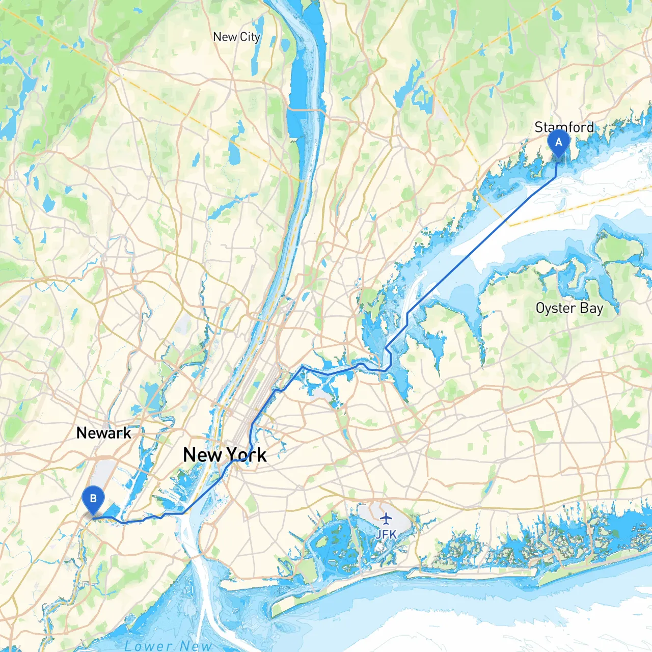
This cruising route from Stamford to Elizabeth is not just a straightforward transit; it’s a scenic journey through some of the most picturesque waterways in Connecticut and New Jersey. Suitable for both intermediate and advanced boaters, this route features stunning landscapes, vibrant marine life, and potential shelter points in case the weather turns inclement. This plan emphasizes safe navigation, along with notable landmarks and local attractions that can make your trip memorable.
Leaving Stamford Harbor, take advantage of the well-marked channels. Pay attention to the Stamford Lighthouse as a navigational point. The harbor can be busy, especially during weekends, so remain vigilant of other vessels.
As you depart Stamford, consider making a stop at Cove Island Park. The cove offers shelter and a calm area to anchor should you need a break. The park has trails and picnic spots, making it a lovely detour if time permits.
The route proceeds through Long Island Sound, an area generally well-marked with buoys. Maintain a watchful eye for commercial traffic, as the sound can be frequented by container ships and ferry boats. Use the charts carefully to stay clear of marked hazards like rock outcroppings and shallow areas.
Moving past the coastline, you will approach the mouth of the Hutchinson River as you navigate into the East River. This can be a bustling waterway, so keep an alert lookout for both recreational and larger commercial vessels.
1. City Island: Before heading into the East River, you may want to cruise past City Island, a charming maritime community. Known for its quaint shops and eateries, this spot offers an inviting atmosphere for a quick stop.
2. The Bronx: As you navigate south along the East River, the Manhattan skyline will unfold on your right. This backdrop feels more dramatic while cruising, perfect for capturing some photos of iconic structures like the Brooklyn Bridge.
3. Goose Island and Randall's Island: Keep this area in mind as you pass; it could serve as a waiting point if you encounter bad weather.
As you continue past the Staten Island Ferry route, pay attention to the extensive ship traffic. You’ll be approaching the Elizabeth River, where the waters can be choppy due to wakes. The Elizabeth Seaport offers a well-marked entry into the harbor.
This pilotage plan offers a delightful yet safe journey from Stamford to Elizabeth, favoring both your spirit of adventure and need for safety. Embrace the vibrant marine life and scenery while being prepared for the unexpected—yet always remember, safety first!