Pilotage Plan: Palmetto, Florida to Siesta Key, Florida
Overview
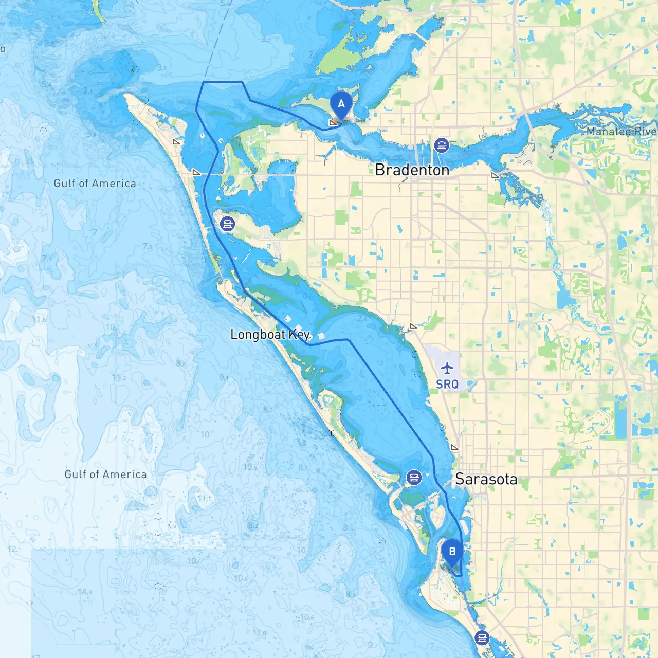
This journey takes you from Palmetto, Florida, to Siesta Key, covering a distance of approximately 15 nautical miles. As a seasoned boater, this route is well-suited for day cruising, offering serene waters with scenic views while providing escape routes in case of inclement weather. The journey combines safe navigation with opportunities for exploration, making it ideal for seasoned boaters and new enthusiasts alike.
Route Sectioning
1. Departure from PalmettoStarting from Palmetto at coordinates (27.5231, -82.6167), you'll leave the Manatee River. Before heading out, make sure to check the local weather and tide conditions. The river can experience strong currents, so timing your departure around a favorable tide will aid your journey.
Navigational Considerations:
- Aids to Navigation: Look for markers guiding you out of the river. Notably, the Palmetto II Bridge (a fixed bridge) needs to be noted for clearance, ensuring that you have ample vertical space to pass underneath.
- Hazards: Stay clear of shoals and submerged objects especially as you head towards the Gulf Intracoastal Waterway (ICW).
2. Turning onto the Intracoastal WaterwayOnce in the ICW, the navigation becomes more relaxed with well-marked lanes. Be cautious of the changing depths and watch for boats that may be fishing or operating in this channel.
- Points of Interest: Keep an eye out for the lovely parks lining the waterways such as the Robinson Preserve, a suitable spot for a short break to enjoy nature and some light trails.
3. Navigating to Sarasota BayAs you approach Sarasota Bay, you will find a few options for shelter and enjoyment:
- Bays to Shelter: If the weather worsens, consider taking refuge in Sarasota Bay. The area offers various inlets and channels to safely anchor and wait for conditions to improve.
- Landmarks: Sarasota offers a vibrant cultural scene; you might spot the famous Ringling Museum from the water, a perfect destination for a post-cruise visit.
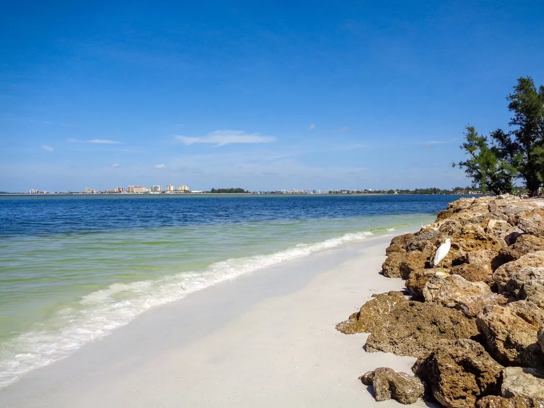
4. Final Approach to Siesta KeyThe last stretch to Siesta Key is approximately six nautical miles. As you approach Siesta Key, you will navigate through a series of waterways leading up to the beaches, where the iconic white sands draw many visitors.
Navigational Considerations:
- Navigational Aids: Pay special attention to the red and green channel markers near the Siesta Key inlet. They’re clearly marked and guide you towards the nearest marinas.
- Local Restrictions: Stay alert for any local boating regulations such as no-wake zones especially when nearing residential areas.
Safety Considerations
Throughout your journey, adhere to the following safety measures:- Always wear life jackets and have sufficient safety equipment on board.
- Keep your VHF radio tuned to channel 16 for emergency communication.
- Avoid navigating in low visibility; know the forecast and have a plan to hug the shore if weather conditions change.
Recommended Boating Apps
As you prepare for your voyage, utilizing navigation tools can enhance your experience. I suggest downloading:- Savvy Navvy: A powerful app that provides charts, tidal information, and route planning capabilities.
- Navionics: Helpful for detailed mapping and updates on local hazards.
- Windy: To keep track of weather changes in real-time.
Conclusion
This route from Palmetto to Siesta Key is perfect for boaters looking for a balance of safe navigation and scenic beauty. With considerations for shelter, notable attractions, and essential navigation aides, it promises an enjoyable day out on the water while prioritizing safety. Happy cruising!