
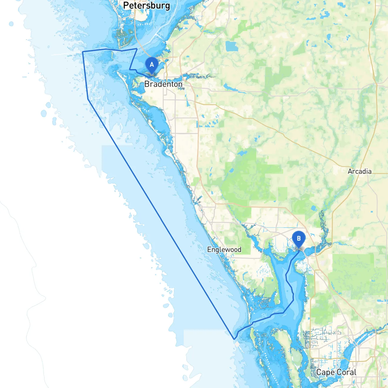
Pilotage Plan: Boat Trip from Palmetto, Florida to Port Charlotte, Florida
Embarking on this journey from Palmetto to Port Charlotte is an excellent choice for power and sailboat enthusiasts alike. This route allows you to experience the scenic beauty of Florida’s west coast while staying mindful of safety and navigational concerns. It is particularly well-suited for intermediate to experienced boaters who appreciate both natural wonders and the occasional challenge.
Your journey begins in Palmetto, located on Tampa Bay. Here, you can prepare your vessel with fuel and provisions, as well as check local marine conditions which can change rapidly in this region. Be sure to take note of the numerous marinas available for any last-minute needs.
The journey will primarily navigate the Manatee River, feeding into the Gulf Intracoastal Waterway, and eventually leading you to Port Charlotte via the waterways of Charlotte Harbor.
1. Out of Palmetto: Head west along the Manatee River towards its mouth. The navigation aids such as buoys and markers (particularly cuts of the Manatee River) will guide you out to Tampa Bay. Pay attention to the port and starboard lateral markers here as you transition from the river to this broader body of water.
2. Mouth of the Manatee River: As you cruise through Tampa Bay, be vigilant of the commercial shipping traffic. Keep an eye on the channel markers to navigate towards the Gulf Intracoastal Waterway. It's advisable to maintain a safe speed and stay within the marked channels, as there are shallow spots nearby.
3. Entering the Gulf Intracoastal Waterway: Once on the ICW, this stretch of water is relatively sheltered, with multiple bays nearby offering safe harbor for unforeseen weather. Notable stops include: - Sarasota Bay: Approximately 12 nautical miles south of your starting point, this is a prime location for an overnight stop should conditions warrant. The bay is well-sheltered, with numerous marinas to choose from. - Big Pass: Just south of Sarasota, this area can be an exhilarating experience for those who chase beautiful sunsets and vibrant marine life.
On your route to Port Charlotte, you’ll encounter a series of markers and day beacons essential for safe navigation:
This route not only introduces you to the beauty of Florida’s coastline but also emphasizes prudent navigation and safety. Whether you are piloting a sailboat or a powerboat, this trip promises enriching experiences while allowing you a palette of nature scattered with friendly stops. Enjoy the undulating waters and safety of your vessel for an unforgettable journey!