
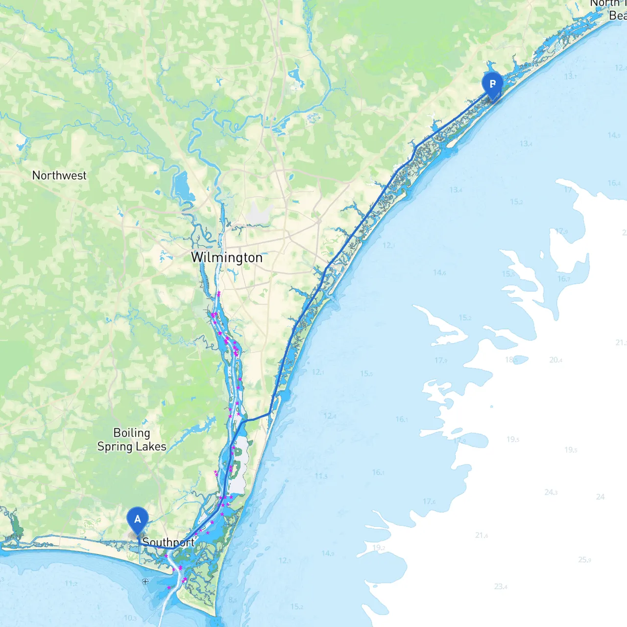
Pilotage Plan for Boat Trip from Oak Island, North Carolina to Topsail Beach, North Carolina
Overview:This delightful journey from Oak Island to Topsail Beach is perfect for intermediate to advanced boaters looking to experience North Carolina’s beautiful coastline. The route spans approximately 30 nautical miles and allows for a balance of safe navigation and scenic exploration. Given the intricacies of coastal navigation, it’s vital to plan for both safety and enjoyment.
Step 1: Departure from Oak Island
Starting your trip at Oak Island, ensure your vessel is well-prepared, checking fuel levels, safety equipment, and provisions. The waters here are relatively sheltered, but sailors must stay vigilant about the currents as they can be strong near inlets.
Navigational Aids:
Step 2: Heading towards Caswell Beach
As you set off, steer towards Caswell Beach, only a short distance away. This stretch provides scenic views of the coastal landscape, and being familiar with the tides is essential, as they can affect your vessel's draft, especially along shallower areas.
Shelter Considerations:Should the weather start to turn, you may find safe anchorage in the waters around hold sites. More specifically, look for spaces near Oak Island where you can seek refuge.
Step 3: Supply and Point of Interest at Southport
Navigating past Caswell Beach, you will approach the charming town of Southport. Known for its historic district and waterfront, it’s a wonderful spot to pause for supplies or enjoy a meal. Be aware that the Cape Fear River entrance can be busy, especially with commercial traffic, so keep a lookout for navigational buoys marking the channel.
Step 4: Capturing the Intracoastal Waterway
After Southport, continue down the Intracoastal Waterway (ICW). This well-marked route is lined with buoys and day markers, guiding you safely through the waters. Remember to maintain appropriate distances and adhere to the local speed limits to ensure a safe passage.
Navigational Challenges:Keep an eye on water depth as the ICW can have shoaling areas, particularly after heavy rains. Using a boating app like savvy navvy will help tremendously in keeping track of depths and hazards.
Step 5: Sneads Ferry and Shelter
Your next significant landmark will be Sneads Ferry, which offers an opportunity for a quick pit stop or an overnight stay if you wish to break your journey. There are sheltered bays nearby if you need to anchor and wait out inclement weather.
Step 6: Approaching Topsail Beach
As you near Topsail Beach, stay vigilant, because the waters tend to get busier with recreational boaters, particularly during the summer months. Look for the distinctive Topsail Beach Bridge as a navigational cue leading into the area.
Safety Considerations:Make sure to consult local weather forecasts and marine warnings as weather can shift. Stay updated with the local rules regarding wake zones and swimming areas to enhance safety for you and others.
Conclusion: A Journey Worth Taking
This boating route from Oak Island to Topsail Beach seamlessly combines relaxation, adventure, and incredible sights. By attentively navigating the established channels, brief stopovers in picturesque towns, and accounting for local weather and navigational aids, this trip is well-suited for seasoned boaters looking to enjoy the best of North Carolina's coastal maritime charm. Remember, safety is paramount, so always remain aware of your surroundings and adhere to local guidelines. Happy boating!