
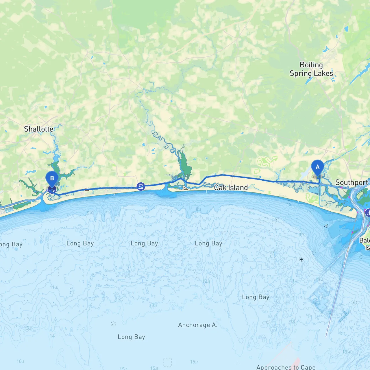
Route OverviewStarting your journey from Oak Island, North Carolina, this route to Shallotte offers a delightful blend of scenic waterways, charming coastal towns, and notable landmarks. It is well-suited for recreational boaters, ranging from beginners to experienced sailors looking for a day trip that doesn’t stray too far from the coastlines but is packed with opportunities for shelter and exploration.
Starting Point: Oak IslandAt Oak Island (coordinates: 33.925586344, -78.059761063), you’ll depart from a well-known beach town, famous for its beautiful lighthouses and serene beaches. Make sure to check weather conditions here before you set sail.
Route Highlights and Navigation Considerations
1. Waterway Navigation - Head out of the Intracoastal Waterway (ICW) at Oak Island. This protected route is ideal for boaters of all experience levels, offering safe passage with minimal exposure to open ocean conditions. - Pay attention to navigational aids such as buoys, markers, and channel depth. Regularly updated local charts and navigation apps like Savvy Navvy can enhance your cognitive map and help avoid shallow areas.
2. Notable Points of Interest - Long Beach: Before heading deeper into the waterway, take a brief stop at Long Beach, where sandy shores and picnic spots await. It’s a great location for a quick dip or just enjoying the sun. - Lockwood Folly Inlet: Enjoy some spectacular views as you pass by this inlet. It’s a popular spot for wildlife viewing, including various seabirds and sometimes dolphins. Be cautious of tidal currents as you approach the inlet, particularly during significant changes in water levels.
3. Potentials for Shelter - Holden Beach: Approximately halfway through your journey, this serene barrier island is an excellent location to take shelter should the weather shift unexpectedly. In case of storms or high winds, you can navigate to the back bay areas of Holden Beach, which offer calm waters and a friendly local atmosphere. There are also restaurants and local businesses that welcome boaters.
4. Entering Shallotte - As you approach Shallotte (coordinates: 33.914653417, -78.370039304), be prepared for local traffic in the ICW. Always maintain a lookout for other vessels, especially fishing boats and recreational craft returning home. - There are several marinas in Shallotte where you can dock and explore the local culture. Don’t miss the local seafood eateries that may serve freshly caught fish, a true highlight for any boater.
Navigational Aids and Considerations
Safety Tips
This trip from Oak Island to Shallotte is not only about the destination but the journey itself. With stunning scenery, potential wildlife encounters, and delightful spots to explore, it’s a perfect excursion for those looking for a calm, beautiful day on the water. Always prioritize safety, and with the right preparations and attention to detail, you're in for an unforgettable experience!