
Pilotage Plan: Charleston, SC to Mount Pleasant, SC
IntroductionEmbarking on a trip from Charleston, South Carolina to Mount Pleasant is not only a short jaunt across the harbor but also a fantastic opportunity to explore some of the area's rich history and scenic beauty. This route is especially suitable for recreational boaters and families looking for safe, calm conditions, and an easy-to-navigate trip. The estimated distance is roughly 10 nautical miles, making it manageable for novice sailors and experienced cruisers alike.
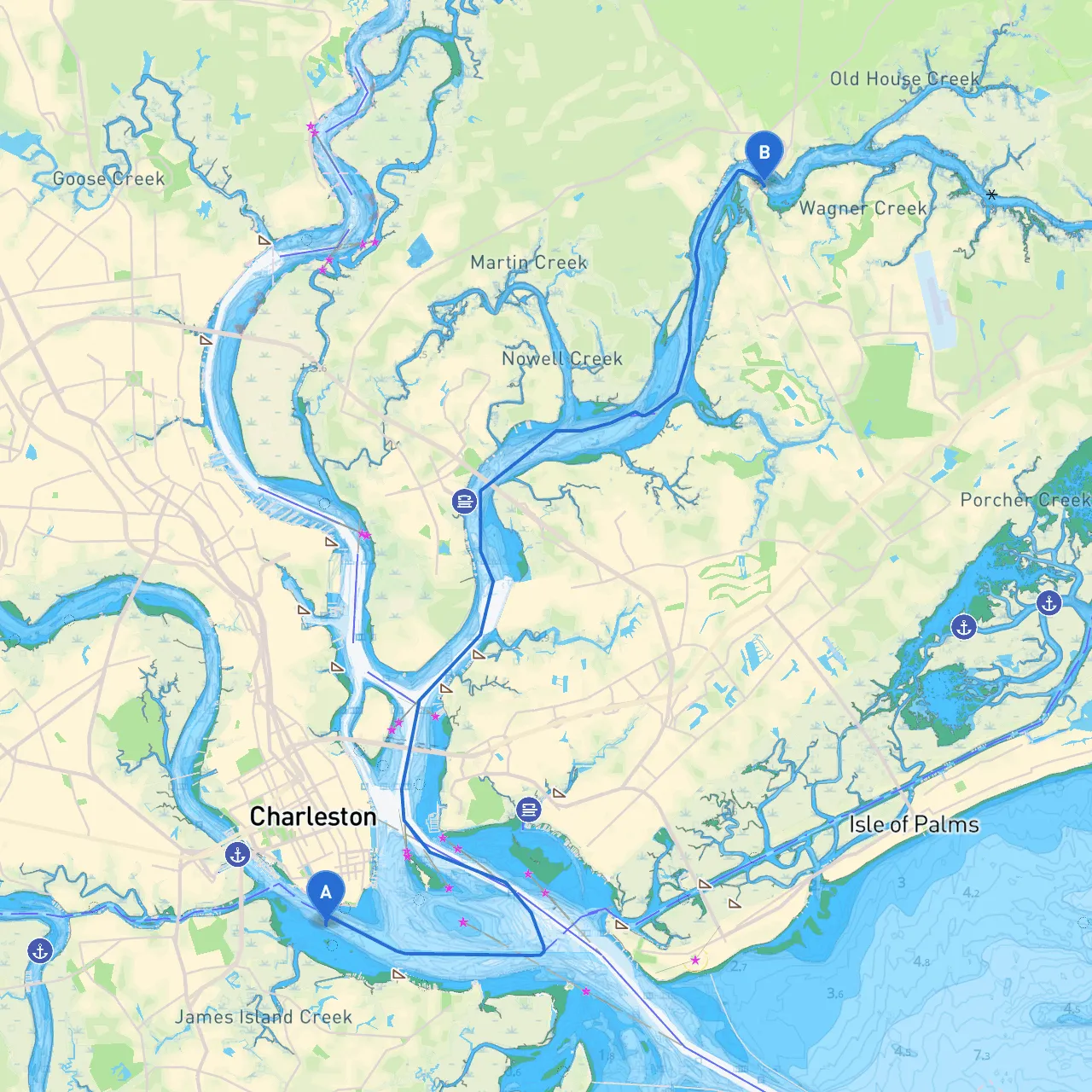
Route OverviewStarting Point: Charleston, SC (Coordinates: -79.9366, 32.7652) Ending Point: Mount Pleasant, SC (Coordinates: -79.8258, 32.9224)
Weather and Safety ConsiderationsBefore heading out, checking the local weather forecast is crucial. The Charleston area can experience changes in conditions quickly, so be prepared for sudden storms. If the weather looks threatening, you’ll want to know your options for seeking shelter.
Notable Shelters & Bay Areas One excellent place to consider for shelter along your route is Shem Creek. Just a short detour will lead you in, providing great facilities and a safe anchorage if conditions worsen. Additionally, you can enjoy local restaurants and a picturesque view of the waterfront while waiting it out.
Points of Interest Along the RouteAs you head towards Mount Pleasant, don’t miss:
1. The Battery: This historic landmark offers beautiful views of the harbor and is an iconic site in Charleston. While viewing it from the water, you can soak in the antebellum architecture and massive live oak trees.
2. Fort Sumter National Monument: Just off your starboard side as you approach the harbor entrance, this historical site is essential to visit for those interested in Civil War history. Although you may not dock here, cruising by provides a fantastic photo opportunity.
3. Shem Creek: This location not only provides shelter but also experiences vibrant local life with restaurants and shops along the waterfront. A perfect place for a quick stop to stretch your legs or dine with a view.
Navigational ConsiderationsThe following points are essential for ensuring safe navigation:
Regulatory ConsiderationsMake sure to adhere to local boating regulations, including speed limits and no-wake zones near marinas and residential areas. Keep in mind that life jackets are mandatory for all passengers on vessels under 16 feet, and it’s recommended to have enough for everyone onboard for larger crafts too.
Recommended Boating AppsFor a seamless navigation experience, utilize boating apps such as:
1. Savvy Navvy: It’s excellent for route planning and offers an intuitive interface complete with tide and weather info.2. Navionics: Great for detailed charts and community-driven updates on navigational hazards.3. Windy: Perfect for checking wind conditions to ensure a pleasant day out on the water.
Final ThoughtsThe voyage from Charleston to Mount Pleasant provides a splendid mix of scenic beauty, historical landmarks, and enjoyable local culture, balanced with the practicality of safety on your boating adventure. As you make your way, adhere to navigational aids and local regulations, and you’ll have an unforgettable day on the water! Happy sailing!