
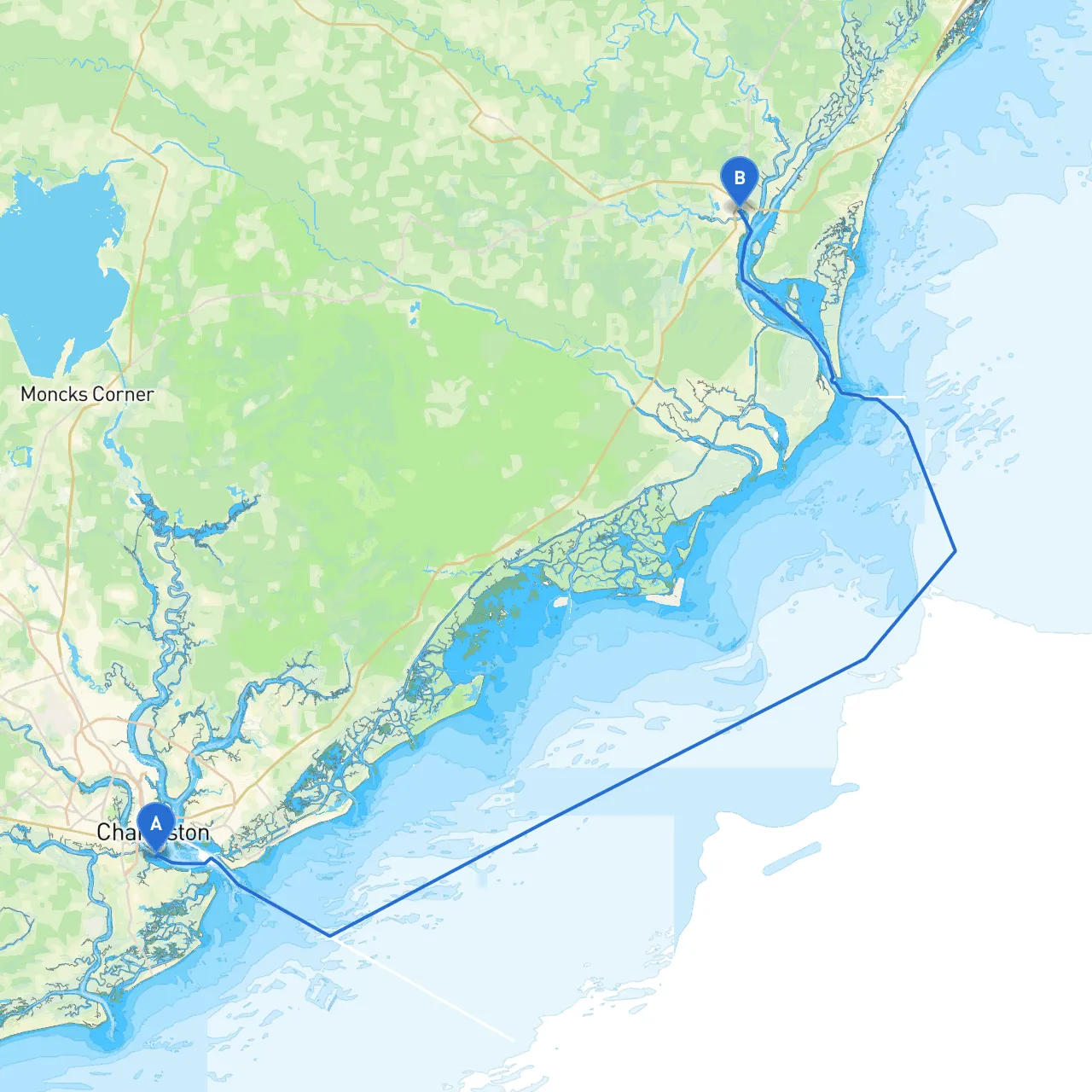
Embarking on a boat trip from Charleston to Georgetown offers a blend of scenic views, rich history, and the opportunity for wildlife observation along the Intracoastal Waterway (ICW) and surrounding areas. This route is perfect for leisure cruisers and those looking to enjoy a leisurely pace. The route is approximately 80 nautical miles, taking you through picturesque waterways, with ample opportunities for exploring and enjoying local attractions.
Starting Point: Charleston, SCAs you set sail from Charleston (coordinates: -79.9366, 32.7652), be sure to navigate carefully through the bustling harbor filled with commercial traffic and local fishing boats. The Charleston Harbor is well-marked, and prominent navigation aids, such as the Charleston Light and various buoys, will assist you in the early stages of your journey.
Key Stops and Shelters:1. Sullivan’s Island: Just seven nautical miles from Charleston, this island provides a safe stopping point. If weather turns unfavorable, you can find shelter at Breach Inlet. The beach here is perfect for a brief exploration, historical Fort Moultrie is a point of interest.
2. Isle of Palms: About 11 nautical miles from Charleston, this picturesque spot offers ample dockage. Enjoy local seafood at a restaurant or take a short walk along the beach. Should the weather worsen, there’s a small harbor where you can anchor safely.
3. Dewees Island: A short detour from the ICW leads to secluded waters. This pristine barrier island offers an escape into nature, with opportunities for shelling and bird watching. The waters around Dewees are often calmer and provide good shelter.
4. Capers Island: Approximately 25 nautical miles from Charleston, this uninhabited island offers some great options for a picnic ashore or exploring. The waters surrounding Capers are generally protected, providing a safe spot if conditions deteriorate.
Navigation Considerations:Continue following the ICW, which is well-marked with navigational aids and buoys. Keep an eye out for tidal changes; waters can shift dramatically, especially in narrow sections. Be aware of the local regulations surrounding wildlife reserves, particularly around Capers Island and near the Bulls Island area. Speed limits are enforced in many of these regions to protect both wildlife and other boaters.
Midpoint: Winyah BayApproximately halfway to Georgetown, Winyah Bay is a broad and sheltered bay that offers an excellent place to anchor, should the weather become stormy. The bay is also rich in history, with several hiking trails and the Winyah Bay Heritage Preserve – a treat for nature lovers.
Georgetown Highlights:
Regulatory Notes:Throughout your journey, maintain a lookout for changes in speed limits, especially near populated areas and wildlife refuges. Respect local fishing regulations, as these waters are popular for both commercial and recreational fishing.
It’s essential that you have a plan for inclement weather. Regularly check forecasts and prepare to seek shelter in one of the bays discussed. Ensure you have adequate safety gear onboard: life jackets, a first-aid kit, and signaling devices.
Consider using updated boating apps such as:1. Savvy Navvy: Provides excellent charting and waypoint management.2. Navionics: Offers detailed marine charts, helping with route planning and navigation.3. Windy: Perfect for real-time weather updates and predictions.
Equip yourself with the necessary tools, stay aware of your surroundings, and embark on a safe, enjoyable journey from Charleston to Georgetown.