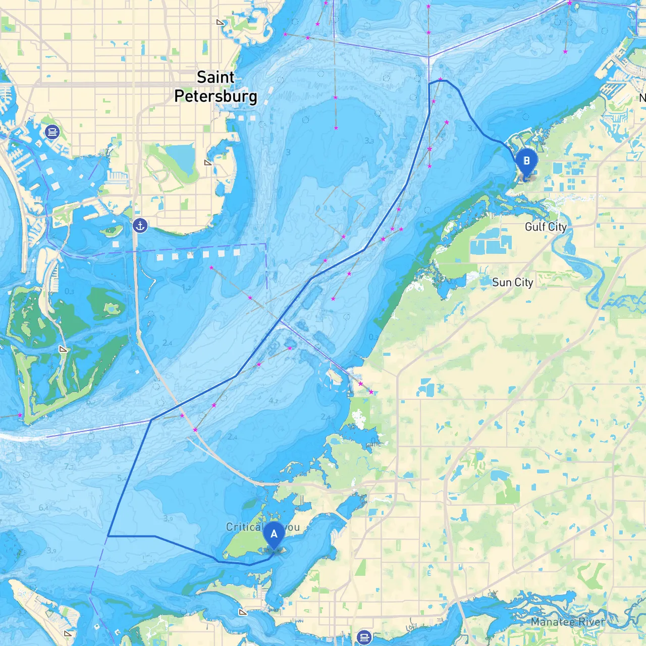
Pilotage Plan from Bradenton, FL to Ruskin, FL
1. Departure from Bradenton, Florida: A Picturesque Start
Your journey begins at the Bradenton Riverwalk, where you can take in the scenic views of the Braden River. Before setting off, ensure your vessel is in top condition and equipped with essential safety gear, including life jackets, a properly functioning VHF radio, and navigation tools. Weather conditions can change swiftly, so keep an eye on local forecasts.
2. Key Points of Interest Along the Route
- Anna Maria Island: As you navigate westward, you’ll have the option to briefly detour to Anna Maria Island. This beautiful spot features sandy beaches and local eateries where you can grab a meal. It's an ideal stopping point for a leisurely break.
- Perico Preserve and Palma Sola Bay: Continuing along your route, enjoy the wildlife at Perico Preserve. The nearby Palma Sola Bay offers stunning views and is a great spot for a lunch break.
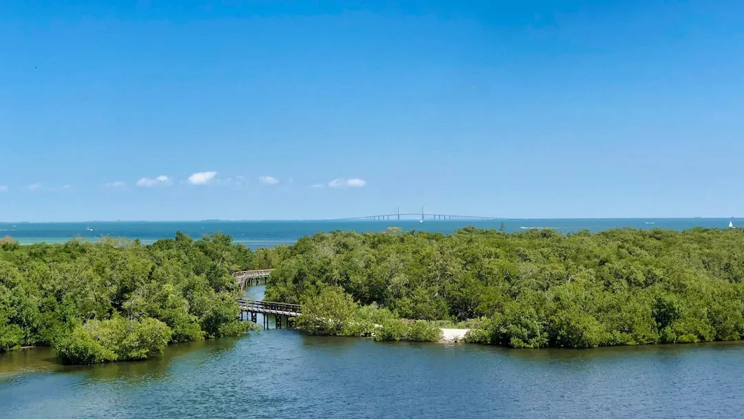
- Tampa Bay Area: As you approach the outskirts of Tampa Bay, keep an eye out for the Sunshine Skyway Bridge, a significant landmark that stands as a testament to Florida’s engineering prowess. Make sure you stay under the bridge’s clearance when passing.
3. Navigational Hazards and Challenges
As you proceed, be mindful of tidal changes and shallow areas, especially in the southeastern thems of Tampa Bay. Pay particular attention to the following:
- Shallow Waters: The water depth can vary greatly, so always refer to up-to-date navigation charts. Areas like Cockroach Bay can have shallow spots that catch the unaware.
- Traffic and Local Regulations: The waters around Tampa Bay can become busy, particularly near commercial shipping lanes. Stay alert for larger vessels and adhere to any navigational rules specific to the region, such as speed limits and no-wake zones.
4. Safe Havens Along the Route
Along with picturesque views and activities, there are notable shelters if you need to ride out bad weather:
- Egmont Key State Park: This accessible island offers natural sandy beaches and calm waters, making it a good choice for shelter. It’s a popular retreat for swimming and exploring wildlife.
- Little Cockroach Bay: This bay presents an excellent point to anchor and wait for inclement weather to pass. The bay is typically calm and protected from wind.
5. Navigational Aids to Observe
Throughout your journey, keep a close watch on the following navigational aids:
- Daymarks and Buoys: The coastal waters are well-marked. Look for daymarks guiding you through the Boca Ciega Bay area. Be especially vigilant when approaching the Tampa Bay channel.
- VHF Radio Channel 16: Monitor Channel 16 for communication with other vessels and the Coast Guard for any updates regarding hazards or weather advisories.
6. Recommended Boating Apps
To enhance your navigational experience, consider using the following apps:
- Savvy Navvy: This is a great app for route planning and real-time weather information, essential for adapting to changing conditions while at sea.
- Navionics: Provides detailed marine charts and charts of hazards, ideal for plotting your course and staying safe.
With thoughtful planning and awareness of your surroundings, this route from Bradenton to Ruskin offers splendid views and remarkable landmarks, making it a cruiser's dream. Enjoy your boating adventure, and prioritize safety as you navigate these beautiful Florida waters!