
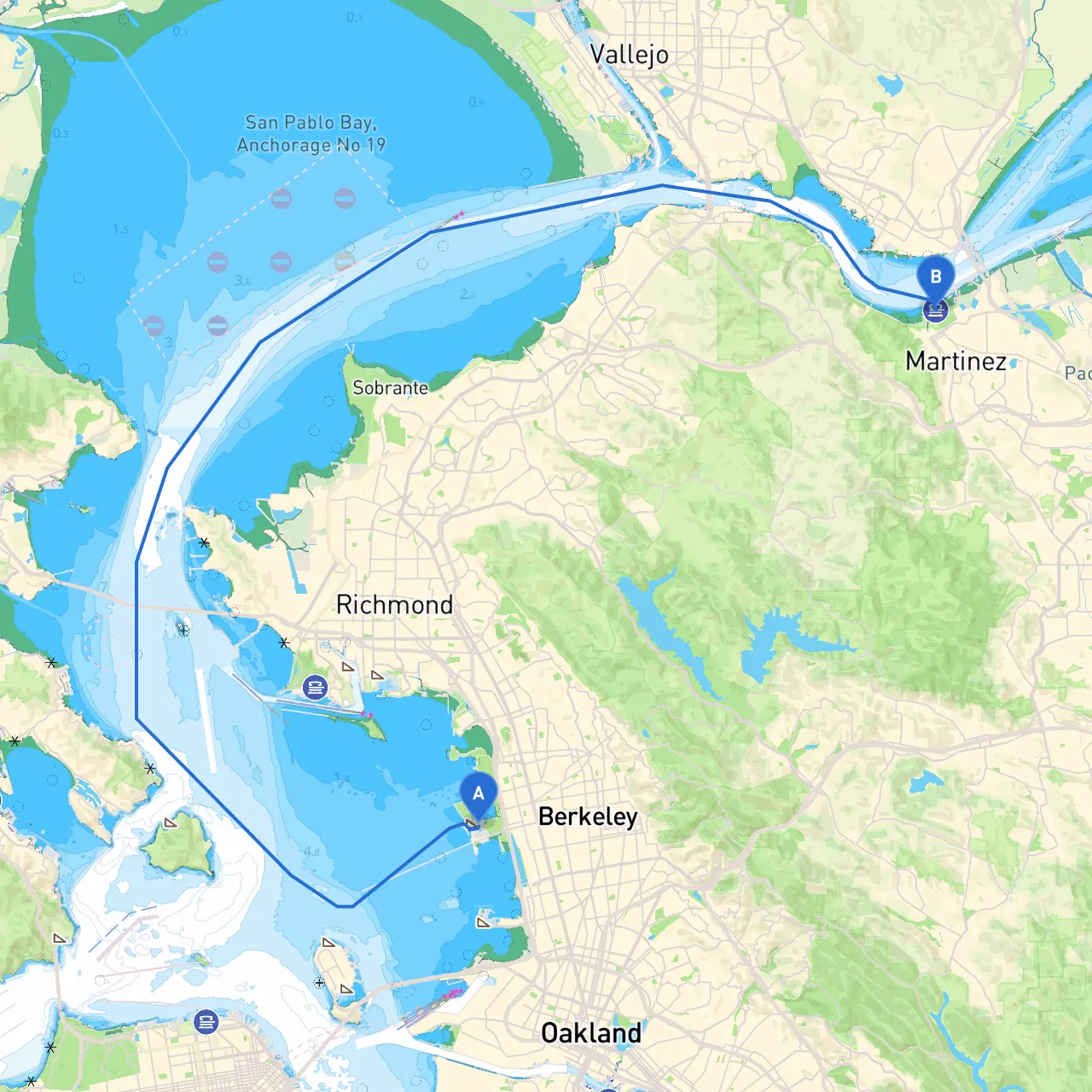
Pilotage Plan: Berkeley, CA to Martinez, CA
Route Overview:
Embarking on this journey from Berkeley to Martinez takes you through the scenic waters of the San Francisco Bay Area, showcasing the region’s unique natural beauty while also challenging you to navigate its busy waterways. This route is well-suited for experienced boaters looking to enjoy a day trip or a weekend getaway with beautiful sights and safe anchorages.
Starting Point: Berkeley, CA
Kick off your adventure at the marina in Berkeley, where you will find well-marked channels and a bustling boating community. Before casting off, ensure your navigation gear is operational, check the weather for any incoming systems, and confirm your vessel is equipped for the day's journey.
Key Hazards and Points of Interest:
1. Berkeley Marina: A great place to start, with good amenities. Look out for other vessels as you leave; the marina can get quite busy during weekends.
2. South of the San Francisco Bay: As you head out towards the bay channel, keep an eye on your weather conditions, particularly wind and tide; the waters can become choppy, particularly in the afternoon when the winds pick up.
3. Treasure Island: Steer towards the southern shoreline of Yerba Buena Island. This area offers a scenic backdrop of the city skyline and is a perfect stop for pictures amid the stunning views. You can also anchor here temporarily to take a break and enjoy the scenery.
4. Concerning Hazards: Be mindful of the tidal flows and sharp currents, especially around the Richmond-San Rafael Bridge—stay close to the navigation buoys. Watch out for large vessels entering and exiting the San Francisco shipping lanes, which can create wakes that could be hazardous.
Shelter Bay Options:
Approaching Martinez:
As you proceed towards Martinez, navigate carefully through the Carquinez Strait. The strait can be narrow, and the traffic can vary from kayakers to commercial shipping vessels.
Navigational Aids:
Regulations and Local Restrictions:
Always adhere to local boating regulations, including speed limits in no-wake zones and observing all maritime signs. Additionally, it's advisable to stay updated on any local advisories, particularly around the Carquinez Strait, where currents can be more unpredictable.
Conclusion:
This route from Berkeley to Martinez is not only a passage through some of Northern California’s most beautiful waters but also an engaging challenge that allows for exploration and excitement with every turn. Anchoring at key spots along the way enriches the trip and offers refuge when needed. Remember to pack your navigation apps like Savvy Navvy to keep track of your route, weather updates, and nearby points of interest as you glide through California’s picturesque landscapes. Safe travels, and enjoy your boating adventure!