Pilotage Plan: Wareham, Massachusetts to Woods Hole, Massachusetts
Route Overview
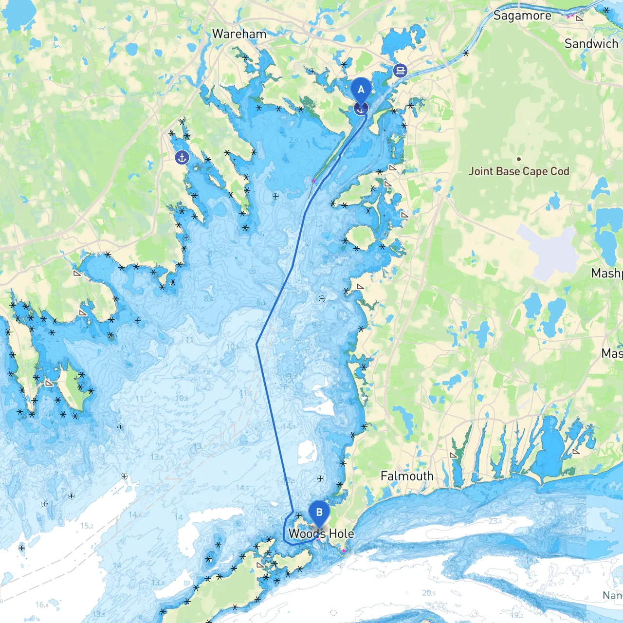
Welcome to an exciting journey from Wareham, Massachusetts, to Woods Hole, MA. This route spans approximately 15 nautical miles and offers scenic views, potential harbor stops, and a variety of navigational challenges, making it perfect for experienced boaters and those looking to hone their skills. The plan ensures safety as a priority, while also highlighting points of interest that make the trip memorable.
Route Sections
1. Departure from Wareham
- Coordinates: Latitude 41.727, Longitude -70.644
- Navigational Aids: Begin your journey by heading southwest to exit Wareham River. Be aware of the local traffic and maintain a lookout for channel markers that guide you out.
- Local Hazards: The river can have shallows; keep to the well-marked navigation channels. Especially note the Wareham River tidal changes to avoid grounding.
2. Buzzards Bay Approach
- Once you exit the Wareham River, you'll enter Buzzards Bay, a beautiful stretch of water known for its broad expanse. This section is perfect for cruising, but still requires serious attention.
- Navigational Aids: Buzzards Bay has several buoys marking the channel. Pay close attention to the green (odd) and red (even) buoys that guide your path.
- Hazards: Be cautious of tidal currents, especially in narrow channels. Swells can be unpredictable in open water, particularly during inclement weather.
3. Notable Stops Along the Route
- Mattapoisett Harbor: Approximately halfway, this small harbor offers a pleasant shelter should the weather take a turn. Here, you can explore quaint shops and restaurants. A visit to the local beaches is also a wonderful option.
- Sippican Harbor: Another option to pull into should conditions worsen. This area offers a serene atmosphere and is great for a brief respite.
4. Approaching Woods Hole
- As you near Woods Hole, be mindful of the well-marked passage leading into the village. The waters here can be busy, with ferries and other vessels making regular runs.
- Navigational Aids: Look for the Woods Hole Research Center buildings; they can serve as a visual landmark. Be cautious around the ferries, and watch for any signals they may display as you approach.
Regulatory Considerations
- Maintain a vigilant cruising speed given the local populated waters. Woods Hole can have increased traffic due to its ferry service.
- Ensure life jackets are available for all passengers, and regularly check your vessel’s safety equipment before departure.
- Stay informed about local fishing regulations if you plan to cast a line along the way; contact local marinas for additional compliance details.
Safety Measures
- Monitor the weather forecast closely before and during your journey. In case inclement weather arises, use the noted shelters (Mattapoisett or Sippican) as safe havens.
- Ensure your vessel has a current chart and you can use apps like savvy navvy for real-time navigating, tide polling, and weather tracking. This is crucial for staying one step ahead of any potential hazards you may encounter.
Conclusion
This route from Wareham to Woods Hole is not just a means of travel; it’s an experience. The combination of tranquil cruising waters, charming ports, and rich maritime history provides a delightful adventure for boaters. This plan prioritizes safety while opening avenues for enjoyment; a perfect blend suited for both seasoned mariners and those developing their skills in a beautiful coastal environment. Enjoy your trip, and navigate safely!