
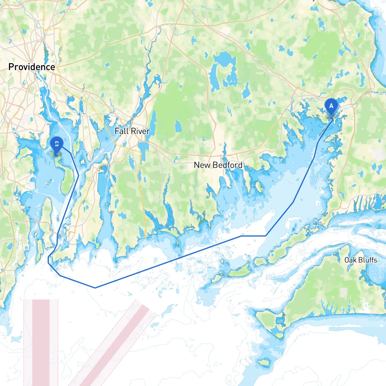
Embarking on this delightful maritime journey from Wareham, Massachusetts, to Portsmouth, Rhode Island, presents both stunning coastal vistas and a wealth of navigational challenges. This route is perfect for experienced boaters looking for a mix of adventure, safe harbors, and scenic destinations.
This voyage covers approximately 25 nautical miles, allowing for a pleasant day trip or a relaxed weekend getaway. The route primarily follows the coastline, providing both protection and plenty of opportunities to take in the local scenery.
Starting from Wareham, we will head southeast towards the mouth of Buzzards Bay, navigating through the picturesque waters of Narragansett Bay that characterizes Rhode Island’s coastline.
1. Wareham River: Before you leave, enjoy the serene ambiance of the Wareham River, dotted with quaint homes and tranquil waters.
2. Buzzards Bay: Head south into Buzzards Bay, where you can stop at Cuttyhunk Island or Marion. Cuttyhunk is a charming stopover with an anchorage that offers shelter should the weather turn inclement. Marion is another safe harbor with various amenities.
3. Sowams River: As you continue towards Portsmouth, consider a brief detour up the Sowams River. It provides a quiet sanctuary lined with lush greenery and gives you a chance to spot some local wildlife.
4. Coles River: A wonderful little detour if the weather permits, offering a scenic stop to explore before heading towards the East Passage of Narragansett Bay.
5. Portsmouth Town Common: As you approach Portsmouth, this central area provides delightful landscapes and nearby dining options. The historic sites and galleries are worth exploring.
While this trip promises fun, safety remains paramount. Ensure that all safety equipment is aboard, including life jackets for everyone, flares, a working VHF radio to stay updated on weather and maritime traffic, and a fully-stocked first-aid kit.
This journey not only provides an avenue to explore the gorgeous New England coast, but it also ensures ample opportunities to anchor safely should the weather take an unexpected turn. Enjoy the tranquility and vistas along the way, all while keeping safety at the forefront of your adventure. Happy sailing!