
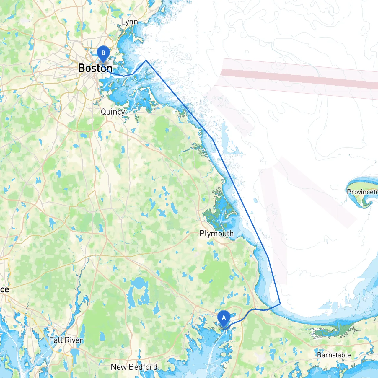
Pilotage Plan: Wareham, Massachusetts to East Boston, Massachusetts
Departure from Wareham, MAAs we set sail from Wareham, you’ll be departing from a quaint town known for its picturesque landscapes and rich maritime history. Before you leave, ensure that your boat is well-stocked with the necessary supplies, safety gear, and that your crew is familiar with the vessel’s operation. Check the weather forecast for optimal conditions, assessing both wind and tides to ensure safe passage.
Shelter Bays and Points of InterestAs you venture north along the coastline, there are a few notable attractions and potential shelter areas you might consider if weather conditions become unfavorable.
1. Buzzards Bay: Just northwest along the route, Buzzards Bay offers several smaller coves and harbors that can provide shelter. Notably, look for Onset Bay and the protection of the weathervane of Grape Island. These areas not only provide refuge but are perfect for fishing or merely enjoying the scenery.
2. Plymouth Harbor: A little further up, you'll find Plymouth Harbor. Besides its historical significance, it offers good anchorage. While there, you can visit the famous Plymouth Rock and the Mayflower II, a full-scale replica of the ship that brought the Pilgrims to America.
3. Duxbury Bay: Just after Plymouth, Duxbury Bay is another great spot, widely known for its calm waters and safety from adverse weather. You can explore the local beaches which are great for a quick picnic.
Navigational RouteYour course will generally follow the coastline, taking into account the various changes in the maritime landscape. It’s crucial to keep an eye on your navigational aids as you proceed.
1. Navigational Aids: The route will take you across various buoys and markers. Pay particular attention to: - Nauset Light Station: A well-known landmark, ensuring you're on course. - Plymouth Buoy: Expect a noticeable change in water depth; make sure to adhere to the channel markers to avoid shallows. - Duxbury Bridge: Keep an eye out for local traffic regulations, especially if you encounter the bridge lights flashing, indicating restricted access.
2. Hazards: As you approach the entrance to Boston Harbor, be vigilant about traffic from larger vessels, especially fishing boats and ferries. Familiarize yourself with the layout of the harbor to navigate through safely while keeping an eye out for the significant commercial traffic.
3. Regulations: Throughout this journey, it's essential to adhere to local laws concerning speed limits, fishing regulations, and waste disposal. The Coast Guard frequently patrols these areas, and being compliant ensures not only your safety but also that of other boaters.
Final Destination: East Boston, MAAs you approach East Boston, the skyline comes into view, with the beautiful backdrop of Boston's cityscape. The harbor here offers ample docking opportunities and a vibrant waterfront teeming with restaurants and attractions. After mooring, consider a visit to the nearby Piers Park, which offers stunning views of the city, walking trails, and a chance to unwind after a day on the water.
Recommended Boating AppsTo stay informed about the marine environment, I recommend downloading:
This itinerary is crafted with the safety and joy of the boater in mind. Whether you’re an experienced sailor or a recreational boater, this journey ensures remarkable sights while minimizing potential hazards, creating a perfect balance for a day on the water. Enjoy your voyage!