
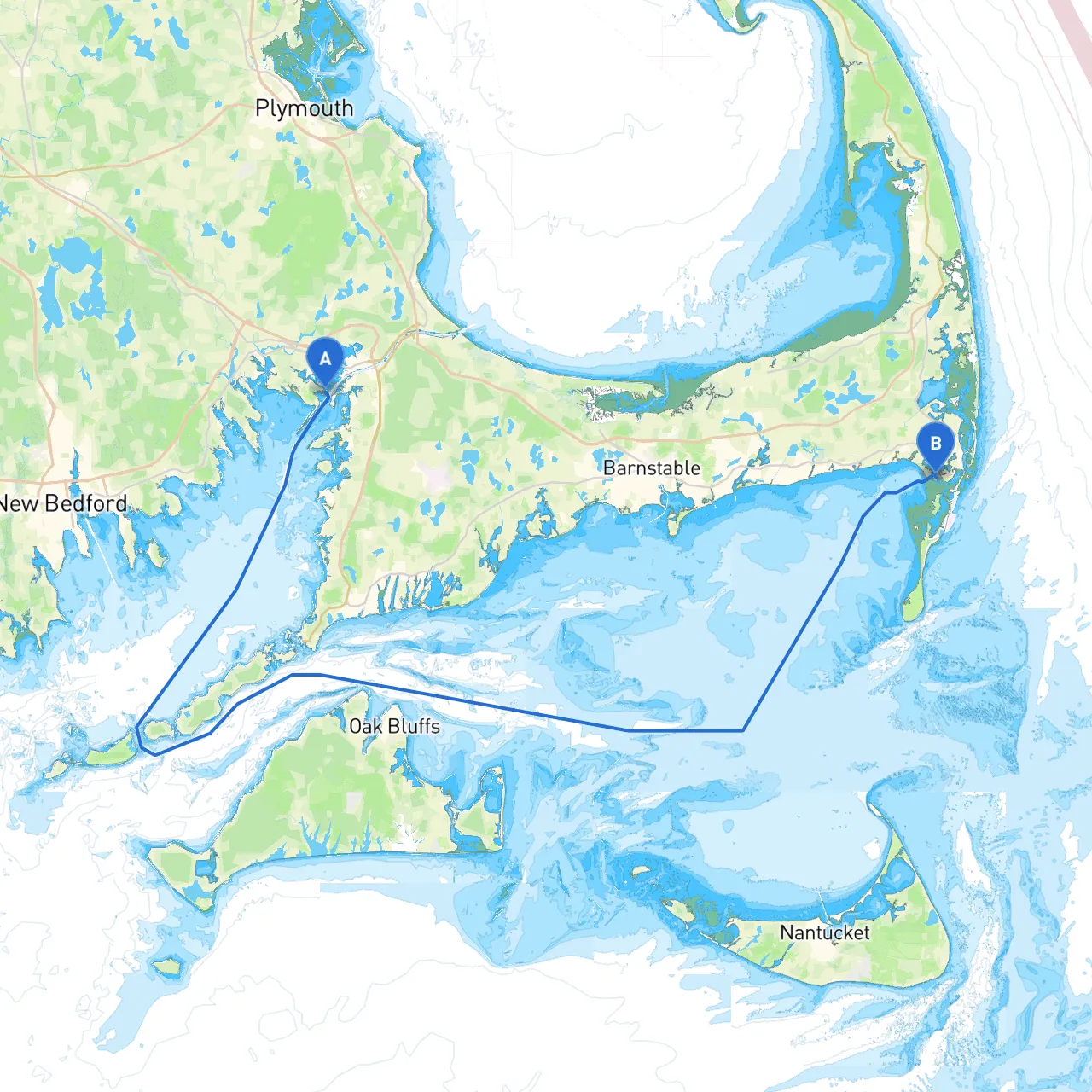
Embarking on a vessel from Wareham, Massachusetts, to Chatham is a delightful journey that offers both breathtaking coastal views and intriguing local landmarks. This route traverses the scenic waters of Buzzards Bay, Cape Cod Bay, and the dynamic stretches of the Cape's shoreline. Perfect for medium-sized powerboats or sailing vessels looking for a mix of recreational enjoyment and safe navigation, this plan will guide you with care and consideration for all potential hazards.
As you set off from Wareham, you'll navigate through the Wareham River, keeping an eye on local traffic. Typical navigational aids include two buoys marking the entrance of the river. Be aware of shallow waters and the channel switches, especially when heading south toward Buzzards Bay.
Points of Interest: Before you leave, consider taking a moment to explore the charming village of Wareham, known for its charming shops and eateries that highlight local seafood fare.
Upon entering Buzzards Bay, ensure your navigation is set southward, making your way towards the approach to Cape Cod Canal. This section is often subject to tidal currents, so it's crucial to time your departure according to the currents for efficient travel.
Navigational Hazards: Be cautious of shallower areas, particularly near the mouth of the Apponagansett River and around the Nasketucket Bay. Navigation aids such as buoys and lights will guide your way, but always heed local charts for tidal adjustments.
Shelter Options: If the weather changes unexpectedly, you may consider sheltering in places like Mattapoisett Harbor or Buzzards Bay Maritime Center at Fairhaven. Both offer safe docks and opportunities for a spurious adventure on land.
As you transit into the Cape Cod Canal, keep in mind that it is a busy and well-traveled shipping route. The Canal itself is well-marked; navigate according to your speed and the ebb and flow of tidal currents. Be alert for commercial vessels entering and exiting, and maintain a watchful eye on the VHF radio for communications.
Regulations: It's important to adhere to the posted speed limits (usually around 5 knots within the canal) to help maintain buoyancy and safety for all travelers.
Checkpoints: Look out for the canal’s prominent landmarks, including the Sagamore and Bourne bridges. These structures often serve as good orientation points.
After transiting the canal, you'll enter Cape Cod Bay. This area can be prone to sudden wind changes and rough seas. Always keep your weather updates handy, with tools like the NOAA Weather app for forecasts.
Navigational Hazards: As you near Chatham, navigate carefully around Monomoy Island and its adjacent shoals. The area is a popular spot for marine wildlife, so watch for seals and birds. Local buoys will mark potential hazards, but maintain caution when venturing close.
Points of Interest: Chatham offers various attractions such as the Chatham Lighthouse and the charming downtown area full of boutiques and restaurants. It's a perfect spot to refuel and enjoy some local cuisine, particularly fresh seafood.
Upon entry to Chatham Harbor, consult local marine charts for navigating to your chosen dock or mooring site. The harbor can get crowded, especially during peak summer months, so patience is essential.
Safety Considerations: Always maintain vigilance for smaller craft and kayakers in the harbor area. Additionally, the tidal changes can be significant, occasionally requiring you to adjust your mooring strategies.
Navigating from Wareham to Chatham is not just a trip — it’s an adventure through the majestic sounds and straits of Cape Cod. Perfect for seasoned cruisers as well as newer boater enthusiasts, this route combines unexpected beauty with the critical knowledge of safety and navigation requirements.
Recommended Apps: To aid in your journey, consider using navigation apps like Savvy Navvy, Navionics, and NOAA Tides & Currents. Each of these can enhance your capabilities on the water while ensuring that you stay on course and within safe limits.
This trip stands as a showcase of New England's nautical treasures, rewarding both the adventurous spirit and the practical sailor. Enjoy the journey, respect the waters, and anchor those precious memories along the way. Safe travels!