
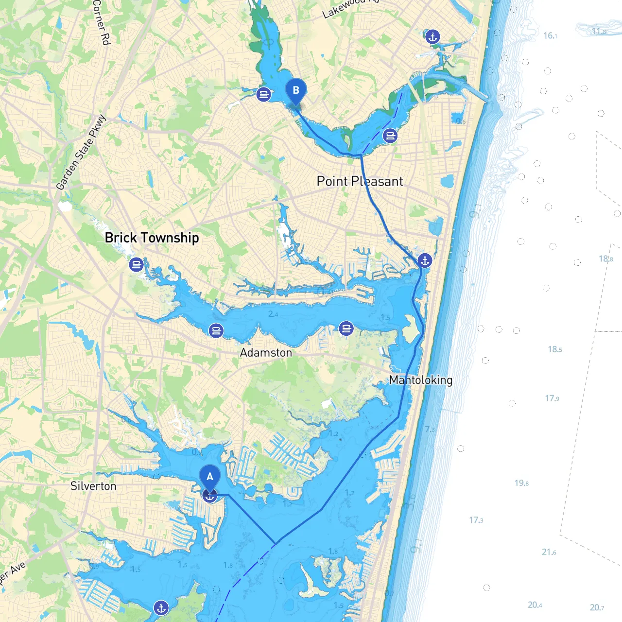
Pilotage Plan: Toms River, New Jersey to Point Pleasant, New Jersey
Overview:This boating route from Toms River to Point Pleasant offers a blend of serene waterways, notable landmarks, and essential sheltering opportunities. The journey is primarily suited for recreational boaters seeking a peaceful outing while remaining mindful of safety and navigation. With a distance of approximately 10 nautical miles, this route is easily navigable for both novice and seasoned mariners.
Route Description:
1. Departure from Toms River:Begin your trip at Toms River, situated on the Toms River estuary. This area is marked by the prominent Toms River Bridge, which stands as a key navigation point. Ensure you have your chart plotter ready and monitor VHF Channel 16 for any local traffic advisories. The Toms River has recreational activities like fishing and a vibrant waterfront which can be explored if you wish to make an early stop.
2. Navigating the Toms River:As you exit the river, proceed slowly, respecting the local speed limits, especially in areas with residential properties and docks. Be watchful for navigational buoys; the channel is well-marked with aids to navigation. The river can narrow in certain spots, so keep a keen eye on the depth sounder and channel markers.
3. Transition to Barnegat Bay:Upon entering Barnegat Bay, you will have a clearer stretch of water. Here, the bay offers expansive views and is safer from winds, making this portion a pleasurable experience. However, it’s important to remain vigilant as boating traffic can increase, particularly on weekends. Monitor weather changes closely, as the open bay can experience sudden shifts.
4. Points of Interest Along Barnegat Bay:If time permits, consider a stop at the island around Good Luck Point or visit the nearby sandy shores of Island Heights. These locales provide secluded spots to stretch your legs, have a picnic, or even take a swim if conditions allow. Always ensure to check local regulations regarding mooring or anchorage.
5. Approaching Point Pleasant:As you make your way toward Point Pleasant, be aware of the Manasquan Inlet entrance. This inlet can be tricky due to its tidal currents, so timing your approach during slack tide is ideal. The inlet is marked with many buoys and navigational aids, which should be closely followed.
6. Arrival at Point Pleasant:Upon arrival, the Point Pleasant Canal offers a safe harbor and excellent marina facilities. Be sure to follow the marked channel leading into the canal to avoid shallows. Point Pleasant is home to several attractions such as the boardwalk, restaurants, and shops. It's a vibrant area where you might consider docking for a few hours to explore or grab a bite.
Safety Considerations:
Recommended Apps:For enhanced navigational support, consider using apps like:
These tools can help with tracking your route, checking weather conditions, and finding amenities along the way.
This passage is tailored for boaters looking to combine tranquility with adventure while ensuring safety at sea. Enjoy this picturesque route from Toms River to Point Pleasant, and may your journey be both safe and memorable!