Pilotage Plan: Toms River, NJ to New York, NY
Route Overview
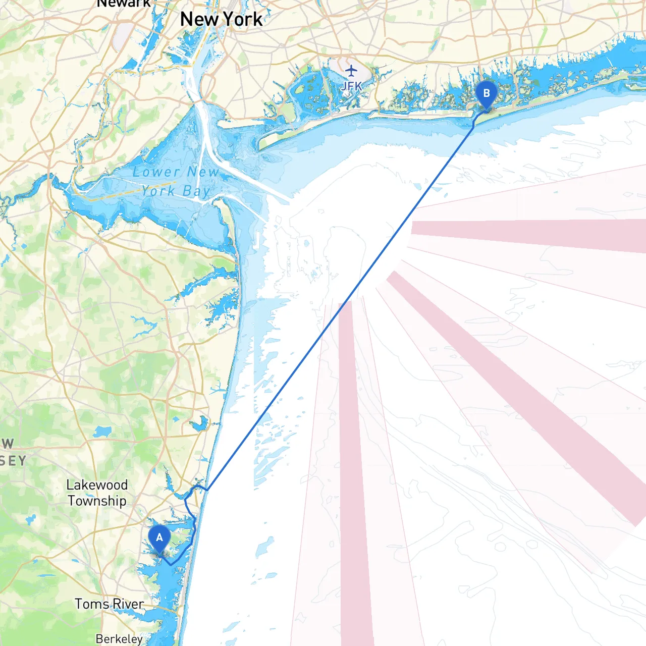
Embarking on this journey from Toms River, New Jersey, to New York City offers an exhilarating blend of coastal cruising and urban exploration. This route, stretching approximately 70 nautical miles, is suitable for experienced boaters who are comfortable navigating through coastal waters, intricate channels, and the busy maritime traffic of New York. As you navigate, safety remains paramount, especially over complex stretches of water.
Route Sections and Notable Areas
Departure from Toms River
- As you set off from Toms River, it's essential to be aware of the local waterways. The Toms River leads into Barnegat Bay, which is your next significant waypoint. Make sure to consult the local tide tables, as tidal currents in the river can be substantial.
Barnegat Bay
- This large, sheltered bay is known for its calm waters and scenic views. If inclement weather arises or a sudden storm hits, there are several safe harbors such as the Forked River and Manahawkin where you can wait it out. The bay is also dotted with recreational sites, including Island Beach State Park, perfect for a fun stop to stretch your legs.
Navigating to the Manasquan Inlet
- After departing Barnegat Bay, your next point of navigation is the Manasquan Inlet. This is a crucial juncture where you transition from the smoother waters of the bay into the Atlantic coastline. Monitor the navigational markers closely, particularly the red and green buoys leading into the inlet, as the passage can be very busy. Watch out for fishing boats and other recreational vessels, especially during the summer months.
Point Pleasant and Brielle
- Once through the inlet, a brief detour towards Point Pleasant can be rewarding, with multiple waterfront dining options and quaint shops. This area is exemplary for family-friendly activities if you wish to take a break. Head towards the Brielle River for a more serene environment.
Rounding Sandy Hook
- As you proceed north along the coastline, your first major landmark will be Sandy Hook. Notably, the Sandy Hook Lighthouse not only offers a historic glimpse but also serves as a critical navigation point. Maintain a distance from the shoal area as it can become shallow unexpectedly.
Raritan Bay
- Entering Raritan Bay, pay close attention to the navigational aids—especially in this area, where commercial traffic intersects with recreational boats. Keeping your vessel close to the marked channel will ensure you steer clear of perilous waters.
Ambrose Channel
- The next section leads into Ambrose Channel, which becomes particularly important as you approach the busy port area of New York City. Keep a vigilant lookout for large tankers and container ships; they have the right of way. Make sure to monitor marine radio channels (VHF Channel 13 is essential here) for any vessel traffic updates and pertinent notices.
Final Approach to New York City
- As you approach New York Harbor, the Statue of Liberty will make for an impressive sight. Consider taking a moment to anchor safely and appreciate this iconic landmark. Proceed toward your destination by navigating around Ellis Island. Use the many navigational aids (such as buoys and lights) and stay within the designated channels to ensure a safe passage through the heavy maritime traffic.
Safety Considerations
- Weather Monitoring: Always check weather forecasts before and during your trip. Sudden storms can hit unexpectedly, so remain aware of changing conditions.
- Traffic Awareness: With busy shipping lanes, especially near New York harbor, maintain a communication channel and stay updated on vessel movements.
- Local Regulations: Be familiar with any local marine regulations, particularly in highly trafficked areas. This includes observing speed limits and No-Wake zones
- Emergency Protocols: Ensure you have a plan for emergencies—such as mechanical failures or adverse weather—and know the nearest safe harbors.
Useful Apps
For navigation and safety monitoring, consider using:- Savvy Navvy: An excellent all-in-one app for routing, tide information, and real-time tracking.
- Navionics: Provides detailed nautical charts beneficial for avoiding hazards.
- USPS: Finalize your trip with up-to-date regulations and safety equipment checklists.
This journey from Toms River to New York seamlessly combines the thrill of cruising with prudent safety measures and remarkable sights. It's an adventure that caters perfectly to those who relish both the serenity of nature and the vibrancy of city life, ensuring an unforgettable experience on the water. Enjoy the ride!