
Pilotage Plan: Sarasota, Florida to Siesta Key, Florida
Overview Embarking from Sarasota to Siesta Key offers a delightful experience for any boater who appreciates coastal cruising. This route spans approximately 10 to 12 nautical miles, depending on whether you choose your most direct path or wander through some of the charming bays and waterways. It's well-suited for recreational boaters, families, and those seeking a relaxed day on the water.
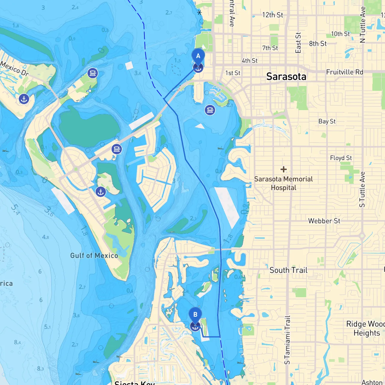
Starting Point: Sarasota, Florida (Coordinates: -82.5502666667, 27.3383) Sarasota is known for its vibrant culture and stunning beaches. Before you set off, take a moment to explore Marina Jack or grab a quick coffee at one of the local cafés. Your journey begins in a busy yet navigable harbor that caters to all kinds of vessels.
1. Navigational Considerations: - Marking Aids: Keep a lookout for navigational aids as you leave Sarasota, particularly the green markers that indicate safe water and channels. - Chart Your Course: Ensure you have updated nautical charts. The waters in this area can be busy, especially during peak seasons, so maintain vigilance.
2. Key Hazards: - Shallow Waters: As you head towards Siesta Key, be aware of shallows, particularly near the entrance to Big Sarasota Pass. Consult your charts, as depths can change with tides. - Local Traffic: The waterways can be busy with private vessels, jetskis, and paddleboards. Maintain a safe distance and adhere to speed limits to ensure everyone's safety.
1. Big Sarasota Pass: This larger waterway connects the Gulf of Mexico with Sarasota Bay. If conditions allow, consider making a stop to fish or admire the views. The current can be strong here, so navigate with caution.
2. Lido Key: As you cruise toward Siesta Key, watch for Lido Key on your starboard side. It's a great spot for a leisurely afternoon, with beautiful beaches and local restaurants.
3. Mote Marine Laboratory: Situated on the western shore, this marine research facility often has educational programs and activities.
1. Sarasota Bay: If weather conditions worsen, returning to Sarasota Bay is an option, as it offers ample anchorage and protection from rough seas.
2. Little Sarasota Bay: Just before reaching Siesta Key, this bay provides a cozy harbor in case you need to wait out the weather. It’s relatively sheltered and offers beautiful views of nature.
Destination: Siesta Key, Florida (Coordinates: -82.5509166666667, 27.2876666666667) As you approach Siesta Key, the white sands of its beaches are inviting, and the serenity of the area is a relief from the bustling pace of Sarasota. Upon arrival, ensure your vessel is securely anchored or docked at one of the marinas available.
This route not only highlights stunning natural landmarks and opportunities for recreation but also keeps your safety as the top priority. Happy cruising, and enjoy the gentle waves and tranquility that the waters of Florida have to offer!