
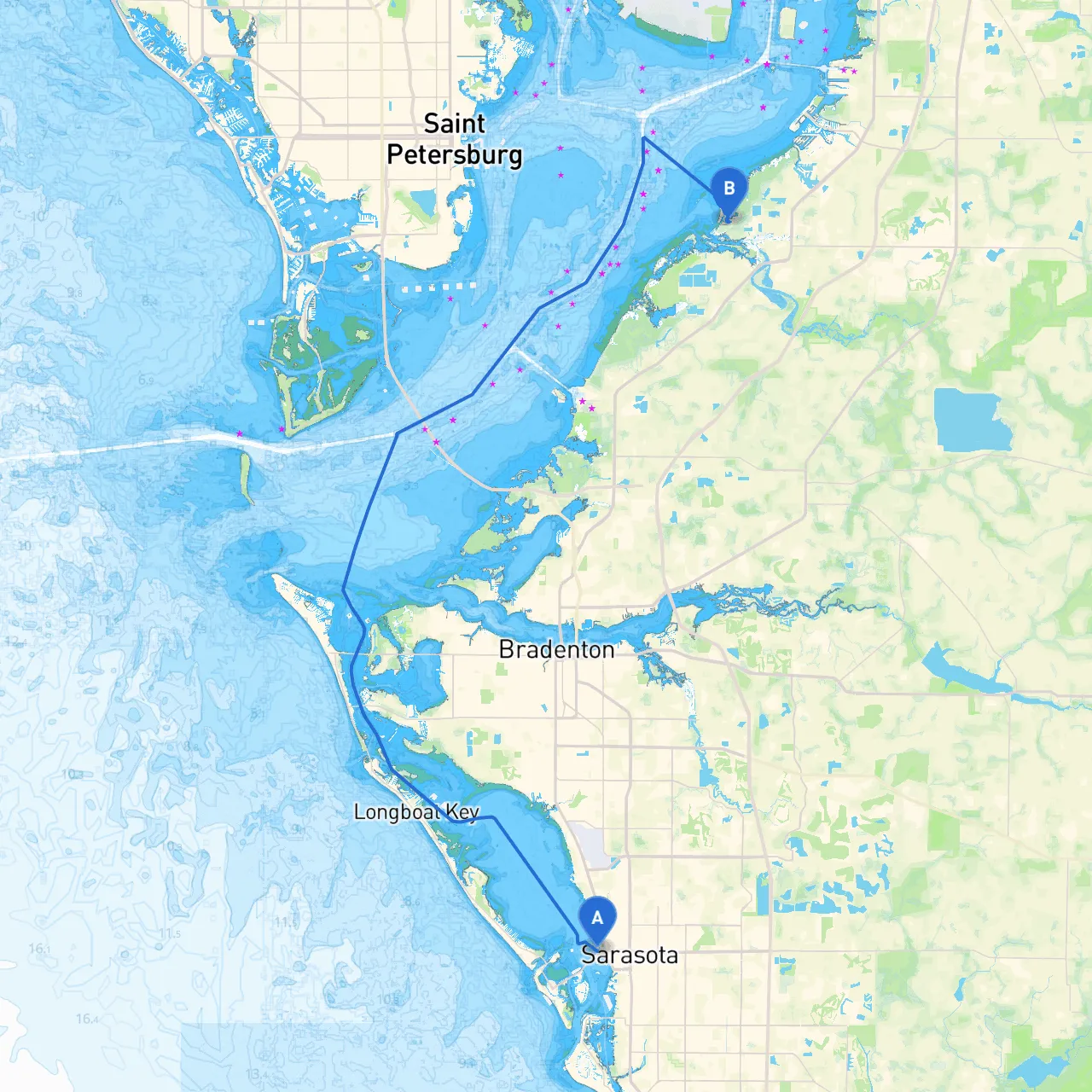
Embarking on a boat trip from Sarasota to Ruskin offers an exciting opportunity to enjoy the scenic beauty of Florida’s Gulf Coast while navigating through some of its protected waters. This route is perfect for recreational boaters seeking a blend of serene cruising, picturesque landscapes, and access to potential shelter locations if the weather turns unfavorable.
Starting Point: Sarasota, Florida Coordinates: 27.3383, -82.5503 Sarasota is well-known for its beautiful beaches and cultural attractions. Before you set off, make sure you’re stocked with supplies and equipment for the journey. The Intracoastal Waterway (ICW) leading out of Sarasota is easily navigable and provides safe passage if you choose the protected waters.
Leg 1: Sarasota to Longboat Pass (Approx. 6 NM) As you set off from Sarasota Bay, head northwest towards Longboat Pass. Along this stretch, be mindful of the shallow areas; keeping an eye on soundings is crucial.
Navigational Aids:
Shelter Options:If conditions worsen, consider ducking into Sarasota Bay, where several inlets provide safe havens.
Leg 2: Longboat Pass to Anna Maria Island (Approx. 4 NM) Once through Longboat Pass, continue your voyage towards Anna Maria Island. As you proceed, enjoy the stunning coastal views on either side.
Navigational Aids:Pay attention to the Anna Maria Island buoys, which help navigate around the shallow waters surrounding the island.
Shelter Options:The Bimini Bay provides excellent protection from inclement weather if necessary, with plenty of anchor spots available.
Leg 3: Anna Maria Island to Tampa Bay (Approx. 6 NM) As you exit the waters around Anna Maria Island, steer towards Tampa Bay. This larger body of water offers a well-marked approach with various navigational aids. The entrance can be a bit busy, so keep a lookout for other vessels.
Navigational Aids:Stay alert to the Tampa Bay entrance markers, which guide you safely into the bay and through its more complex navigation systems.
Shelter Options:If storms approach, retreating into Bishop Harbor or Apollo Beach are both great. They offer relatively calm waters in rough conditions.
Leg 4: Tampa Bay to Ruskin (Approx. 8 NM) The final leg of your journey brings you to Ruskin. This section is primarily within sheltered waters, providing a relaxing end to the trip.
Navigational Aids:Watch for the Ruskin channel markers, ensuring you remain in the necessary channels to avoid any lurking shallows.
Shelter Options:The entrance to Ruskin provides more options like the Little Manatee River for exploration should you want a quick paddle up the river.
This route from Sarasota to Ruskin is perfect for recreational boaters keen on experiencing the stunning Gulf Coast while prioritizing safety. With ample opportunities for shelter and plenty of attractions along the way, you’ll find this expedition both enjoyable and practical. Bon voyage!