
Overview:Embarking on a boat trip from Sarasota to North Fort Myers is an exciting venture, rich with opportunities for exploration and breathtaking views. This route is best suited for experienced cruisers, as it requires navigational skills and a keen awareness of the local maritime environment. Along the journey, you’ll encounter beautiful bays, notable landmarks, and navigational aids that ensure a safe passage.
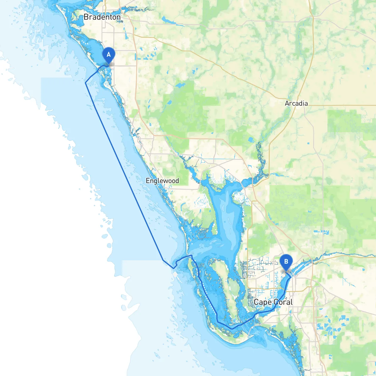
Start Point: Sarasota, Florida Coordinates: 27.3383, -82.5503
End Point: North Fort Myers, Florida Coordinates: 26.6577, -81.8963
Venice Inlet: As you begin your journey south, the Venice Inlet provides a safe harbor just a short distance from Sarasota. This is a convenient spot if the weather begins to turn unfavorable, and there are several dining options nearby for a quick respite.
Charlotte Harbor: Further along, Charlotte Harbor is a major waterway that offers plenty of sheltered anchorage areas. It’s an expansive region with opportunities to anchor safely if conditions worsen or you’re in need of a break. The harbor is home to several islands, including the beautiful Cape Haze and Pine Island, perfect for exploring.
Estero Bay: Heading toward your destination, Estero Bay offers excellent shelter. This bay is designated as a marine preserve, providing beautiful scenery and an opportunity to observe local wildlife. It is also a great spot for fishing or simply enjoying the sun.
As you make your way from Sarasota to North Fort Myers, several navigational aids and considerations will guide your journey:
Ensure you are familiar with local boating regulations, particularly in areas such as Estero Bay Preserve where there may be no-wake zones or restrictions on anchoring to protect marine life.
Be equipped with all necessary safety equipment, including life jackets, a first aid kit, and signaling devices. It’s also wise to keep your VHF radio functional and monitor channel 16 in case of emergencies.
This route from Sarasota to North Fort Myers is a wonderful journey for seasoned boaters looking to enjoy Florida’s stunning coastline. While safety is paramount, the enticing prospects of natural beauty, wildlife interaction, and cultural landmarks make this trip a compelling choice.
To enhance your navigation, consider utilizing boating apps such as Savvy Navvy, which offers real-time weather updates, tide information, and detailed charts, ensuring your trip remains delightful and safe.
Happy boating on your adventure!