
Pilotage Plan: Richmond, CA to Berkeley, CA
Embarking on a boat trip from Richmond to Berkeley is a wonderful choice, offering scenic waters, notable landmarks, and an enjoyable experience for boaters looking to explore the San Francisco Bay Area. This itinerary will ensure you safely navigate while enjoying points of interest along the way.
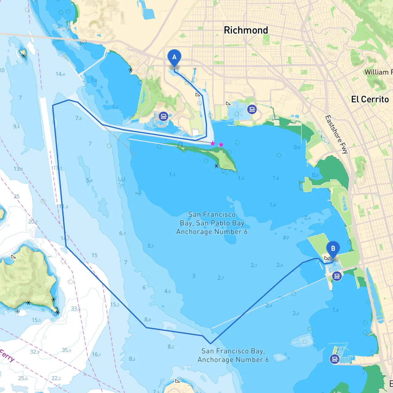
Starting at Richmond, CA (coordinates: -122.3744, 37.9243), the journey spans approximately 4 nautical miles across the Richmond-San Rafael Bridge and into the waters of the East Bay. The trip is particularly suitable for recreational and amateur boaters, as the route is generally safe yet requires attention to local navigation considerations.
1. Richmond Marina Bay: Before you set off, take advantage of the amenities at Richmond Marina, known for its boater-friendly facilities, restaurants, and beautiful views of San Francisco. A great place to check your equipment and refuel.
2. Point Isabel Regional Shoreline: Just east of the Richmond-San Rafael Bridge, this picturesque park offers an easy stop for a walk on its scenic trails. Keep an eye out for wildlife, especially migratory birds, while you enjoy the fresh bay breeze.
3. Marina Park on Point Richmond: If the weather starts to turn, this bay-side park provides protection and a place to do some quick exploration. The historic charm of Point Richmond is delightful, with opportunities for food and local shops.
4. Berkeley Marina: Upon reaching Berkeley, the marina provides excellent facilities for transient boaters, including restrooms, fuel, and dining options. You’ll be near the Berkeley Pier, which is a great place for fishing and offers sweeping views of the Bay Bridge.
As you navigate this route, it is essential to remain aware of the following:
This pilotage plan from Richmond to Berkeley is more than just a route; it’s an opportunity to soak in the natural beauty and vibrant culture of the East Bay. With careful planning, awareness of the environment, and respect for local navigation rules, this trip promises a rewarding experience for boaters of all skill levels. Whether you're a seasoned captain or a day-tripper, this journey will be one you'll cherish.
Set your course, respect the water, and enjoy every moment on this beautiful route!