
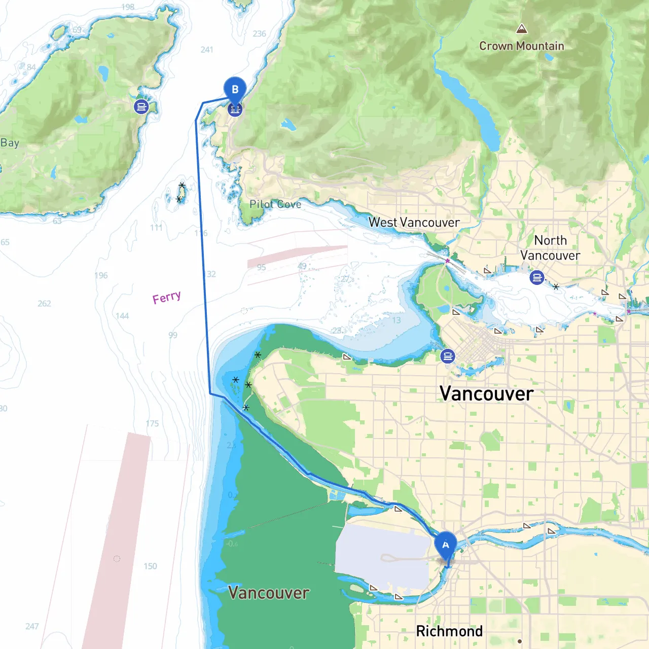
Pilotage Plan: Richmond, BC to West Vancouver, BC
Route Overview:This adventure will take you from the tranquility of Richmond, through the picturesque waters surrounding Vancouver, to the vibrant West Vancouver. With a mix of scenic views, potential hiding spots from inclement weather, and the chance to explore various points of interest, this route is suitable for intermediate to experienced boaters. Always stay mindful of your surroundings and local regulations for a safe and enjoyable trip.
Starting Point: Richmond, BCRichmond is located on the southwest coast of Canada and serves as a fantastic launch point. As you prepare your vessel, ensure all safety gear, including life jackets, flares, and a first-aid kit, is onboard and accessible.
Leg 1: Exit Richmond and Transiting the Fraser RiverYour journey begins by navigating the Fraser River. Keep the channel markers prominently in sight, as this busy waterway has commercial traffic. Be aware of changing water depths, particularly in shallower areas, and remain cautious of tides. It’s wise to plan your outing around high tide for easier passage and additional water depth.
Notable Navigation Aids:
Shelter Bay at Point Roberts (Optional Stop)Before entering Boundary Bay, consider a short detour to Point Roberts if weather conditions turn unfavorable. This enclave offers a well-protected bay, making it an excellent spot to shelter if needed.
Leg 2: Boundary Bay to English BayAs you exit the Fraser River, you’ll find yourself in Boundary Bay, noted for its expansive views and natural beauty. Navigate through the bay toward English Bay while watching for local wildlife, including sea lions and various seabirds, which make this area quite enchanting.
Important Navigational Considerations:
Leg 3: Approaching VancouverOnce you round Point Grey, prepare for the stunning vistas of Vancouver's skyline. Here, you'll encounter various boats, so ensure you’re keeping an eye on traffic patterns. This leg of your journey offers several opportunities for delightful breaks.
Points of Interest:
Leg 4: Entering English BayAs you make your way into English Bay, enjoy views of the bustling urban and mountain backdrop. This area is a hotspot for recreational activities, and you'll find other boaters enjoying the water.
Navigational Aids and Local Regulations:
Final Approach to West VancouverAs you continue towards your destination, West Vancouver, keep an eye out for the scenic Lion’s Gate Bridge, an iconic landmark of the region. You’ll also spot several marinas and yacht clubs rich with potential distractions; they could make for an excellent final stop if you desire.
Best Marinas in West Vancouver:
Final Thoughts:Your route from Richmond to West Vancouver serves not just as a means of travel but as an opportunity to engage with the landscape, culture, and marine life of this beautiful region. Always plan with safety in mind—monitor weather conditions, have a backup plan for shelter, and familiarize yourself with required navigational aids.
Boating Apps:For navigating this trip smoothly, it’s highly recommended to utilize apps like Savvy Navvy alongside others such as Navionics and C-Map. They will help you stay oriented and aware of real-time marine conditions.
Enjoy your journey, stay safe, and embrace the remarkable beauty that the waters of British Columbia have to offer!