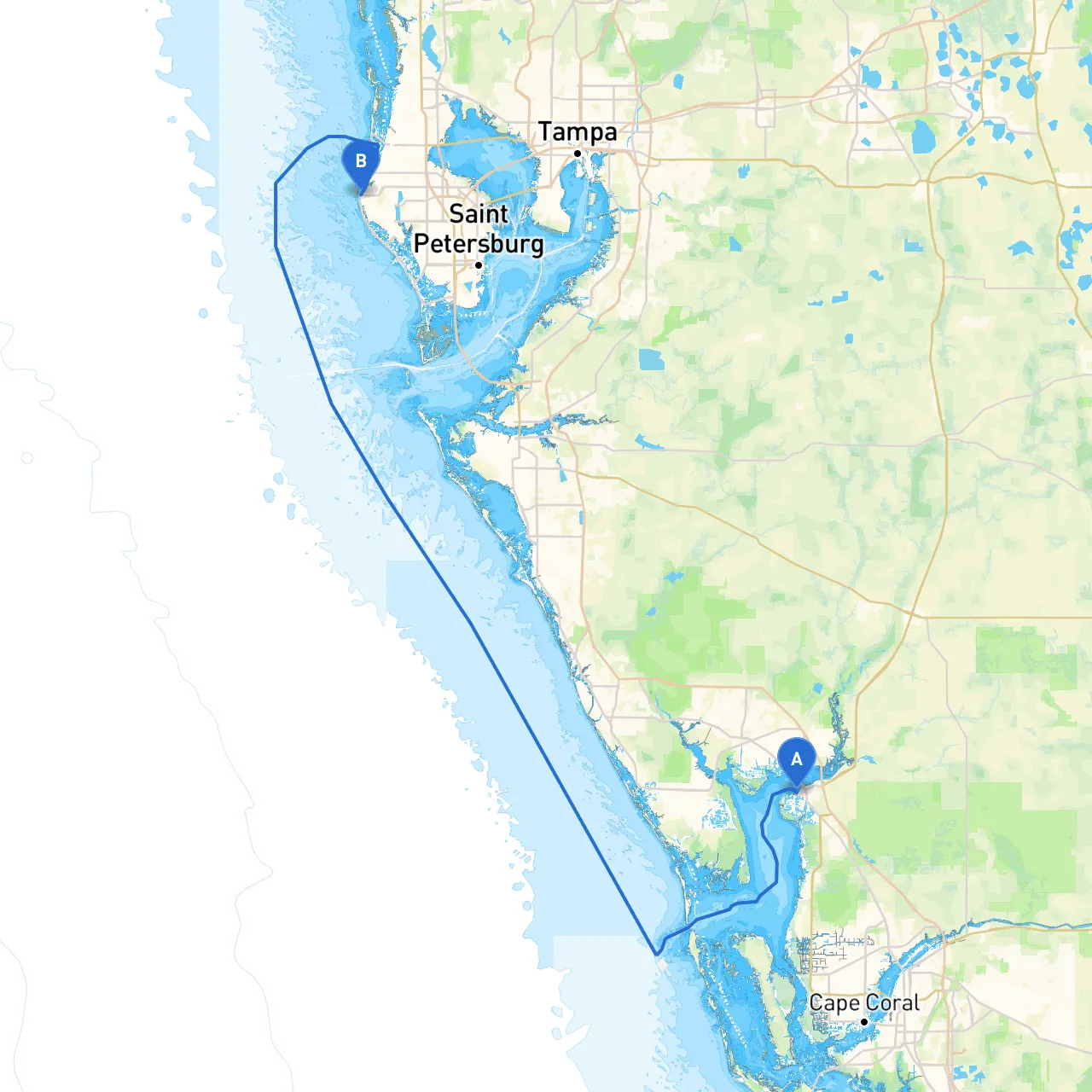
Pilotage Plan from Punta Gorda, FL to Indian Rocks Beach, FL
Overview
This journey from Punta Gorda to Indian Rocks Beach promises an unforgettable boating experience, rich with scenic views, interesting wildlife, and opportunities for relaxation along the Gulf Coast. As you navigate this well-loved route, safety remains our top priority, complemented with plenty of chances to take a break and explore the attractions along the way.
Starting Point: Punta Gorda, Florida
Your adventure begins in the picturesque waters of Punta Gorda, a charming town renowned for its friendly atmosphere and vibrant waterfront. The harbor here is a navigational gem, but be sure to check the weather conditions as you set out and ensure your vessel is shipshape before departure.
Important Navigational Aids
- Punta Gorda Channel Marker: Located at the mouth of the harbor, it serves as a critical landmark to guide your exit from the harbor.
- Charlotte Harbor: The largest estuary in Florida, this area can be busier with fishing and recreational boats. Watch for local fishing buoys.
Route Details
As you cruise north out of Charlotte Harbor, you’ll want to take Raccoon Bay, where the waters can get choppy depending on the weather conditions. This is a suitable area for shelter should you encounter sudden storms or wind shifts. Raccoon Bay offers an excellent stopping point for a quick rest or picnic—the scenery and calm waters will not disappoint.
Notable Landmarks and Points of Interest
(Optional Detour): If you have extra time, consider making a detour to Boca Grande. It’s famous for its lighthouse and beautiful beaches—perfect for a lunch stop.2.
: Nearby, this area offers great shelling and beachcombing opportunities. The coastline is dotted with enchanting nature preserves you'll want to explore.
Navigating toward Indian Rocks Beach
Upon entering the waters of the Intracoastal Waterway (ICW), keep your eye on the green and red buoys that guide the way. As you approach Tampa Bay, watch for the bustling boat traffic; it’s alive with charter boats and personal vessels alike. The ICW is generally well-marked, but pay careful attention to shallow areas, especially around the tidal points.
Recommended Shelters on the Route
- Sarasota Bay: An ideal retreat from turbulent weather, with ample anchorage options and stunning views of the Ringling Bridge.
- Clearwater Harbor: Known for its friendly marinas and vibrant beachfront; a great place to tie up and enjoy local seafood or beach activities.
Arrival at Indian Rocks Beach
As you near Indian Rocks Beach, be sure to enjoy the picturesque shoreline and the vibrant atmosphere. The local restaurants offer some of the freshest seafood around; a perfect celebration of your journey.
Regulatory Considerations
Stay cognizant of local regulations regarding speed limits, especially in manatee protection areas where you must slow down. The Gulf waters may have temporary restrictions or seasonal changes to consider, so always check the local notices before your journey.
Useful Boating Apps
To assist in your voyage and ensure safety, consider using the following applications:- Savvy Navvy: An excellent navigation tool that provides weather updates and route planning features.
- Navionics: For detailed charts and marina information.
- Windy: To keep track of wind patterns and storm developments.
Conclusion
This route is particularly suited for recreational boaters who appreciate both serene nature and the thrill of coastal adventures. Remember to prioritize safety while exploring, and set aside plenty of time for spontaneous discoveries along the way. Enjoy the beauty of Florida’s coastline and safe travels!