
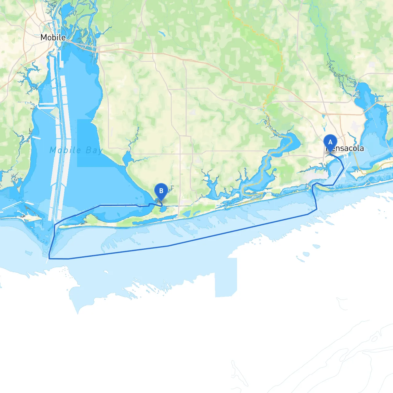
Starting Point: Pensacola, Florida Coordinates: Long -87.2577, Lat 30.4067 Gulf Shores, Alabama, is your destination. This scenic cruise along the Gulf Coast provides ample opportunities for sight-seeing, while ensuring safety is maintained throughout the journey.
The trip spans approximately 30 nautical miles along the coast, allowing you to enjoy the breathtaking views of the shimmering Gulf waters while keeping an eye out for local wildlife and unique landmarks. The route is primarily along the protected waterways and coastal regions, making it particularly suitable for both experienced cruisers and novice boaters who are keen to explore.
Before you set sail, ensure that your vessel is seaworthy. Check the weather forecast, keeping an eye on wind conditions, tidal currents, and potential storms. The Pensacola Bay entrance is well-marked, but be prepared for any traffic from commercial vessels as this is an active port. As you navigate out of the bay, take a moment to enjoy the historic forts — Fort Pickens and Fort Barrancas — which offer a glimpse into the past.
As you cruise eastward, keep vigilant for navigational aids like buoys and channel markers. One prominent feature you will encounter is the Pensacola Lighthouse, a perfect backdrop for photographs. Note the following landmarks:
Should the weather take a turn for the worst, various bays along this route provide safe harbors:
Be sure to stay updated with the latest weather conditions via your marine radio or pre-installed weather apps.
As you approach Gulf Shores, it's essential to be aware of local regulations. The Gulf Shores area has specific no-wake zones particularly near the beach and congested areas. These are indicated by signs and colored markers, so maintain a safe speed to ensure both safety and compliance.
While you’re here, enjoy the local attractions like the Gulf State Park, featuring picturesque trails and picnic areas. Thriving marine life around this region also provides excellent fishing opportunities for avid anglers.
For a smooth sailing experience, consider implementing the following resources:
1. Savvy Navvy: This app offers comprehensive route planning with detailed maps and real-time weather updates.2. Navionics: Known for its rich chart database, it helps with navigating tricky waters.3. Weather HD: A great way to get live weather radar and forecasts specifically for marine settings.
This journey from Pensacola to Gulf Shores promises to be both enjoyable and safe if navigated thoughtfully. By following this detailed pilotage plan, keeping an eye out for landmarks and hazards, and utilizing appropriate technology for navigation, you're set for an unforgettable experience on the water. Happy cruising!