Pilotage Plan from Pensacola, Florida to Foley, Alabama
This itinerary provides a delightful and feasible route for boaters looking to travel from Pensacola, Florida, to Foley, Alabama. The journey traverses a variety of landscapes along the Gulf Coast, making it not only a safe passage but also a visually stunning adventure. The estimated distance for this journey is approximately 30 nautical miles, and it is suited for both experienced and moderate-level boaters.
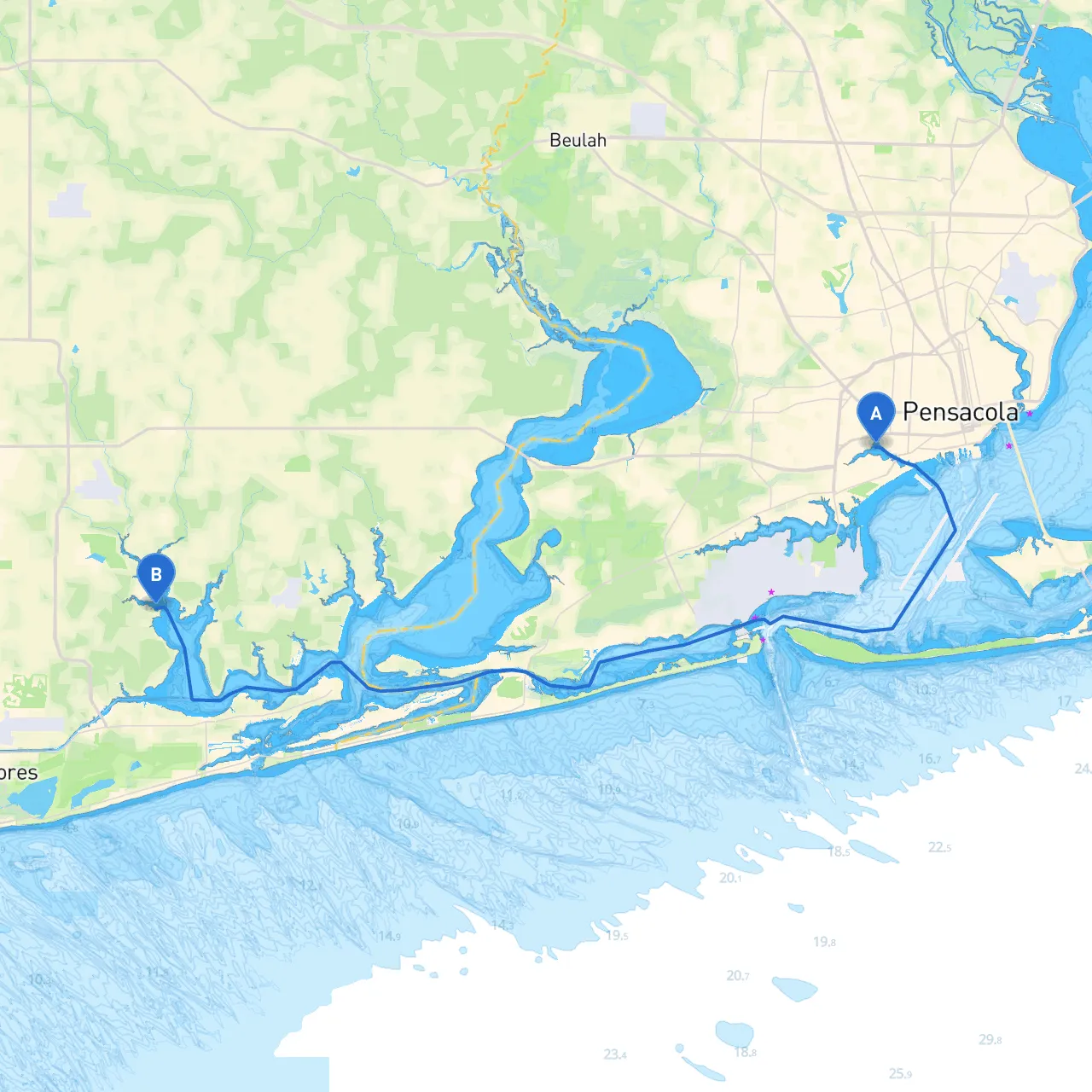
Route Overview
Departing from the bustling marina at Pensacola, the route takes you through the serene waterways of the northern Gulf of Mexico. This trip is particularly splendid for those who enjoy coastal scenery and are keen on observing local wildlife, including dolphins and a plethora of seabirds.
Starting Point: Pensacola, Florida
Coordinates: Longitude -87.2577, Latitude 30.4067
As you prepare to set sail, ensure your vessel is stocked with essential safety gear, including life jackets, flares, and a well-stocked first aid kit. Keep in mind that the waters around Pensacola can be busy with commercial traffic, so take care to stay alert and observe any navigational lights or buoys.
Notable Navigational Aids:
- Pensacola Lighthouse: A significant landmark that can guide you out of the bay.
- Navy Point Channel Marker: Stay close to the marked channel to avoid shallow waters.
Along the Route
Once you have navigated out of Pensacola Bay, head east towards the scenic waters of Perdido Bay. This area is relatively sheltered and offers a good haven should weather conditions deteriorate.
Points of Interest:
- Perdido Key: A perfect spot for a pit stop; it offers pristine beaches for relaxation and a chance to take a dip in the crystal-clear waters.
- Big Lagoon State Park: Known for its beautiful scenery and wildlife, it is a wonderful location for a brief exploration, kayaking, or simply enjoying the stunning landscape.
Sheltering Options:
- Wolf Bay: If conditions turn unfavorable, Wolf Bay provides excellent shelter from rough seas and is easily accessible. It's an ideal spot to anchor and wait for storms to pass.
Transition to Foley
After leaving Perdido Bay, navigate towards the Intercoastal Waterway. Be mindful of your speed and watch out for recreational boaters in the area. The Intercoastal is well-marked with navigational buoys, and following these will keep you in safe waters.
Important Navigational Aids:
- Channel Markers: Familiarize yourself with the light patterns on these markers as they indicate safe passages and depths.
- Radio Communication: Keep your VHF radio on channel 16 for emergency communications, and monitor local channel for any navigational updates.
Arrival: Foley, Alabama
Longitude -87.6053, Latitude 30.3395
As you approach Foley, watch for the entrance marks. Foley is positioned close to the waterway, allowing for a picturesque finish to your voyage. Don’t forget to check local regulations regarding mooring and anchoring.
Final Suggestions
- Avoiding Hazards: Be cautious of shifting sandbars, especially in the shallower areas of the bays.
- Boating Apps: I recommend using savvy navvy to track your route, monitor weather updates, and ensure safety throughout your journey. Other apps worth considering include Navionics and MarineTraffic for additional navigational support.
This trip combines a safe and pleasurable boating experience with the potential for captivating sights and marine encounters. Take your time to soak in the beauty of the Gulf Coast, and always prioritize safety on the water. Happy boating!