
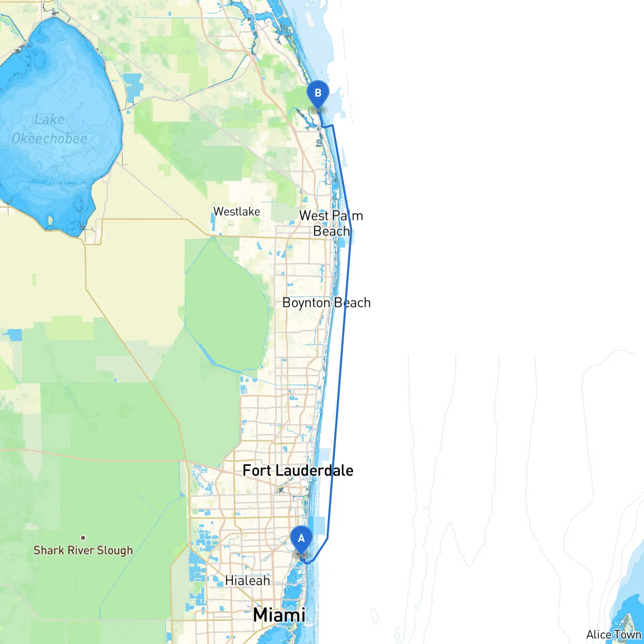
Embarking on a boat journey from North Miami to Tequesta is a splendid way to embrace Florida’s coastal beauty, perfect for cruising enthusiasts and aspiring sailors alike. This route covers approximately 50 nautical miles along the Intracoastal Waterway (ICW), providing a scenic adventure while ensuring safety with well-marked navigational aids and numerous stopping points.
Navigational Considerations:Departing from North Miami, you'll head north along the ICW. The route is straightforward, but watch for the numerous fixed and movable bridges. The most significant is the 79th Street Causeway Bridge. Ensure to note their opening schedules to avoid delays.
Points of Interest:
Shelter Options:If the weather changes, head to the nearby Port Everglades or dock at Fort Lauderdale’s marinas for shelter while waiting for conditions to improve.
Navigational Aids:As you continue northward, the ICW remains your thoroughfare. Keep an eye out for navigation buoys and markers, particularly around the Hillsboro Inlet, where tidal currents can be tricky.
Points of Interest:
Shelter Options:The Hillsboro Inlet area offers ample opportunities for safe anchorage should you need to wait out inclement weather.
Navigational Considerations:The channel remains well-marked but be cautious of boat traffic, especially around the busy Boca Raton areas. Pay attention to the Boca Raton Bridge, which also may have specific opening times.
Points of Interest:
Shelter Options:If storms arise, Boca Raton Inlet has protected areas to anchor and ride out the weather.
Navigational Aids:Follow the ICW while being cautious of local fishermen and water sports enthusiasts in the area. Adhere to no-wake zones and speed regulations, particularly as you approach Boynton Beach.
Points of Interest:
Shelter Options:Boynton Beach has several well-sheltered marinas, which offer safe havens in case high winds or heavy chop occur.
Navigational Considerations:In the final stretch, continue to follow the ICW markers. Pay special attention to any local fishing zones or restricted boat areas as you approach Tequesta. The Loxahatchee River provides the opportunity to turn inland if desired.
Points of Interest:
Shelter Options:Tequesta has numerous marinas where you can safely dock. The entrance to the Loxahatchee is also a good shelter point, rich with scenic views and wildlife.
Always have your boating safety equipment on board, including life jackets for everyone, sound signaling devices, flares, and an adequate first-aid kit. Before setting off, check the weather forecast and make sure to have a reliable navigation app; I highly recommend savvy navvy for route planning and real-time updates. Other useful apps include Navionics and iNavX—these can provide electronic charting and an additional layer of security during your journey.
It’s critical to stay updated on local rules, especially regarding anchorages and no-wake zones, which help protect our delicate marine environments and ensure a safe passage for all.
This itinerary from North Miami to Tequesta encompasses a harmonious blend of safety, stunning scenery, and exciting stops along Florida's ICW. Whether you’re a seasoned sailor or a novice, this route is designed to offer a memorable experience while keeping safety at the forefront. Happy cruising!