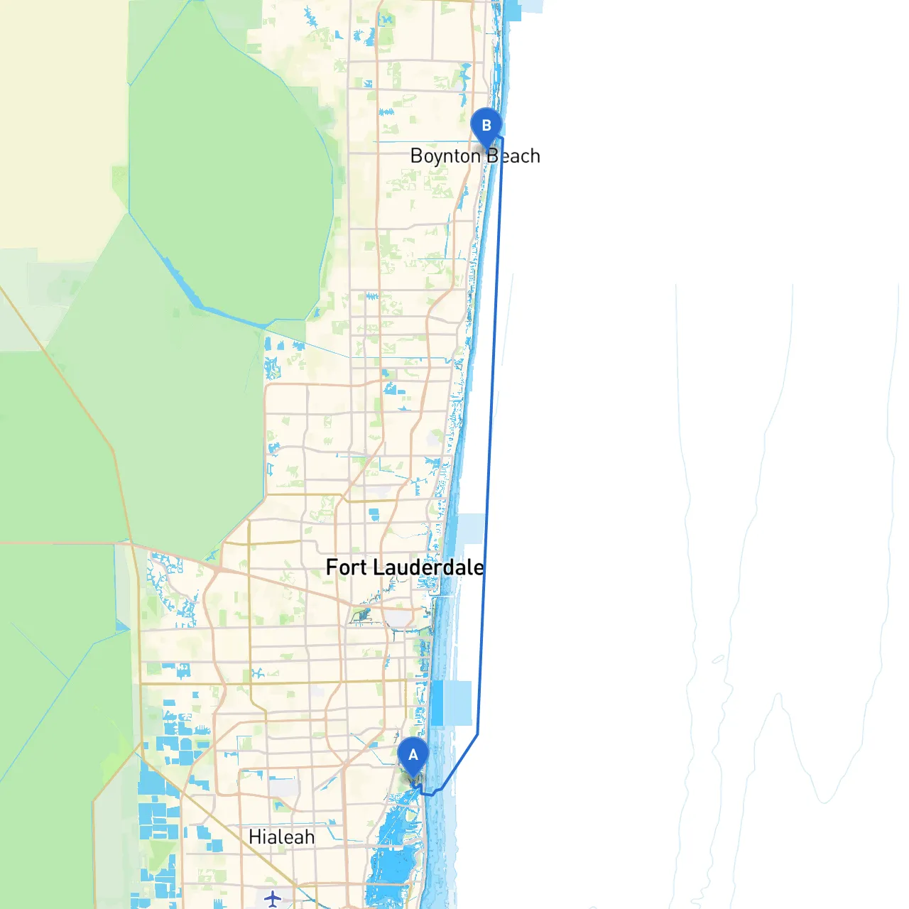
Pilotage Plan: North Miami, Florida to Boynton Beach, Florida
Overview
Embarking on a nautical journey from North Miami to Boynton Beach is not only an exhilarating experience but also an opportunity to appreciate the stunning coastal scenery of South Florida. This route is ideal for recreational boaters and weekend cruisers alike, as it combines relatively calm waters with plenty of options for shelter, dining, and entertainment along the way.
Route Highlights
- Starting Point: North Miami, Florida (Coordinates: -80.1341, 25.9113)
- Destination: Boynton Beach, Florida (Coordinates: -80.0545666667, 26.5281)
Points of Interest
- Oleta River State Park: Just north of North Miami, this park offers scenic views, winding waterways, and picnic areas. Consider making a quick stop for a paddle or a stroll nice stretches of nature.
- Haulover Sandbar: A popular spot for boaters, this anchorage is famous for its social atmosphere, sandy beaches, and calm waters. Anchor here for some fun in the sun, but be cautious of its shallow areas when approaching.
- Deering Estate: This historic site provides a glimpse into early Florida life and beautiful views of Biscayne Bay, perfect for a short tour if time permits.
- Biscayne National Park: To port side, enjoy the stunning marine ecosystem; you may want to plan a stop here to explore the underwater world or engage in a bit of snorkeling or diving.
Navigational Overview
The navigational path southward is marked by a mix of coastal waterways, the Intracoastal Waterway (ICW), and stretches of open water. Here are key navigational considerations:
1. Intracoastal Waterway (ICW): The route follows the ICW, which provides a sheltered path, generally safe from ocean swells. Take care to follow the channel markers to avoid shallow waters. The ICW is well-marked, with numerous buoys and aids to navigation that direct your path.
2. Hazards: Keep an eye out for shallow areas, especially near the Haulover Sandbar, and areas where currents may be stronger, particularly when coming into the inlet at Boynton Beach or crossing through busy channels.
3. Navigational Aids: Pay careful attention to the various navigational markers guiding your way: - Red and Green Aids: Stick to the right side of the channel when traveling South, following the “Red Right Returning” rule. - Lighted Buoys: Expect lighted buoys near popular areas which serve to enhance navigational safety during twilight hours.
4. Local Restrictions: Be mindful of the no-wake zones particularly around dock areas and residential zones. Adhering to speed limits ensures the safety of both your vessel and the surrounding community.
Shelter Options
In case of inclement weather, there are several bays and safe havens along the route you can utilize:- Gulfstream Park: Located around Haulover Beach, there are nearby facilities where you can seek shelter or grab a meal before continuing your journey.
- Lake Worth Inlet: A great harbor to duck into if the weather turns turbulent. This inlet offers ample docking options and secure mooring.
Tools and Resources
For navigation and safety, consider utilizing the following apps:- Savvy Navvy: An intuitive application for route planning, real-time weather updates, and tide information.
- Navionics: Helps you view charts, and helps detect obstacles and navigation channels along your route.
- Windy: Excellent for checking tide patterns, wind strength, and forecasts, essential for planning your day on the water.
Conclusion
This boating route from North Miami to Boynton Beach is not only safe but filled with opportunities for entertainment, with plenty of options to enjoy the natural beauty along the Florida coast. It’s perfect for family outings, day cruisers, and those looking to soak up the sun while enjoying a leisurely day on the water. Prioritizing safety ensures that your adventure remains enjoyable from start to finish!