
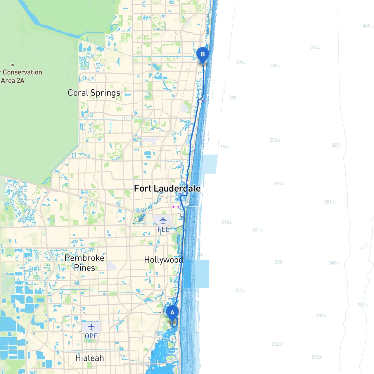
Embarking on a boating journey from North Miami to Deerfield Beach offers a delightful blend of coastal scenery and vibrant attractions. This pilotage plan is designed to ensure a safe and enjoyable trip while highlighting essential navigation points, potential hazards, notable landmarks, and opportunities for shelter along the way.
Departure Point: North Miami, Florida (Lat: 25.9113, Long: -80.1341) Start your journey at the intersection of Biscayne Bay and the Atlantic Ocean, a busy area where local marine traffic is prevalent. As you venture out, be mindful of the marked channels; the waters here are bustling with boats of all sizes.
Key Navigation Aids:
First Section: Biscayne Bay As you navigate through Biscayne Bay, you’ll find yourself surrounded by picturesque islands and beautiful waterfront homes. This area has numerous shallow spots, so keeping to the marked navigational channels is crucial. Look out for pleasure craft, kayakers, and paddle boarders, especially near the popular areas of Virginia Key and Hobie Island Beach Park.
Sheltering Options:
Continuing North: Haulover Inlet Upon exiting Biscayne Bay, you’ll approach Haulover Inlet. This opening is known for its choppy waters and can be hazardous in adverse weather conditions. Always check the forecast before attempting to cross. Ideally, approach the inlet during slack tide to minimize rough seas and reduce the risk of capsizing.
Important Navigation Aids:
Second Section: Aventura and Sunny Isles Beach Once you’ve crossed the inlet safely, you’ll enter calmer waters. As you cruise along the Intracoastal Waterway, enjoy views of luxurious waterfront properties and marinas. These areas are not only scenic; they offer safe harbors if the weather deteriorates.
Points of Interest:
Final Leg: Fort Lauderdale Continuing north, you’ll soon approach Fort Lauderdale, a boating hub with numerous attractions. The Intracoastal Waterway here is wider, allowing for a comfortable cruise. Watch for other recreational vessels and be prepared to navigate through some busy spots near the Las Olas area.
Sheltering Options:
Approaching Deerfield Beach The final stretch leads you to Deerfield Beach, where the coastline unfolds with beautiful sandy shores. Take care to adhere to any local speed limits as you approach the shoreline, as this area can have increased pedestrian and water traffic.
Consider using these navigation tools to enhance your experience while ensuring safety on the water:1. Savvy Navvy - This app offers precise mapping and route planning features.2. Navionics - Excellent for providing detailed charts and community reports on hazards.3. Windy - A powerful weather app that helps you track wind conditions.4. MarineTraffic - Useful for monitoring nearby vessels and their movements.
This route from North Miami to Deerfield Beach is perfect for boating enthusiasts who prioritize both safety and enjoyment. The blend of sheltered bays, scenic views, and rich opportunities for exploration makes this a memorable day on the water. Always stay vigilant of your surroundings and enjoy every moment of your adventure!