
Route Overview
Embarking on this journey from North Miami to Miami is a delightful exploration of the scenic Intracoastal Waterway. This route offers a smooth, vocational ride through a vibrant urban sprawl, ideal for leisure cruising. The navigation is straightforward, combined with plenty of attractions and safe havens along the way. This trip is particularly suited for family cruisers as well as recreational boaters wishing to explore Miami's beautiful coastline while remaining mindful of safe boating practices.
Section 1: Departure from North Miami
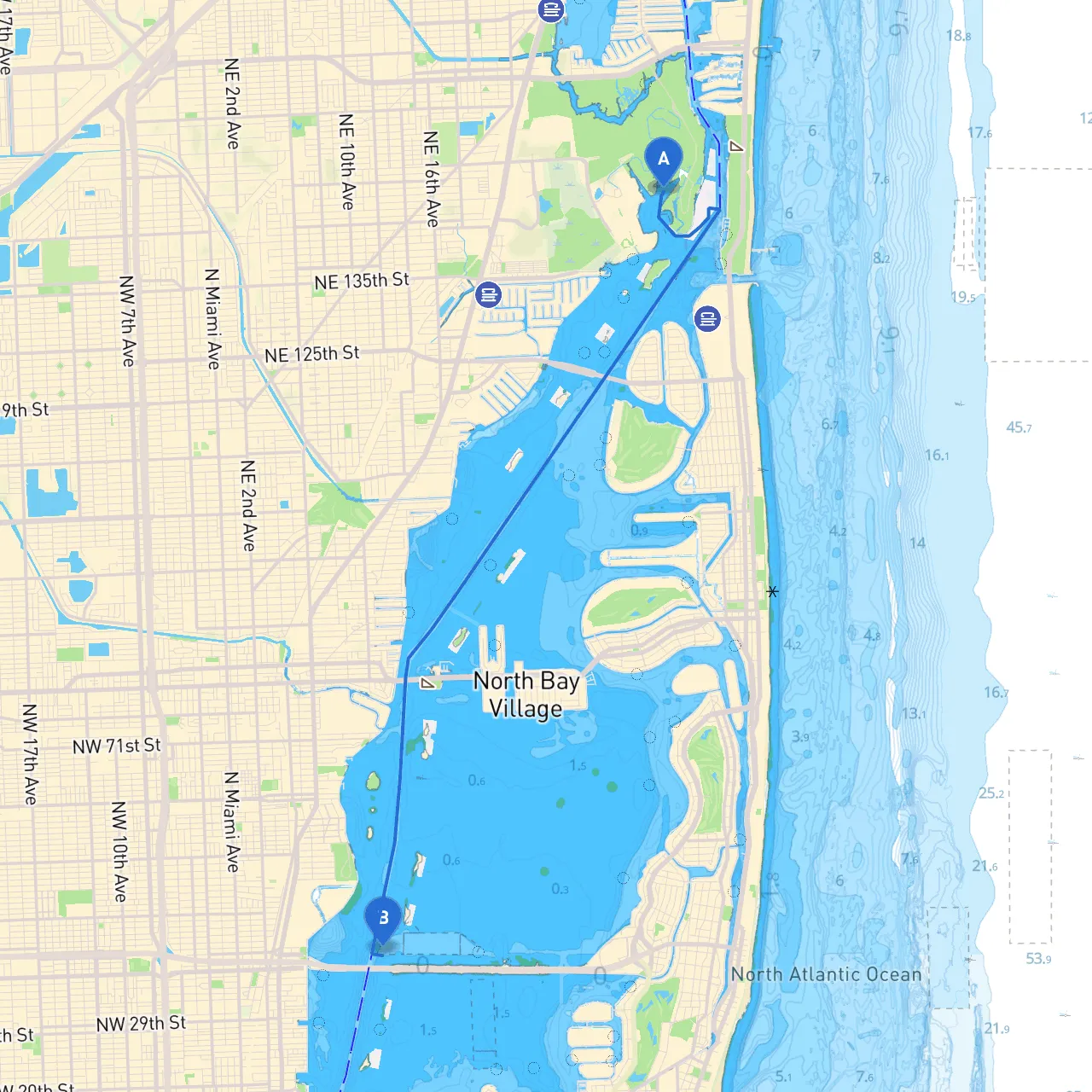
Start your journey at the coordinates 25.9113° N, 80.1341° W in North Miami. Before casting off, ensure your vessel is equipped with all necessary safety gear, including life jackets, a first aid kit, and a reliable means of communication.
Hazards and Considerations:
Points of Interest:
Section 2: Intracoastal Waterway Journey
As you navigate towards Miami, continue heading southwest on the Intracoastal Waterway (ICW). The ICW is well-marked, with navigational buoys guiding the way.
Navigational Aids:
Shelters:
Local Regulations:
Section 3: Approaching Miami
As you near the lively city of Miami, prepare to blend recreational cruising with the bustling marine traffic. The transition from the tranquility of the ICW to the more hectic Miami harbor area can be exciting, but always remain vigilant.
Notable Landmarks:
Final Leg into Miami:The coordinates for the Miami destination are 25.8129° N, 80.1744° W. As you pull into the marina/harbor area, keep an eye out for incoming vessels and adhere to tight marina protocols.
Safety Precautions:
For a truly enriching experience, consider utilizing boating navigation apps like savvy navvy, which offer precise charts, local marina information, tide predictions, and weather updates—keeping you safe and informed throughout your journey. Other apps include Navionics and BoatUS, providing additional resources to enhance your boating experience.
This boating adventure from North Miami to Miami is not just about reaching your destination; it's about experiencing the journey, the sights, and embracing the Florida maritime culture. Safe travels and smooth sailing!