
Pilotage Plan: North Miami, Florida to Hallandale Beach, Florida
Route OverviewEmbarking on a journey from North Miami to Hallandale Beach provides not just a transit from one bustling locale to another but also a chance to experience the tranquil waters of South Florida's coastline. This route is particularly well-suited for experienced and casual boaters alike, offering picturesque views and the opportunity to explore local attractions while ensuring safety remains the top priority.
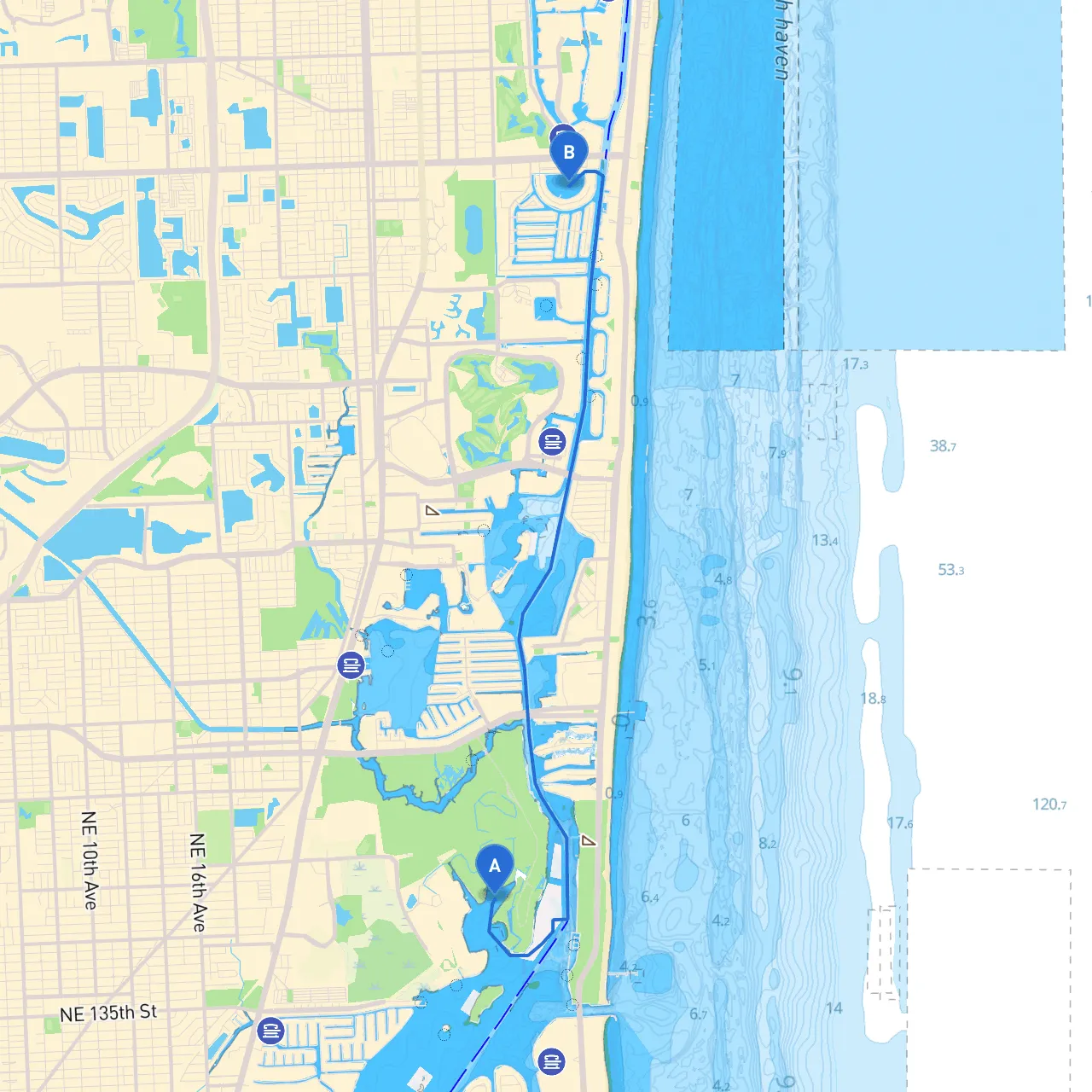
Starting Point: North Miami, Florida (25.9113, -80.1341)Launch your boat from the North Miami area, ensuring all safety gear is stowed and functional. Make sure your vessel is equipped with life jackets, flares, a fire extinguisher, and a first aid kit. A thorough check of the engine, fuel levels, and navigation equipment can prevent unnecessary mishaps.
Navigational Considerations and HazardsAs you head out, be mindful of local boat traffic, especially near the Intracoastal Waterway (ICW) and nearby marinas. Look out for larger vessels and respect their right of way.
1. Oleta River State Park: Shortly after leaving North Miami, consider a stop at this beautiful state park. The park is home to mangroves and an extensive network of waterways, providing opportunities for kayaking, biking, and hiking. It offers good protection from winds should weather conditions change.
2. Haulover Park: A little further down along the ICW, Haulover Park presents a perfect place to relax. It’s popular for picnics, fly kites, or simply enjoying the beach. It’s also a good shelter spot if the wind picks up.
3. Sunny Isles Beach: As you glide down the coast, take a moment to absorb the views of luxurious beachfront properties. This area is bustling with activity and might be a perfect spot for a short swim break.
The Route ItselfAfter enjoying Oleta River and Haulover Park, continue your journey southward toward Hallandale Beach. Follow the ICW as it meanders through the stunning waterways lined with homes and lush scenery.
Ending Point: Hallandale Beach, Florida (25.9833, -80.1258)As you reach Hallandale Beach, you’ll find that the area is a vibrant locale packed with dining, shopping, and entertainment options. Take some time to explore the canals and beaches available here; they offer beautiful spots for mooring and relaxation.
Additional Safety AppsTo enhance your safety and navigation while on the water, consider downloading savvy navvy along with these recommended apps:
This planned route emphasizes your safety while still providing enjoyable stops and sights along the elegant waterways of South Florida, making it a delightful day out for boaters of all levels. Happy cruising!