
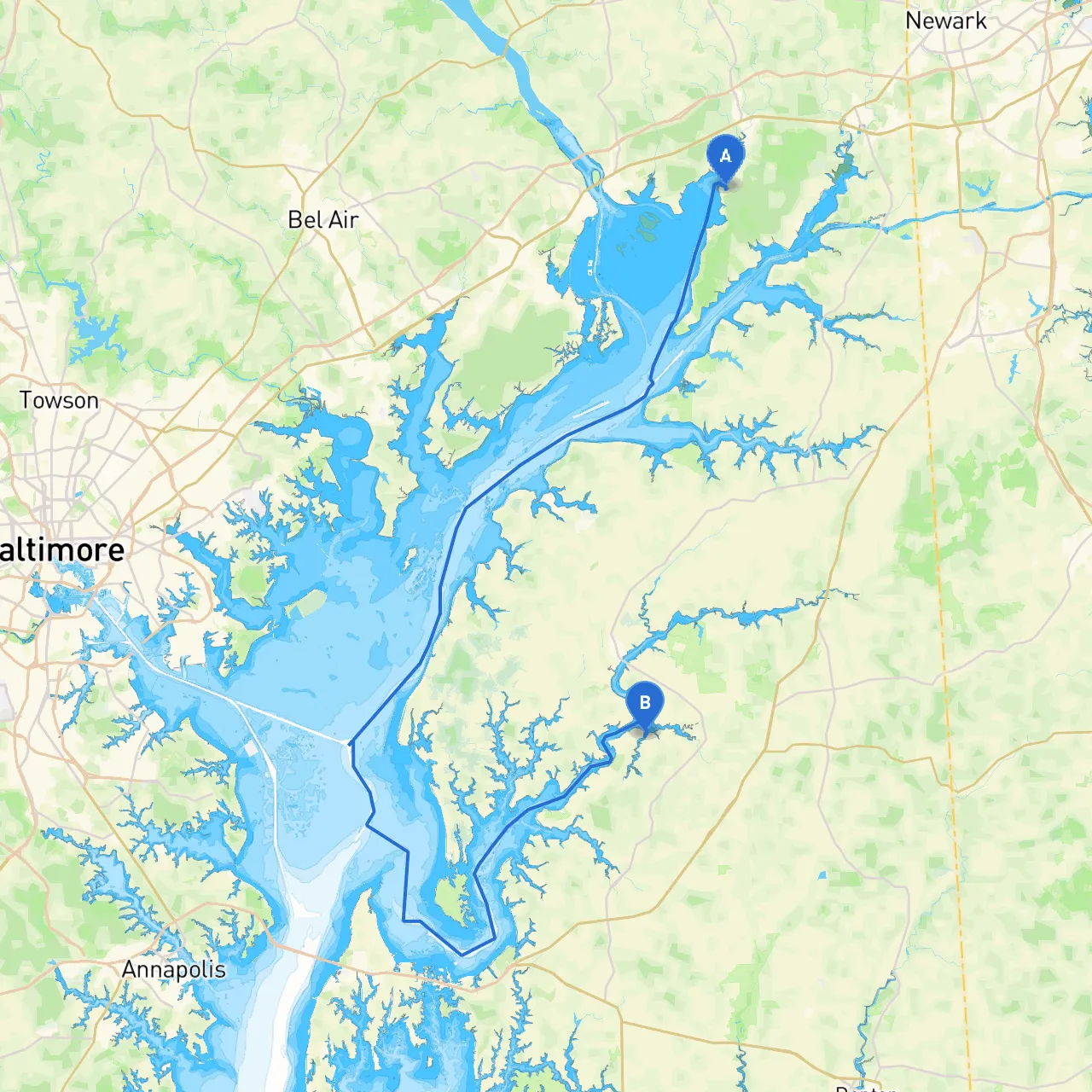
Pilotage Plan: From North East, MD to Church Hill, MD
Overview of the TripEmbarking on a boat trip from North East, Maryland, to Church Hill offers a delightful journey through the scenic waterways of the Chesapeake Bay region. This route is particularly suitable for experienced recreational boaters looking for a mix of relaxation, potential wildlife sightings, and navigation challenges.
Departure: North East, MDYour journey will start at the picturesque North East River, a tranquil expanse ideal for a leisurely departure. Before casting off, ensure to check the weather conditions, as this area can experience sudden changes. Local amenities, such as the North East Marina, provide provisions and fuel if needed.
Leg 1: North East River to Elk RiverDistance: Approximately 6 nautical miles
As you leave North East, follow the channel markers along the North East River to the confluence with the Elk River. Be mindful of the Elk River's narrow sections, which can be tricky with strong currents, especially after heavy rainfall. The Elk River is home to several parks, including Elk Neck State Park, where you can spot diverse wildlife and enjoy short hiking trails. If weather conditions deteriorate, you can find good shelter in the Elk River.
Navigational Aids:
Leg 2: Elk River to Sassafras RiverDistance: Approximately 12 nautical miles
After passing through the Elk River, proceed toward the Sassafras River. This leg offers breathtaking views of the surrounding marshlands and agricultural lands dotted with historic farms. As you navigate, watch out for recreational fishing boats, particularly near the Sassafras entrance.
Points of Interest:
Navigational Aids:
Leg 3: Sassafras River to the Chester RiverDistance: Approximately 10 nautical miles
Continue your voyage into the Chester River, a wide, scenic waterway that opens up to stunning views of Chesapeake Bay. Here, you’ll find several islands, perfect for exploring or taking a leisurely stroll.
Shelter Options:
Navigational Aids:
Final Leg: Chester River to Church HillDistance: Approximately 7 nautical miles
Approach Church Hill by making your way through the upper Chester River. As you close in, you’ll cross some stunning stretches of the waterway, with plenty of opportunities to spot local wildlife, including bald eagles and diverse waterfowl.
Be sure to transition from the river into the small docking areas near Church Hill. This destination is historically rich and provides a peaceful conclusion to your journey.
Arrival: Church Hill, MDAs you arrive at Church Hill, relish the charm of a quaint town with rich colonial history. Don’t miss the chance to explore local parks, enjoy a meal at one of the nearby establishments, or simply unwind on the water’s edges.
Important Safety Tips:
Recommended Apps:Utilizing boating apps can enhance your journey's safety and enjoyment. Consider using:
This trip from North East to Church Hill provides ample opportunities for relaxation, exploration, and engagement with nature while navigating the models set by experienced mariners. With a bit of preparation and attention to safety, you're sure to have a memorable experience on the waters of Maryland.