
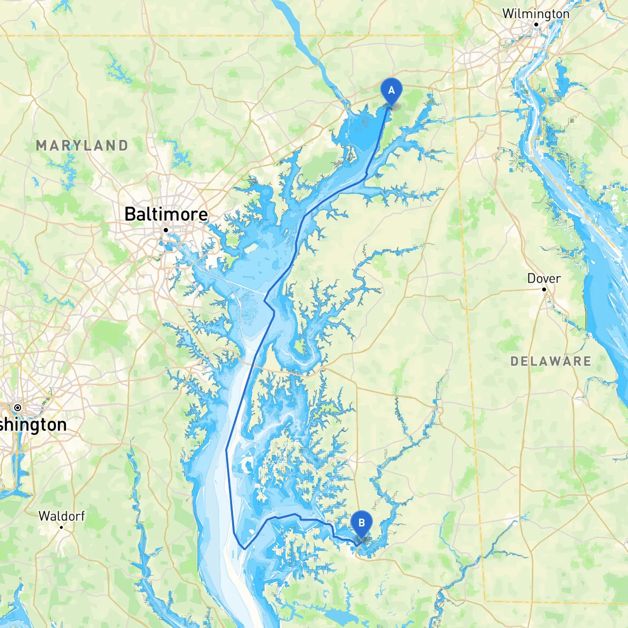
Pilotage Plan: North East, MD to Trappe, MD
OverviewThis pilotage plan takes you from North East, Maryland, in the charming Upper Chesapeake Bay, to Trappe, Maryland, nestled within the serene waters of the Choptank River. The journey covers approximately 35 nautical miles through an area rich in history and natural beauty, making it ideal for both recreational boaters and those seeking a peaceful retreat on the water.
Route Sections
1. Departure from North EastStart at the North East River (coordinates: 39.55805, -75.9627833333), where the river meets the Chesapeake Bay. Ensure your vessel is in good condition, with all safety gear on board, including life jackets for all passengers, flares, and a functional VHF radio.
Points of Interest:
Navigational Considerations:
2. En Route to the Sassafras RiverAs you navigate south toward the Sassafras River, maintain a lookout for the markers guiding you along the bay. This part of the journey showcases the Maine-like vistas of the Chesapeake, but remember that tides can affect water depth.
Shelter Stops:
3. Proceeding to the Choptank RiverOnce you leave Sassafras, continue your course south, leading you toward the entrance of the Choptank River. As you navigate, watch for the active commercial shipping traffic, especially nearing the convergence of the rivers.
Navigational Aids:
4. Points of Interest and Local AttractionsWhile on the Choptank River, you will encounter several notable sights:
5. Final Approach to TrappeAs you make your approach to Trappe (coordinates: 38.5925, -76.0486166667), let the waterway guide you through picturesque landscapes. You are now transitioning from the wide stretches of the Choptank to the quieter, narrow waters that characterize this area.
Safety Considerations:
Useful Apps for Navigation:To enhance your navigation and safety during your trip, I highly recommend utilizing digital aides:
ConclusionThis route from North East to Trappe is particularly suitable for leisure boaters, families seeking tranquility, and individuals looking to explore the natural and historic offerings of the Chesapeake Bay area. By following this pilotage plan, you’ll enjoy a safe, scenic, and memorable boating adventure. Always prioritize safety, heed local regulations, and you'll have a fantastic time on the water!