
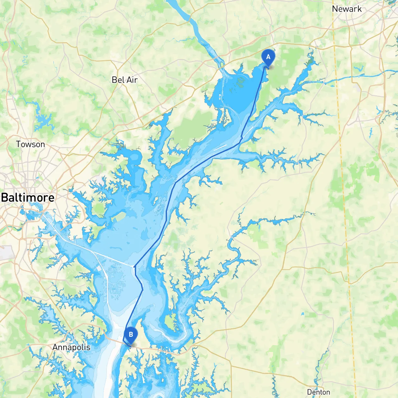
Departure: North East, Maryland, USA Coordinates: 39.55805, -75.9627833333
Your adventure starts in North East, nestled at the head of the North East River. This serene, picturesque spot will provide you with the perfect launchpad for your journey. Before you set sail, make sure to check your vessel’s readiness and ensure you have all necessary safety equipment on board—life jackets, flares, a first aid kit, and proper communication devices.
Route Overview Your trip covers roughly 30 nautical miles through the Chesapeake Bay’s eastern shore. As you navigate southward, you’ll experience stunning landscapes and notable landmarks, all while keeping an eye on safety and regulations.
1. Bohemia River Approximately 6 nautical miles into your journey, a quick detour into the Bohemia River will offer a scenic retreat. This area presents opportunities for fishing and a peaceful place to drop anchor if the weather turns foul. The river can be quite tranquil, making it a perfect spot to wait out any inclement weather.
2. Rock Hall Continuing south, you'll find Rock Hall, renowned for its charming waterfront and numerous marinas. This quaint town is a great place to rest, refuel, and enjoy local dining options overlooking the harbor. If you plan to stop, take a stroll along the shore or visit one of the local shops for unique finds.
3. Sassafras River Further south, you can access the Sassafras River, which offers refuge against strong winds. The banks here are lined with rich greenery, providing a beautiful place to unwind.
4. Cox Creek Just before approaching the Chesapeake Bay Bridge, Cox Creek provides yet another opportunity for shelter. This small creek is well-protected and makes a great spot for a quick break while enjoying the views of the surrounding area.
As you navigate through the bay, you’ll encounter several critical aids to navigation. Keep a close eye on:
Before you head out, review local guidelines. The Chesapeake Bay lays out specific regulations regarding fishing, anchoring, and speed limits in certain areas—especially around marinas and near inhabited shores. Make sure to adhere to no-wake zones and keep an eye out for any temporary restrictions due to environmental conditions or construction.
This boating journey from North East to Stevensville is perfectly suited for experienced day sailors and recreational boaters alike. While prioritizing safety, you can revel in the breathtaking views and tranquil waters of the Chesapeake Bay, making this trip a memorable one. Whether you choose to anchor in a quiet creek, enjoy a meal in Rock Hall, or simply glide through the stunning bay landscape, you will feel the refreshing spirit of a perfect day on the water.
Before you depart, consider utilizing boating apps like Savvy Navvy to help with route planning and live weather updates, ensuring a smooth and safe experience. Enjoy your trip—safe boating!