Home
 /
Maryland
 / 

North East to Chesapeake City by boat

North East to Chesapeake City

Distance - 18.7 Nm

Avg Speed
5 kts
10 kts
20 kts
30 kts
Time Estimate
3 hr 43 min
1 hr 51 min
0 hr 55 min
0 hr 37 min
North East to Chesapeake City

North East to Chesapeake City

Pilotage Plan from North East, MD to Chesapeake City, MD

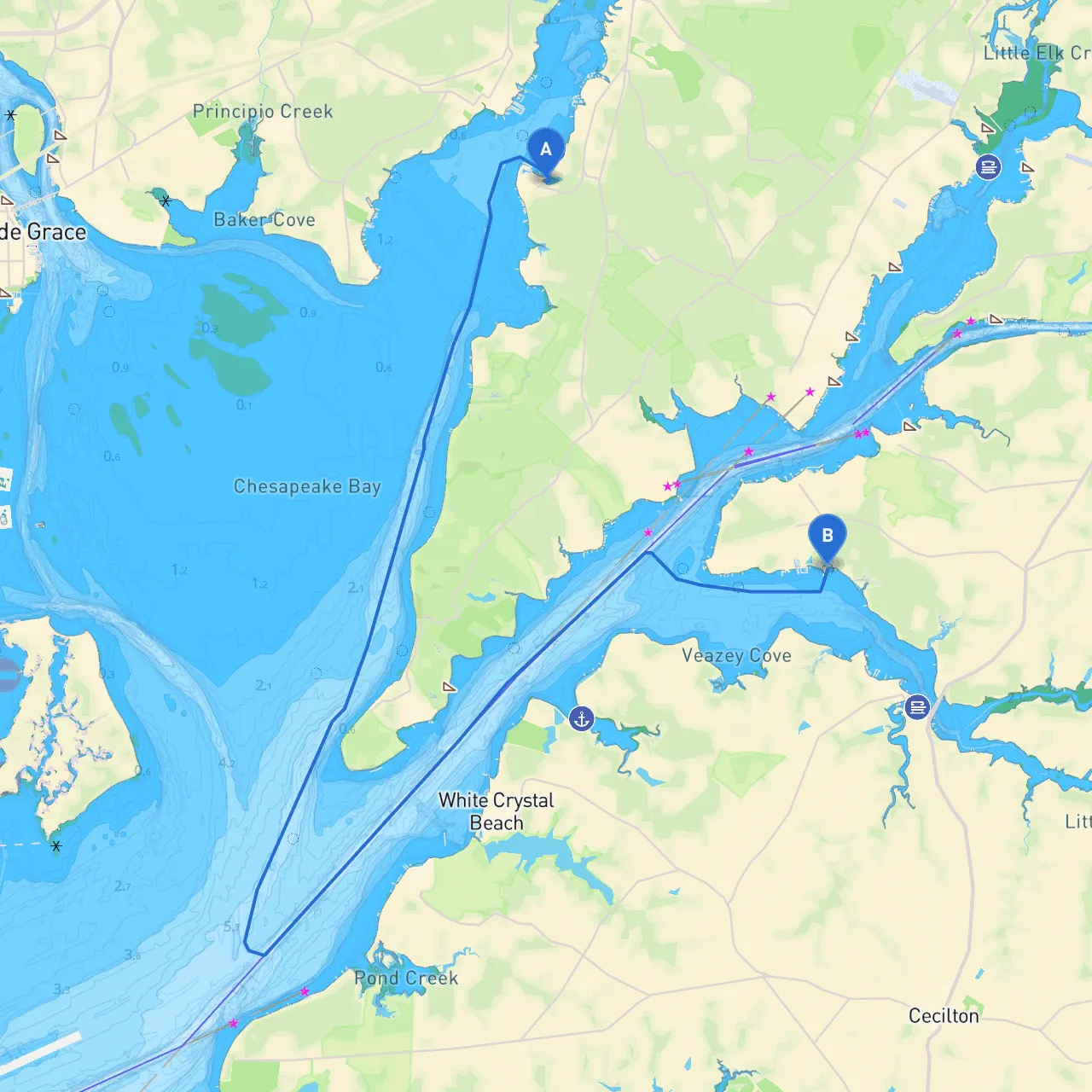
Route Overview:This journey from North East, Maryland, to Chesapeake City, Maryland, offers a delightful cruising experience along the beautiful waters of the Chesapeake Bay and its surrounding tributaries. Stretching approximately 15 nautical miles, this route is perfect for recreational boaters looking to enjoy scenic views, intriguing landmarks, and quality time on the water, while remaining vigilant about safety and navigational concerns.

  • --

Route Details:

1. Starting Point: North East, MD - Coordinates: Longitude -75.9627833333, Latitude 39.55805 - Depart from the North East River, which provides protected waters and a serene environment for a daily outing.

2. Navigational Aids: - Make sure to identify the "Northeast River Light" as it marks the entrance and provides guidance toward the main part of the river. You should also ensure you are aware of local tides as they can significantly affect your navigation in this area.

3. Departure: - Head south towards the mouth of the North East River and exit into the Chesapeake Bay. Watch for the “Dagger Point” marker as you transition into open waters.

  • --

Key Points of Interest Along the Route:

  • Basin Cove: Approximately 4 nautical miles from your starting point, this cove provides a great opportunity for a quick rest stop. Should the weather become inclement, Windsor Cove is another option along your path, offering ample shelter.
  • Cecil County Park: Located on the eastern shore of the Chesapeake Bay, a little detour can provide a fun picnic stop. With hiking trails and natural beauty, it’s an excellent place to recharge before the final leg.
  • Chester River: While this route does not take you directly there, it's a notable area nearby, rich with history and natural beauty. A slight diversion could provide a chance to explore quaint towns and waterfront activities.
  • --

Navigational Challenges:

1. Weather Considerations: - Pay close attention to weather forecasts; the Chesapeake Bay can experience sudden squalls and changes in wind direction, particularly in the summer months. Always have a backup plan for refuge.

2. Traffic and Restrictions: - Be aware of the heavy commercial traffic in this region and navigate with care. Observe all local boating regulations, including speed restrictions, particularly in marked zones around marinas and residential areas.

3. Depth Concerns: - Keep a close eye on your draft. Documented depths around the North East River can vary, so always refer to updated charts or apps.

  • --

Route Navigation:

From North East, MD, you'll exit into the Bay, maintaining a course toward the mouth of the Sassafras River, staying clear of shallow areas and commercial shipping lanes. As you approach Chesapeake City, be mindful of “Sandy Point” and the associated channel markers guiding you into the Canal.

  • Turning Point into Chesapeake City: Look for the distinctive structures of Chesapeake City at the confluence of the C&D Canal. The entrance is well marked by lights and buoys.
  • Final Destination: Chesapeake City, MD
  • -
    Coordinates:
    Longitude -75.8952833333, Latitude 39.4866666667 - Arriving in Chesapeake City offers unique marina facilities, quaint shops, and restaurants along the historic canal. Consider stopping to explore the scenic waterfront, which is perfect for wrapping up your day.
  • --

Safety Recommendations:

  • Boating Apps: Utilize navigational tools like “savvy navvy,” which provides up-to-date charts, tide information, and a user-friendly interface. Other apps to consider might include Navionics and myShipTracking for further safety assurances and navigational accuracy.
  • Safety Gear: Ensure your boat is equipped with safety gear, including life jackets, a first aid kit, flares, and fire extinguishers. A VHF radio is also essential for communication with other vessels and for emergencies.
  • Monitoring Traffic: Keep a lookout for navigation warnings and communicate regularly with nearby boats in busy channels.
  • --

With these detailed planning steps, this route is not only safe but also rich with opportunities for enjoyment. Every sailor, from novice to experienced, will find something to appreciate on this journey between North East and Chesapeake City. Enjoy your time on the water, and stay safe!